Lunch at Green Mountain Reservoir.
If anyone pays attention to the time of day when these posts generally go up you’ll be aware that this is much later in the day than usual. That’s because I only just got back from an all-day ride with the RMMRC. Roy called last night and told me to be at his place just before 8, so I was. So were Charley and Tim. We headed on out to Morrison to meet up with the rest, and there were a bunch today, about 12 of us.
Essentially this was a fall color ride. This is the time of year when the mountainsides are covered in yellow and gold and it’s always the sort of thing you want to take pictures of. Happily for us, it was also one of these incredibly beautiful October days that Colorado is know for. Let’s ride!
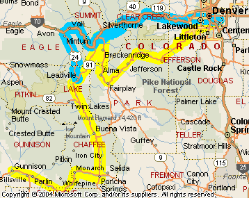
We headed up past Red Rocks to US 40 where it runs alongside I-70 going up Mount Vernon Canyon. Right away we lost Roy, who rides sweep. No one had any idea what happened to him and we hoped he didn’t break down but the plan from the start was that if we got separated just regather at the Subway in Granby.
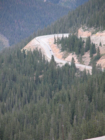
We took US 40 and then US 6 as much as possible, just getting onto I-70 briefly when we had to, and then followed 40 up over Berthoud Pass. Bob, who I consider one of the fast guys, suggested that the guys like Mike, who Bob considers a fast guy, might want to blast on ahead. Mike said he would stay with the group until we hit the pass but then look out, he’d be gone.
So we were totally splintered by the time we got to Granby, and who should I see first but Roy. Seems as sweep, he saw two bikes behind him so he waved them ahead and then followed them. They were not part of our group. Oops. So he went up Lookout Mountain and caught US 40 that way and ended up ahead of us.
The Subway in Granby was not going to open for another 15 minutes so some elected to stay and wait while the others went on to the Subway in Kremmling, with the others to catch up with us there. The idea was to get lunch to go and then go have a picnic down by Green Mountain Reservoir south of Kremmling.
I took off with the group heading to the Kremmling Subway and what happened then was like much of the day. Everyone else was on newer, powerful bikes. I was on my very old, decidedly less powerful Honda CB750 and I just can’t keep up with these guys. No matter, we all knew where we were headed.
Food in hand, we turned south. CO 9 runs along the east edge of the reservoir but we turned onto the road that runs along the west shore and finally found the only campground still open. Time for lunch.
I wrote last week about differences in the OFMC and the RMMRC and here’s another one. The road down into the campground was gravel and none of us were on dual-sport bikes, but we all went down it anyway. The OFMC–other than me–flat out refuses to do any gravel. They would not have done this.
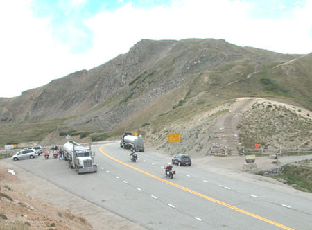
After lunch we continued south on CO 9 with the plan to get gas at Silverthorne. Some people were more antsy to ride so even while a few were not ready to roll yet, a bunch took off. I was the tail end of that group. We were going to go over Loveland Pass rather than through the tunnel. Once again, they left me in the dust.
I was not unhappy with that. I like to ride at my own pace and blasting over a high mountain pass at excessive speed is not my thing. I figured at this point we were all totally scattered and that was really the end of the group ride but to my surprise, as I got down to I-70 they were waiting. And not just for me. Did I know where the others were? No, I hadn’t seen them since the gas station but in less than a minute there they were and they passed us and we pulled in behind them.
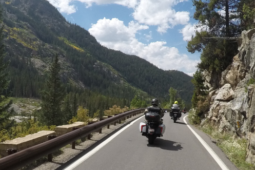
Bob, in the lead, was still following the practice of avoiding the slab so we got off at Bakerville and onto US 6 again, down to Silver Plume. This old road running alongside but away from the interstate is such a nicer ride than the slab. We had to get back on I-70 at Silver Plume, just to get down to Georgetown, and then we were off again, although we lost one rider who didn’t realize we would do this and was stuck in the left lane going past the exit.
So it was US 6 on down to Idaho Springs and two people, I’m not sure who, headed up Squaw Pass. For the rest of us, once we were back on the interstate this time it was all over. I quickly found myself riding just with Roy. But I didn’t figure I wanted to do the slab all the way home so I got off at El Rancho and turned down Kerr Gulch Road, angling down to CO 74 at Kittredge. Much nicer ride.
And there I was, heading east on US 285/Hampden when who pulls up alongside me but Tim. He had been way out in front of me. How the heck did I get ahead of him? Was my shortcut that much faster? Or was Tim one of the ones who took Squaw Pass, and he did it so fast that he barely ended up behind me? I have no idea.
Whatever. Bottom line was, this was a terrific day of riding. The weather was great, the colors were good, most especially down CO 9 from Kremmling to Silverthorne. Of course it totally disrupted everything else I had had in mind to do today but that’s the price you pay when you’re (deep, rumbling voice) a biker.
Extra: In my earlier post comparing the OFMC and the RMMRC I forgot one really big thing, which I have since added into that post. But rather than make you go look for it I’ll paste it in here.
In the OFMC, if we get cold, we’ll stop and put on more gear. If our legs are getting stiff, we’ll stop and take a break. With the RMMRC it seems that once we get rolling we are going to continue rolling. These guys like to ride, not stop. Of course, with a group of any size, stopping requires time. One or two people can stop quickly and get going again, but with eight people it takes about four times as long. And you don’t cover lots of miles in a day if you’re stopping all the time.
Biker Quote for Today
You know you’re a biker if taking your wife on a cruise means a putt down the interstate.
 Note to the world: Colorado is open for the season.