Archive for the ‘motorcycle touring’ Category

Riding The Million-Dollar Highway

Thursday, October 1st, 2026


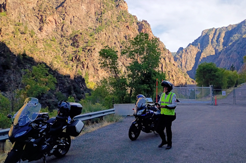
As far as the general public can go on the road at the bottom of the Black Canyon.

Nick was underwhelmed. His number one objective in coming out from Chicago was to ride this magical “Million-Dollar Highway” that he had heard so much about. I guess he thought the sheer canyon portion of it ran most of the distance between Durango and Ouray. When it turned out that stretch is only about 10 miles he was let down. Oh well. It’s still a terrific ride in my opinion.

We left Durango that morning and I needed gas. Nick had just filled up in South Fork so he was fine. Because he only buys gas from “top tier” stations I rode past a couple I would have stopped at, plus one he would have stopped at that was on the other side of the street. It’s just so much easier if the station is right there on your right.

But there isn’t much gas on the right side of the road on your way north out of Durango. No matter, I knew there was a station ahead before we would get up on Molas Pass. If Nick didn’t want to get gas there that was his choice.

Well, it was a Marathon and he’s OK with Marathon, so we both filled up. I had been leading and expected to continue to lead but we pulled up to get on the highway and he took off, at a point where there was traffic approaching that I would have let get by.

So I took off, too, and as we got into our lane he nailed his throttle. I did the same but my 650 Suzuki does not have the acceleration his 1200 BMW does. Just then I was startled to find a truck hauling a couple cars screaming past me on the right. I’m sure that driver had many choice curse words for me. Why did this idiot pull out in front of him like that when he was moving so fast!!?? You really do need to ride your own ride.

That left us separated, which was fine with me at that point, until Nick stopped at the top of Molas Pass, as I figured he would. We had no desire to stop in Silverton so we just continued past and headed on up Red Mountain Pass. On over the top, down, and through the relatively short section of canyon. Down into Ouray and it was time for a break.

We had been kicking around going up to Montrose and then east by way of the Black Canyon of the Gunnison or up to Delta, then east to Hotchkiss. We decided to go to Montrose. We got to the turn-off for the national park and headed on in. We had ridden up CO 92 along the north rim of the Black Canyon the last time Nick had been out so this time we agreed to ride the south rim. After that we headed for the East Portal Road.

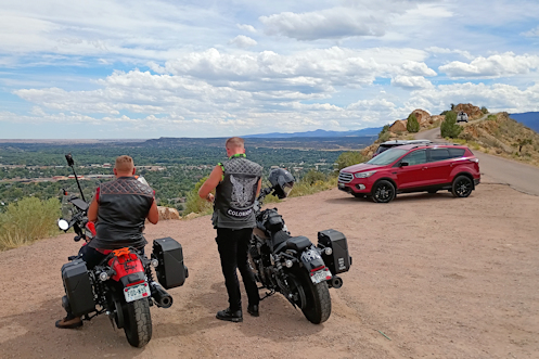
The East Portal Road is a very steep, twisty road that goes from the rim all the way down to the river at the bottom. It’s a favorite with motorcyclists. We went down and road the stretch at the bottom that goes as far upriver as you can. Got off the bikes, shot a few pictures, and headed back up and out. Then back to US 50 and on to Gunnison.

Going past the Blue Mesa Reservoir it was more empty than I have ever seen it. The word is that they are draining most of the upriver reservoirs in order to keep Lake Mead from dropping so low that the hydro plant can no longer produce electricity. We’re in a serious drought.

At Gunnison we checked in at our motel, a place the OFMC has stayed but which more recently had tried to shift to a more upper crust clientele. Apparently that effort did not work out well because we had gotten our room there that night at a very good price.

And that was day three of this four-day trip.

Biker Quote for Today

100 reasons not to date a biker: 23. Can’t find us? We’re in the garage again. We live in the garage.
West To Durango

Monday, September 28th, 2026


Stopped on top of Wolf Creek Pass.

Slept late the morning of our second day on this four-day trip, but Nick and I were on the road by 9 anyway. I like motels that provide a breakfast for you. It saves a lot of money and it’s a heck of a lot faster than going to a restaurant and waiting to be served.

We headed west out of Walsenburg over La Veta Pass on US 160 and then down to Alamosa. Then it was already time to stop for a cup of coffee. I had mapped out this ride figuring to go south from Alamosa to Antonito then over Cumbres and La Manga Passes to Chama, New Mexico, then west and north again to regain 160 at Pagosa Springs. I didn’t know if Nick ever been over Wolf Creek Pass but I was sure he had never been over Cumbres and La Manga.

We talked over coffee and he did not think he had been over Wolf Creek so we opted for that route. It was once again a beautiful day for riding but I figured it would be cool going over Wolf Creek so at a gas stop in South Fork I put on a sweatshirt. I probably didn’t need it because it was pretty warm but I didn’t regret having it on. I’d rather be too warm than too cool.

We stopped at the view point on the way down and Nick was properly impressed. It really is a terrific view.

At Pagosa I was very interested to see what progress they had made on the huge reconstruction project they have on the main road all the way through town. I naively thought they must be close to wrapping it up but not on your life. They have made substantial progress but they are nowhere close to done. It’s going to be another year for sure.

We wanted to have lunch here and with all the construction it can be hard to find places or to find parking. But we saw one cafe with a parking lot and pulled off. Walked up to the door and found they were closed. Dang. Nick checked his phone and found another place just half a block down the street so we walked there. This place was Sage. They didn’t have a very extensive menu so I just ordered a burger and I have to tell you, this was the best burger I have eaten in years. It was great! Sadly, Nick’s chicken sandwich was nothing to write home about but if you’re in Pagosa and want a burger, go to Sage!

From Pagosa it is a short run to where CO 151 forks off from US 160, and it is in that V where you will find Chimney Rock National Monument. We stopped to get a couple pix and then cruised on to Durango. I had had a motel in mind in Durango but Nick was making that night’s reservations and he found a place right in downtown for a very good price, the Durango Lodge. I’m not sure how he found it because the search engines don’t list is as an option–they probably refuse to pay Google to be listed. But that allows them to keep their prices down and it’s a nice place.

One of the nicest things about it was that it was just a block from the Durango & Silverton Narrow Gauge Railroad Museum. We had visited this free museum when the OFMC was in Durango a few years ago and had been really impressed. It’s well worth a visit. Nick was equally impressed, although unfortunately we arrived when they were set to close in 15 minutes so we didn’t get to see all that much.

Time to find dinner.

Biker Quote for Today

Flat tracks will abound in Utopia.

First Day On Four-Day Colorado Ride

Thursday, September 24th, 2026


On top of Skyline Drive.

Nick and I headed out on a four-day clock-wise loop ride through Colorado, getting on the road about 9 a.m. We headed out US 285 up to Pine Junction and then turned south. Our first stop of the day was at Deckers. There were maybe 8 other bikes there at the time but in less than five minutes another dozen or so came pouring in. Looked like a good day to ride.

We were set up with Cardo communicators and on the “Public” frequency so we were curious if we’d pick up anyone else’s conversation but we did not. There were a bunch of Cardos on those helmets, though.

We continued south to Woodland Park, passing through the burn area of the Hayman Fire 25 years ago. For the first time I noticed the new growth finally looking like it was really getting established. So 25 years to come back from the fire.

At Woodland Park we turned west to Divide, then south to Cripple Creek. Just a very few aspens starting to turn color at this point. Our interest was not in Cripple Creek itself, though I’m sure Nick was interested to see the place because it is pretty picturesque, but we really just wanted to go through it and on south further. That’s a really nice ride in case you’ve never done it.

As we hooked up with CO 9 and then US 50 we headed on into Canon City. My first eye-opener of the trip for Nick was Skyline Drive. He was not expecting it and was a bit unsure, telling me he found it “slightly unnerving.” Guardrails? I don’t need no stinkin’ guardrails.

After lunch in Canon City we continued to Florence, then south on CO 67. Now we were getting into an area I have certainly been through numerous times but where I am not totally acquainted with all the roads. I had looked at the map beforehand but that’s not always enough. We got to where 67 meets CO 96 and I took the right. I believed this was the correct route but Nick is one of those guy who has every gadget and he was looking at his GPS. We were headed for Walsenburg that day and his GPS was telling him to go the other way.

We cruised a bit–me unsure and him arguing for the other direction–and eventually we turned back. We got past where we had gotten on this road, went further, and the terrain was not looking like mountains at all, it was looking like the prairie. I asked Nick where his GPS showed this road taking us and he said straight to Pueblo. Pueblo?! No! We do not want to go to Pueblo. We stopped and I checked the map and sure enough, I was right in the first place. So we turned around again, riding one particular stretch of this road for the third time. Good thing we’re not going far today.

Following 96 south we got behind a guy in a pick-up who was going slow. And he kept going slower. And slower. Nick offered that he was probably slowing down to let us get past him. That was fine, and courteous of him, but we were in a stretch full of blind curves. I don’t care how slow you’re going, I’m not passing you on a blind curve. We finally did get around him, and then turned south again on CO 165.

The next eye-opener of the trip came up soon enough, Bishop Castle. Nick handles his bike well at speed but he is one of those folks who absolutely hate gravel. That’s one thing that made our turning around and turning around again particularly troublesome because he insisted on doing so on pavement–and pavement wasn’t necessarily available in those places. I told him he had no choice, we were stopping here and there was no pavement. But I picked a spot where we could pull right off the road, arc around, and stop with our noses to the road just a couple feet away. He didn’t like it but he went along with me.

Nick perplexed me several times on this ride. We walked up to Bishop Castle but being an Easterner (Chicago) he was feeling the altitude and had no inclination to go in the castle or climb up into any of the turrets. Instead, he pulled out his phone and spent 10 minutes reading about . . . the Hayman Fire. I finally slapped him on the shoulder and asked, “We’re standing at the base of Bishop Castle. Why are you reading about the Hayman Fire?” His response: “I’m just compulsive.”

Heading out from Bishop Castle we did not check first to see that our communicators were talking to each other and it turned out they weren’t. No matter, we don’t have far to go and we both know where we’re going.

Good thing because coming into Colorado City there is a turn-off, a short-cut, that takes you to join I-25 further south. But it is not well marked. I went past it but with no communicators Nick could not tell me that his GPS was saying to take this turn. I saw him waving in my mirror and turning so I went back, expecting to find him waiting for me there. He was not.

I didn’t know for certain this was where he turned so I checked Google Maps. Google Maps told me the cut-off was a little further back so I went there. Turned down this road and it quickly became gravel. This was the second of three times recently when Google Maps has sent me on wild goose chases. I turned around again and this time just headed on into Colorado City and I-25.

I blasted south on I-25, got to Walsenburg, and the motel was right there. Nick was in the lobby but informed me they did not have a reservation for tonight under my name. What? It turns out I screwed up making the reservation and booked it for a week later. Fortunately the lady at the desk was able to straighten it all out and we got our room.

OK, first day is in the books. We had our share of screw-ups. But hey, we’re out riding.

Biker Quote for Today

You might be a Yuppie biker if the only time you’ve thrown up is when you’ve had the flu or just had too many veggie fajitas.

A Beloved Honda Pacific Coast

Thursday, September 17th, 2026


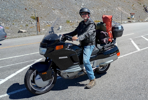
I saw this guy up on top of Cottonwood Pass.

When I first started riding motorcycles for real–as opposed to once in a while as a kid–John was receiving copies of various motorcycle magazines from the wife of a friend of his who had died. John would read them and pass them along to me.

One of the very first magazines I ever saw was Rider magazine with a picture of the brand new Honda Pacific Coast on the cover. That cover really struck me, such an unusual bike, and while I have no recollection of so many Rider covers over all these years, I still remember that one clearly.

The Pacific Coast was a dud for Honda. It was really not much more than a glorified scooter and at 800cc it was universally agreed to be seriously underpowered. You saw a few for a few years and then they just pretty much disappeared.

I saw one last week. Nick and I were up on top of Cottonwood Pass and this guy came in and parked. I said oh my gosh and went to have a look.

Nice guy. Loves the heck out of that bike. He told me he bought this one used (not his first) about two years ago and it had 20,000 miles on it then. It now has 89,000. He loves that bike.

He hasn’t had a bit of trouble with it but there is one difficulty I’m familiar with. It’s almost impossible to find the right tires for it. I had a 1999 Kawasaki Concours for 25 years and in later years the only tires I could find of the right size cost me about $250 apiece. If I could find them. So at the suggestion of Jungle, who had a nearly identical Concours, I took to running tires that were not what Kawasaki intended. That is, Kawasaki wanted radials and I was running bias-ply. You know what? They worked just fine.

So now the guy–I didn’t ask his name–was headed down to Arizona. Decided to come through Colorado and the mountains on his way. Stopped on top of Cottonwood just long enough to take a break and then he was off again.

Got more miles to put on this baby.

Biker Quote for Today

To me it doesn’t matter whether it’s raining or the sun is shining or whatever: as long as I’m riding a bike I know I’m the luckiest guy in the world.

A 5-Day Colorado Ride

Thursday, August 6th, 2026


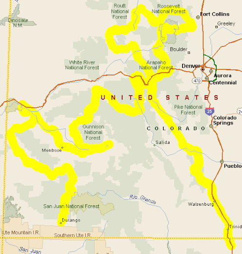
Map for 5-day ride.

I got a comment last week from Richard, referring back to a very old post where I had put together a suggested ride for someone who had found this website:

Hello Ken, I will be part of a 4-bike group coming from Central Texas September 20 and starting our CO tour 21st. This route looks great but would you recommend a slightly different one for us? Our only two wishes would be to 1. ride the MDH from Ouray to Silverton (north to south rather than the other way around) and 2. end up in the very south of CO as we need to head for Ruidoso NM on Day 6 (Saturday 26th).

I could probably adapt this myself but why not ask an expert who knows the state as I could route us right past something magnificent. We are coming from Brownwood TX and are comfortable with 600 miles or so on our ride to CO – so maybe staying that night in the very north of NM.

Of course I’m always happy to help riders plan their trips so using the original post as a starting point I put together this following route to meet Richard’s wishes.

Two points I would make: These days are around 300 miles and while that may not seem like much, on slow-going mountain roads that can actually be a pretty long day. So you should just pick different points to stop for the night and whatever other adjustments suit your needs. Also, this route leaves the group in southwestern Colorado for the fifth day so if they wish to stay west it could be a short day, but if they want to head back east it’s a nice day’s ride of their choice. Heading for Ruidoso the next day I suspect they will want to come back east. Here’s the route:

Arriving
Come from central Texas and stop for the night at either Raton or come into Colorado a bit to Trinidad or Walsenburg.

Day 1
Starting out Day 1, cruise a short distance north on I-25 to the Colorado City/Rye exit (CR 670) into Colorado City and pick up CO 165 west toward San Isabel. Pass through San Isabel and make a stop at Bishop Castle. After you’ve gotten enough of that amazing piece of art continue on 165 to where it hits CO 96 and turn right, heading up to Florence and then take CO 115 on into Canon City. Go west on US 50 just out of town and look for the turn-off to Skyline Drive. Ride Skyline Drive, which takes you right back into town. Then head west on US 50 again, this time looking for CO 9, at Parkdale and take it north to Fairplay. Continue on 9 over Hoosier Pass down to near Frisco and then take a right onto Swan Mountain Road along the east side of Dillon Reservoir. You’ll hit US 6. Take US 6 east over Loveland Pass and down to I-70. A short jaunt on I-70 will bring you to the US 40/Empire exit. Take US 40 through Empire and on up over Berthoud Pass, down to Winter Park. That’s just a hair under 300 miles so Winter Park might be a good place to stop for the night.

Day 2
Continue north and west on US 40 to just past Granby and turn right onto US 34, which runs up past Grand Lake and into Rocky Mountain National Park and over Trail Ridge Road. Be aware that you need to arrange your entrance into and through RMNP in advance. Trail Ridge Road brings you out at Estes Park. Continue on US 34 down the Big Thompson Canyon but before you get into Loveland make a left turn on CO 56 up toward Masonville. Take CR 27 (Buckhorn Road) to the left and stay on it (just stay on the pavement) up to Stove Prairie and down the other side where you’ll pick up CO 14 up Poudre Canyon. Take a left on CO 14, up and over Cameron Pass into North Park and Walden. At Walden go left and where the road splits, CO 14 and CO 125, stay to the right on CO 14 down to Muddy Pass, which is US 40. Go west (right) on 40 over Rabbit Ears Pass, down to Steamboat Springs. Unless you want to see Steamboat you will turn at the bottom of the pass onto CO 131/CR 14F and take that road down to Oak Creek, to Yampa, and on to Toponas where you will take a left onto CO134 over Gore Pass and will rejoin US 40 just outside of Kremmling. Take 40 into Kremmling and at just under 300 miles Kremmling would be a good place to spend the night.

Day 3
Head south out of Kremmling on CO 9 (right at the stoplight) on down to Silverthorne. When you reach I-70 get on it and blast west a short distance over Vail Pass, past Vail, to Minturn and turn off onto US 24 over Tennessee Pass. This will bring you to Leadville. Continue south to the Twin Lakes turn-off (CO 82) which will take you over Independence Pass. Go through Aspen down to Carbondale and turn south (left) onto CO 133 over McClure Pass. At Hotchkiss turn south on CO 92 through Crawford down along the north rim of the Black Canyon of the Gunnison until you get to the dam, where you reach US 50. Take 50 on into Gunnison for the night. Total mileage for the day about 315 miles.

Day 4
For Day 4 you’ll start with a little backtracking along the Blue Mesa Reservoir, but soon you’ll reach the dam again and now you keep going on US 50 to Montrose. A terrific sidetrip, if you don’t mind about 20 extra miles, is to turn into the Black Canyon of the Gunnison National Park and ask at the gate about how to find the East Portal Road. This very steep road twists its way all the way to the bottom of the canyon. It’s a great ride. Then you’ll come back up the way you came, all the way back to US 50. Then continue on into Montrose. Head northwest (right) on US 50 through Delta and on to Grand Junction. Follow 50 all the way until it hits I-70 and then take I-70 west a few miles to Fruita. Get off at Fruita and take the well-marked CO 340 down into Colorado National Monument and follow Rim Rock Road through the monument. This will ultimately bring you right back into Grand Junction where you will pick up US 50 and head back the way you came in, but only for about 8 miles. At Whitewater turn right onto CO 141, the Unaweep Tabeguache Scenic Byway through Gateway and on down to Naturita. Past Naturita, where CO 145 splits off from CO 141 take CO 145 to Placerville. At Placerville go left onto CO 62 to Ridgway. Another 10 miles south on US 550 puts you in Ouray for the night. Total about 310 miles.

Day 5
This last day has you headed onto the Million Dollar Highway. You climb up into the canyon from Ouray and wind your way south to Silverton over Red Mountain Pass. From Silverton you continue south over Molas Pass down to Durango. That’s just over 60 miles. From here you have a number of options and I’ll leave it to you to decide what works best. You could head east out of Durango on US 160 to Pagosa Springs and then go over Wolf Creek Pass and down to South Fork. From there you would continue east on 160 to Alamosa and then maybe turn south to set up for your next day’s ride to Ruidoso. Or at Pagosa you could turn south on US 84 down into New Mexico and turn south at Chama toward Espanola. Or at Chama you could come back into Colorado on NM 17/CO 17 over Cumbres and La Manga Passes to Antonito. Then turn south on US 285 into New Mexico. Or from Durango you could continue south on US 550 to Aztec and wherever in New Mexico you want to make it to that day.

So, OK. Tweak away. I guarantee this route would be pretty darn sweet but everyone is different. Take from it as you wish. Have a great ride.

Biker Quote for Today

It truly is an odd thing we bikers do, riding through miserable conditions like this. We don’t invite then or look for them, surely, but when they are upon us we relish the challenge and silently claim the superiority of adventure over comfort, wilderness over warmth, discovery over certainty. — Foster Kinn

An Easy-Going Ride To Cheyenne

Monday, July 13th, 2026


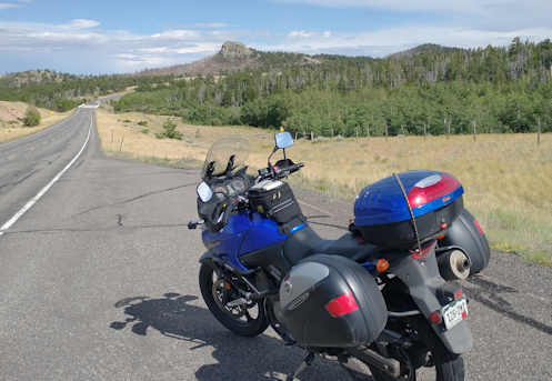
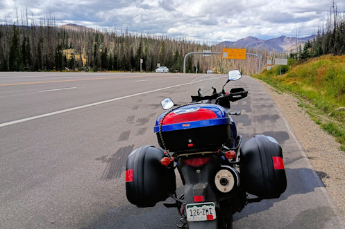
Wyoming 210 heading east from Laramie to Cheyenne.

I needed to go up to Cheyenne but there was no way I wanted to take the interstate. I-25 was certainly the most direct way. I live about 1 mile from the highway and it takes you straight up to Cheyenne, less than a mile from my destination. Nope. Not gonna happen.

Instead, I figured I would cruise out to the west side of town and take Colorado 93 up from Morrison, to Golden, and on to Boulder. Then I’d head to Longmont, catch US 287 north to Laramie, and then cut east on a short stretch of I-80 and the rest of the way in on Wyoming 210. Much better, but a lot slower. Hey, I’m in no hurry. I just want to get out for a nice ride.

It has been blazing hot lately, and it was when I headed out on the V-Strom on Thursday. But we’ve also had a lot of smoke from forest fires further west and that smoke, while making the air hazardous to breathe, does provide some relief from the heat. You don’t have that blistering sun beating down on you. So it was a hot ride across town but a bit nicer along the foothills.

I got through Golden and up to the turn-off up Eldorado Canyon, just south of Boulder, and turned east to pick up Cherryvale Road to continue north. I wanted the bypass around Boulder and then the Longmont Diagonal up to Longmont. But I must have missed a turn somewhere. Doesn’t matter, as long as I take roads going either east or north they’re all heading in my direction. What this wandering did though was to add a lot of slow travel in the heat. There’s a reason I try to avoid Boulder County and this is a big part of it.

Coming into Longmont I knew I could skirt around the more congested parts of town but I intentionally wanted to go straight to 287 because I had not been this way recently and wanted to see the changes. There is so much development and redevelopment going on up and I’m curious. And what I saw confirms that Longmont more and more seems like a place it could be really nice to live. Not that I have any intention of moving. But a very nice smaller town.

Once I finally got through Longmont I was able to pick up speed a bit. Meanwhile, the sky ahead was looking decidedly wet. Bring it on. As long as it doesn’t come down too hard I won’t even stop to put on my rain suit. And I did get a bit wet as I got close to Loveland. I got through Loveland surprisingly quickly and then on to Fort Collins. Even Fort Collins was less of a traffic jam than Longmont and going out of town I needed a break.

I stopped for gas–not that I needed it but it’s a reason to stop–and spotted an ice cream shop right next door. Score! I had been thinking about an ice cream stop. I enjoyed the air conditioning and the ice cream, then looked out to see that it was actually pouring rain. OK, I guess I’m in no hurry.

The rain didn’t last that long and I went out and now had to decide what gear I needed. I knew the roads would be wet and even if it didn’t rain any more I could still end up with wet, dirty pants. But I decided against pants. I did put on my rain jacket, just in case I did run into actual rain. Somewhat to my surprise those were both good decisions.

Yes, at first my pants legs got a bit damp but soon the road was drying out and that was that. Meanwhile, the rain had cooled things off enough that the extra warmth and wind-breaking quality of the jacket was appreciated. It was actually a little chilly.

Then it was a direct cruise up to Laramie. I stopped again to stretch and have a bit to eat and what a difference Wyoming was. It was a good bit cooler than Colorado and no smoke in the air.

Heading east out of Laramie you have little choice but the interstate but in just a few miles you can get off onto the two lane. I took the exit, crossed over the highway, and then came to a T intersection. Going left seemed to go straight north, while going right was headed east. Easy choice. Until I went about half a mile, crossed a small bridge, and found nothing but gravel on the other side. What the hey?

I turned around and went back, then consulted the map. It turned out the road that appeared to go due north only did so for a very short distance and then it bent east. This was my road. And what a nice road! Not mountains but hills and a much nicer transit to Cheyenne than the interstate would have been. Time to find my hotel.

Biker Quote for Today

A true biker knows that life begins at the end of your comfort zone.