Posts Tagged ‘Butler Maps’

What, No Maps?

Monday, December 11th, 2023

I always have maps in that case on top of my tank bag when I travel–unless I forget my maps.

I had a very odd experience this summer when the RMMRC took a ride down into Arizona and New Mexico in that for perhaps the first time in my motorcycling life I had no maps with me. I just forgot them, though how you do that I’m not sure. But I managed to, somehow.

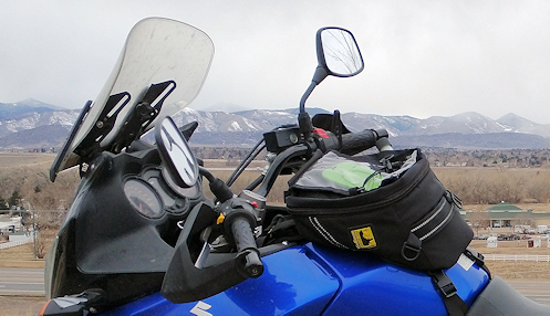
I have tank bags on all my bikes and typically I bring maps and have them in the map case on top so that I can refer to them at a glance at any time. Back when there were a lot more guys in the OFMC and John was usually the leader it was not at all unusual for several of them to have no idea which way we were going. They just got in the group and followed whoever was in front of them. John remarked at one point that the only person he trusted to know where they were going was me, because he knew I had a map in front of me at all times. And I generally rode sweep so the other guys could just play dumb and it didn’t matter.

So there I was with no map. It was weird. And uncomfortable. Sure, I would pull out my phone and call up Google Maps before the day’s ride and check out the route. But it’s not the same.

The time it mattered the most was the day we stopped for gas–and tried to get lunch, but didn’t–in Alpine, Arizona and there was confusion about which way we were going. First the group decided to go one way, then we had to wait because one guy was missing, and by the time he showed up a few guys a bit away from the rest of us decided to go a different direction and just took off that way. So the rest of us followed but I was distressed because I knew the way we had intended to go was really nice and I didn’t now anything about this alternate route except that it was a good bit longer.

Well, if I’d had a map in front of me, especially a Butler map, I would have seen that the road we did take was one of the best in Arizona. Heck, I probably would have been pushing that route as the clear best choice. If I’d had a map.

The other time it would have come in handy we were leaving Grants and needed to head west a bit so we could go north and then east. As it was, we went west on I-40 a good ways to Thoreau and went north from there. But before we got to Thoreau we pulled off at Milan to regroup. It turns out, we could have taken the road north out of Milan and gotten where we wanted to go and saved about 60 miles of flat, straight road. I think whoever planned this day’s ride used GPS and GPS does not always give you the best route. I would have seen it on the map and I would have pointed it out. If I’d had a map.

Then later that day we planned to go one route but the guy in the lead went a different way and I knew we had varied from the planned route but I had no idea where he was headed or where we would come out. Nothing would have changed by my knowing but at least I would have been able to see where we were, and where we were headed, and I like to know.

I don’t know about you, but I love maps. I hope I don’t ever forget mine again.

Biker Quote for Today

I do believe it’s time for another adventure.

You Mean There’s Good Riding In Texas?

Monday, December 14th, 2015
Texas Hill Country

Not one, but three twisted sisters. That sounds good.

From Colorado, taking a motorcycle trip in Texas is not unthinkable. If you head down toward Lamar, to the southeastern corner of the state, Texas is only 40 miles away across the Oklahoma panhandle. From Denver you can actually be in Texas in just a few hours. But then your trip is barely begun.

“Texas is a world all of its own. It takes a lifetime to drive from Eastland to Van Horn.” That’s a line from a Little Feat song. And they should know. Texas is BIG.

So where would you go to ride in Texas? You guessed it: I’ve got another new Butler Maps map, this one for the Texas Hill Country. And where exactly is the Texas Hill Country? Oh, just about 700 miles south of where you would be coming into the state. Down around Austin and San Antonio. And let’s face it, most of that is going to be just burning up miles. Unless you’re Iron Butt-inclined, this needs to be a trip of a full week or more.

And what do you find when you get there? Well, hills for one thing. And that generally means twisty roads running through canyons and valleys. That sounds good, doesn’t it? The biggest attraction as far as I can see is what they call the Three Twisted Sisters. I don’t think that needs explanation. Butler maps out a Three Twisted Sisters route that starts and ends in Kerrville, running 225 miles. A nice day’s ride.

The map also shows three other day ride loops, a 131-mile ride out of Bandera, a 140-mile ride out of New Braunfels, and a 140-mile ride out of Luckenbach.

Perhaps surprisingly for Texas, the map also lists 28 dual sport adventure roads. Texas is known for not having a lot of public land but if you want to get off the pavement there are at least some places you can go. However, be warned. Here’s what Butler has to say about these roads:

They are best suited for advanced riders on bikes such as the BMW R1200GS or KTM 1190. Do not try these roads if your skills or machine are not up to the task.

Something on this map I don’t recall seeing on others are highlight text labeled “Don’t Miss This.” On the Bandera loop, for example, they list things like:

  • The Lone Star Motorcycle Museum near Vanderpool houses a treasure-trove of bikes dating from 1910 to the present.
  • The Apple Store in Medina is a great place to stretch your legs. Be sure to try their signature apple-cinnamon ice cream.

Texas really is a world all of its own. I guesstimate that this map covers maybe one-fifth of the state. In other words, there’s a whole heck of a lot more of it. And I’m sure there is some good riding in other places but I suspect Butler focused on the Hill Country because that’s the best. At least in a concentrated grouping. Considering how huge Texas is I welcome someone pointing me to the really good stuff so I don’t end up burning up thousands of miles on country that is not all that interesting.

One note though: if you’re going to go I suggest you do so in the spring or fall. I’ve heard that, just as riders put their bikes away for the winter up north, riders in Texas put their bikes away for the hottest part of the summer.

So am I going to go riding in Texas? Well, yeah, I’d sure like to. But will it happen? I honestly can’t say. We’re talking serious miles and I’m in the heart of some of the best riding in the world here in Colorado. But I’m definitely going to be considering it.

Biker Quote for Today

But officer, I only have two wheels so I’d have to do 110 mph to break the limit!

New Mexico, The Land Of (Map) Color

Monday, December 7th, 2015
New Mexico 152, that state's "tail of the dragon"

That squiggly yellow line means good motorcycling.

I see there’s one particular part of New Mexico I need to spend more time in. I’m looking right now at another map I recently received from Butler Maps, and this one is for New Mexico. The area is the mountainous section east of Alamogordo that includes Ruidoso. Butler rates motorcycle roads by color–yellow, red, and orange in descending order–and there’s a good bit of yellow here.

Of course I know there’s a big motorcycle rally each year in Ruidoso, and you know they don’t hold those things in places without good motorcycle roads. But I guess I’ve never been there. I say “I guess” because I thought sure the OFMC had been to Ruidoso one time but checking our trip logs I sure can’t find any trip where we did. We generally do our annual ride in July or August and neither of those months are good for going that far south in New Mexico.

We have, however, been all over the northern part of the state, many times, and there is an awful lot of color up there, too. Absolutely no surprise. Northern New Mexico is mountainous and gorgeous.

A surprise for me, however, is how much orange there is on this map. That is, there are a whole lot of roads that perhaps are not spectacular but that Butler says are still pretty darn nice. None of them are interstate however (surprise!) so if you really want to see the good parts of New Mexico you definitely need to get off the slab. Forget about burning up the miles, slow down and see the place.

Not a surprise is that Butler has identified a road I’ve been extolling for years. This is New Mexico 152 running from San Lorenzo over to Hillsboro and down to Caballo. I did a piece for Examiner.com calling it New Mexico’s Tail of the Dragon. Butler calls this the Emory Pass Road and marks it in yellow. Here’s what they have to say about the road.

Named for Lieutenant W. H. Emory, who chronicled the U.S. Army of the West expedition over Emory Pass in 1846, the highway was finally opened for travel in 1938. Highway 152 is without question one of the most breathtaking routes in the state, a little known treasure off the beaten track that is well worth experiencing. As with most roads built during early statehood, this too was engineered to follow natural landmass contours as closely as possible.

That means curvy, you know? “. . . follow natural landmass contours as closely as possible . . .”

One other point of interest: Butler points out more than 100 dual sport adventure roads, so if that’s your style of riding, you want to ride New Mexico. I’m thinking March might be a good time to head that direction.

Biker Quote for Today

I do not know where I’m heading. Let the road decide.

Butler Map Turns My Eyes To Montana

Monday, November 30th, 2015
Butler Maps Montana

There is a lot more color in the northwest corner of Montana than anywhere else.

I’ve probably been through more of Montana than most people who don’t live there. So I was very interested looking over my newly arrived Butler Motorcycle Maps Montana edition to see that the one part of the state I’ve never been to seems to be one of the best for motorcycle riding. How did that happen?

Well, I know how it happened. The area in question is the far northwest corner of the state where only the narrow panhandle of Idaho separates Montana from Washington. As much of the western US the OFMC has ridden, including Glacier National Park, we have never been to the Pacific Northwest because it’s just too far to go when you only have a week. Now, that limitation doesn’t apply to me, but it does to most of the other guys, so we’ve never done that ride.

Looking over the whole map confirms what most people presume about Montana: the eastern part of the state is wide open with many, many miles without a lot of curves. The juicy part is in the west, where the mountains are. And we’ve been through those mountains, from the Beartooth Highway on the southeast up to Butte and Salmon, Idaho, but not north of that. This summer I got further north, to Missoula, and down over Lolo Pass. But never, ever north of Missoula.

Well, on Butler maps, the more color you see the better the riding. Guess where the most color is on this map? Let’s just say it’s not south of Missoula. That portion of the map above is what I’m looking at.

Another thing I like about this map, something I don’t think I’ve seen on other maps, is that they have a listing of the best dual sport adventure roads and the coordinates on the map so you can find them. And there are dotted red lines all through the mountains, which are identified on the legend as “Recommended Dirt Rd.” On the enlarged map of this northwest area the red dotted lines are everywhere. This is not the kind of riding the OFMC is ever going to do but maybe next year I can convince Kevin and Jeff to head up that way.

This is that time of year, isn’t it, when motorcyclists pull out maps and start dreaming about next year’s trip. Montana’s looking really good.

Biker Quote for Today

I like to ride dirt bikes to meet women. Nurses mostly.