Archive for the ‘Colorado motorcycle rides’ Category

Pre-Riding Comes Through Again

Monday, June 29th, 2026


It seems the worst of the flooding damage was on the road that is part of my planned route.

I wrote about pre-riding a route you plan to lead a group ride on just a few weeks ago. Well, it seems there’s a very good reason not to do that pre-ride too far in advance. Conditions change.

We just got back from two weeks in Alaska. We flew from Juneau to Seattle and needed to change planes in Seattle. We found right away that our flight was delayed a bit more than an hour. As it turned out, the plane to Denver was coming from Denver and they were delayed more than an hour from taking off. It seems there was a bit of a weather event. We never did learn much about it because it was all over by the time we did get home.

We’ve been home a week now and it occurred to me that if I intend to lead this ride that I’ve been planning since before I got hit head-on exactly one year ago, this is really when I should do it. I was leaning toward posting the ride on the RMMRC site Saturday and meanwhile I was catching up on all the emails that piled up while I was gone.

Surprise, surprise! I came across a new item saying there was extensive flooding in Evergreen and Kittredge, connected to the tornado that shut down the airport. Roads were completely blocked. And my route for this ride goes right through Evergreen and Kittredge. I figured Sunday I’d better take a ride up there and check it out before posting the ride.

So I did. As I headed up Colorado 74 out of Morrison I thought I ought to see a warning sign if the road was closed ahead, and there was no such sign. That’s positive. You go through Idledale before you reach Kittredge and there was a sign just outside of Idledale but I didn’t see it in time to read it, so no help. But that said to be cautious.

I got into Kittredge and the first thing I noticed was that the restaurant I planned to stop at for lunch on this ride seemed to be closed. It is right beside the creek so that was foreboding. I’d have to check on that. Then I got to the west end of Kittredge and where the creek crosses under the road it was obvious what had happened. There was an area to the side where a lot of logs and stumps were piled up, obviously from a clean-up effort, and the bridge abutment still had a lot of the same packed against it. But the road was open, albeit with a good bit of gravel remaining.


It appears they will be reopened in time for us.

On to Evergreen. Everything looked pretty good in Evergreen, though when I reached the fork where one way goes north and the other south, my route being south, I made that turn and it was clear they were not done cleaning up from flooding right there. But it was not bad. On south about a tenth of a mile and you get to the turn-off up Little Cub Creek Road–my route–and then the flooding became extremely evident.

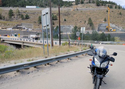
Mostly it was where the stream had come out of its banks and left gravel–a lot of gravel–on the road. Then a little further along I came to a spot where at first I thought the road had been carried away altogether. I turned around and stopped to shoot that picture above. On closer inspection I could see that the adjoining road had been nearly washed away and all that rock and soil was covering the road I was on. It’s all passable but don’t try screaming down this road on a motorcycle. No problem as long as you know what to expect.

At this point I headed back the way I came and in Kittredge I stopped to check out the restaurant. They had a sign on the door saying that due to the flooding they were closed over the weekend but would reopen right away.

OK, I guess I can lead this ride. Now I just have to get it posted.

Biker Quote for Today

Cause one day you are gonna say that today was bumping. We’re living on the edge and my motorcycle’s speeding. It is what it is and this is how I’m feeling. — Charles Smith

Making The Most Of The Ride Home

Thursday, June 18th, 2026


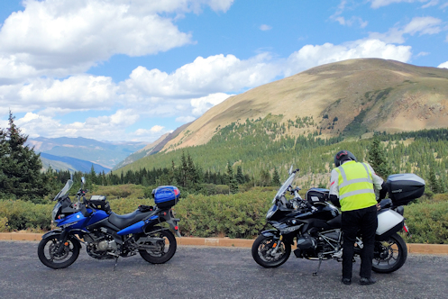
At a pull-out going up Independence Pass.

Day 5 was the last day of our RMMRC 5-day Utah ride. It could have been a quick blast east on I-70 but there was no way we were going to do that. Heck, we were in Basalt, which is right next door to Aspen, which is the gateway to . . . Independence Pass. One of Colorado’s real gems. Which direction do you suppose we went?

We heard from a cabinetmaker staying at our hotel that the morning commute into Aspen is killer. Because no one who does any of the hard work in Aspen can afford to live in Aspen. But either because we started a little later in the morning–9 a.m.–or because it was Saturday, we had no issue with traffic. That’s a win.

There’s no way in the world they’ll ever be able to build a bypass around Aspen so we had to go right through the middle of town. Not a win, but that’s life. Then we were out in the open, heading up the pass. And there was very little traffic this early in the day. That’s a win.

There are a couple places along the road going up the west side of Independence where it narrows down to one lane. I was riding sweep and as we came around a bend in one of these one-lane stretches I joked on the intercom that we should stop here for a group picture. Gene, in the lead, said OK. I came around the bend then and saw there was a pull-out right there and everyone was pulling in. Had to laugh about that one.

Of course, then as we left the pull-out I forgot to plug my electric vest back in so it was going to be a cold ride up to the summit. Dang. I knew it was totally unsafe to try to plug that thing in while riding but I still considered it. I thought if I secured the the female connector between my leg and the tank that maybe, on a straighter stretch, I might be able to insert the male connector. The opportunity came and I made a feeble attempt but clearly it was not going to work, and I was not willing to risk my life to avoid being cold for half an hour. When we stopped at the top I made absolutely certain to plug in before we headed down.

That was a good thing, because on the east side of the pass there was a ferocious wind blowing and that wind was cold! It didn’t really get warm until we were almost to Buena Vista. But oh hey, Independence Pass was its usual gorgeous self. What a nice ride.

We didn’t stop in Buena Vista. Too early for lunch and a couple guys had said they did not plan to do a lunch stop. Usually about the time we get onto US 285 headed back down the hill it’s time for the group to dissolve as the horses head back to the stable. Amazingly, this time that did not happen.

Dave and Lindsay told us as we made our final stop at Johnson Village that they intended to peel off on US 24 at Antero Junction, where you come down the hill into South Park. They did and then Tom and Gene and I stayed together all the rest of the way into town. The two of them finally got separated from me coming across town when I caught a red light they got through. Then it was home and this really good trip came to an end.

Biker Quote for Today

The road is a mirror; it reflects who I truly am.

There It Is–How Do We Get There?

Monday, June 15th, 2026


Stopped on McClure Pass Summit

The fourth day of this 5-day Utah ride brought us back into Colorado. We were continuing south out of Moab, down US 191 to where Utah 46 splits off to the east to cross the base of the La Sal mountains into far southwestern Colorado. If you’ve never taken this road you are missing a really sweet one. The decline into Paradox Valley is magnificent.

First, though, I had to get all screwed up. I left the motel ahead of the others telling Dave I would stop at the first gas station out of town on the right. There is no gas station going out of town on the right. I ended up doubling back as the other guys came past me heading out of town and I had to do a U-turn and hit the road without having all my riding gear on properly. What a pain that was.

So we got into Colorado and reached Naturita and had two options: go left up to Gateway and then out to US 50 north of Delta or go right down to Placerville and over to Ridgway, then north on US 550 to approach Delta from the south. The north route takes you along the Unaweep Tabeguache Scenic and Historic Byway and is a terrific ride. The south route is very pretty and a good bit shorter. We went south.

There’s not much in Placerville but we wanted a pit stop so we pulled in. The only store in town had no public facilities but a note on the door saying there was a park two blocks north where there were restrooms. We never knew that. And what a nice little park. Now we know.

Reaching Ridgway we were planning to stop for lunch but we got into town and it was jammed. A festival going on. OK, we’ll go on to Montrose.

But first, going north out of Ridgway, Lindsay had an idea. The turn-off to Owl Creek Pass is right outside of Ridgway and he wanted to show us something. Some rich dude had built an amazing house just up the road a ways. But Lindsay, this road is gravel. I was on a dual-sport but the others were not. Are they really that interested?

We went a distance and they were not. Through the communicators Tom and Gene said we’re going back. Lindsay was out of communications distance so I passed the word along. We never saw that house. Not all ideas are actually good ideas.

We lunched in Montrose, went north to Delta, and turned east on Colorado 92, picked up Colorado 133 at Hotchkiss and up and over McClure Pass. I was glad to see McClure. My lunch had been unexpectedly large and I had eaten it all. Heading for Delta I started getting drowsy and the whole was to Hotchkiss and Paonia I was struggling to keep my eyes open. The curves on McClure woke me up. Just what I needed!

If you’re familiar with Aspen you know the Maroon Bells. McClure Pass shows you the back side of the Maroon Bells. Nice ride.

Down to Carbondale and then we needed to take Colorado 82 toward Aspen, though we were stopping today in Basalt.

I was never familiar with the old Basalt but it’s a certainty that it looked nothing like current-day Basalt. Basically an extension of Aspen. I noticed one young woman in particular who was truly decked out in Aspen chic attire. Whatever floats your boat.

Finding our motel was the challenge of the day. We could see it. We could get about 100 feet from it. But there was all this construction going on and there didn’t seem to be any way to get to it. Crazy. Finally we ducked down what looked like an alley and got there. Crazy.

Biker Quote for Today

I ride to feel alive, not just to reach a destination.

Off To Utah On 5-Day Ride

Monday, June 1st, 2026


Stopped to catch a view in Utah.

Five of us with the RMMRC headed to Utah last week on a 5-day ride. On the BMWs were Dave, Lindsay, and Tom. Gene was on his Yamaha and I was on my Suzuki.

We met out at the Phillips 66 in Morrison and the first order of business was to link our communicators. We failed and headed out with only two linked, Tom riding lead and Gene riding sweep. It was a chilly morning destined to get a lot colder before it got warm.

Our destination on Day One was Green River, Utah, which is about 330 miles. We were doing it all on I-70, just to get there. We ran up from Morrison past Red Rocks, got on I-70, and blasted west.

The first point of interest came at the foot of Floyd Hill. At that spot I-70 comes down a steep incline and then makes a hard turn left into Clear Creek Canyon. That hard left makes the turn a bit of a hazard. The state has been working for a couple years now to straighten out the bend and generally improve that stretch of road but all that has been visible all this time has been some earth-moving as they cut into the hillside a bit.

That has changed. Down at the bottom you now see tall pillars with a short slab of what will be highway indicating the route of the new flyover they’re putting in. Around the bend you see more pillars indicating that they are raising the highway leading to the curve and you can see where the lane will go right through a notch they have cut in the hillside. Very interesting.

We climbed on up toward the Eisenhower Tunnel and by now my fingers were getting numb and I was cursing my failure to wear my electric vest. I had it with me but it wasn’t doing me any good in my bag. We got through the tunnel and headed down to Silverthorne and as it didn’t get much warmer down there I knew I was going to be cold all the way to Vail.

Up from Silverthorne, past Frisco, past Copper Mountain, and up Vail Pass. Just over the top of Vail we encountered more major highway construction. Apparently they are widening the road on that side and there is already a high median barrier in place. However, we were heading west on the eastbound side of that new barrier because they’re just in the process of building the highway on the westbound side. Also, up at the top of Vail Pass, there was a brand new rest area to replace the old one that has been closed for a couple years. Your tax dollars at work. Probably good expenditures.

Tom was setting an aggressive pace the whole way and after we got down and through Vail he bumped it up another notch. We stopped for lunch in West Glenwood and headed on toward Grand Junction. We had discussed where we would need to get gas and we all agreed we could make it to Fruita. But at this blistering pace–80 to 90–my gas mileage was suffering badly. We got into Debeque Canyon and I was down to just one bar on my fuel gauge and it was flashing red. I had no helmet communications but Gene, just behind me, did and I waved him up. I pointed to my gas tank and he got the idea. He told Tom I needed to stop for gas so Tom pulled off at Palisade. I really don’t think I would have made it to Fruita.

Off we went again and once we got into Utah we were truly blasting. That stretch of I-70 has an 80 mph speed limit and we were going the obligatory 5 to 10 mph faster–or more. And the wind was blasting us in the face. Google says from Palisade to Green River is 113 miles. My fuel gauge was showing three bars of five when we got there. Normally I get about 140 on my first two bars.

So now we were in Utah. The slog portion of the trip was over. Tomorrow the real fun begins.

Biker Quote for Today

The bike is an extension of my being; we ride as one.

The Wisdom Of Pre-Riding

Monday, May 4th, 2026


Riding in the hills.

I’ve had this particular day ride in mind for the RMMRC since before my year’s riding got disrupted last year by my crash on the CB750. Now with the weather getting better and better I figured it’s time. But I also figured it would be a good idea to do the ride myself again first in case any of the roads are torn up or who knows what.

Sunday was warm but cloudy, while the forecast for the coming week was for cooler with rain (we should hope!). Sunday would be my day.

As I usually do when I’m heading this direction I went west on Belleview with thoughts of turning south on Santa Fe. But this was exactly what I was doing when I got hit head-on so I’m still a bit shy of that intersection. Instead, I went under Santa Fe, on to Lowell and then south on Lowell. South of Bowles, Lowell becomes South Platte Canyon Road and that would take me down to C-470. Lowell/South Platte Canyon is a much nicer, far less busy road than Santa Fe anyway so why not?

At C-470 I got on the slab just to the next exit, Wadsworth, and then off and south to the first right turn, Deer Creek Canyon Road. I headed on west into the foothills and was soon being followed by two other riders, none of us with the other. But I turned off Deer Creek Canyon Road onto South Deer Creek Road while they went straight.

South Deer Creek Road goes up that canyon about as far as it can and then starts climbing the side of the canyon, up and over. Lots of switchbacks and slow going. For me at least. Up in the switchbacks I encountered a group of sportbike riders blasting down the other direction. Hey guys, there’s a bit of gravel in the corners here–really? They were followed, at varying gaps, by four more guys who weren’t so gung-ho to scream down this particular bit of road.

I got on up and over and started down, then came to Oehlmann Park Road, which goes up and over another big hill. That was my route and here the turns were tighter, calling for a lot of simultaneous braking and throttle, and there was more sand and gravel. Just take it easy.

Up and over that one and then down to South Turkey Creek Road. I turned right, toward Tiny Town, but then went left at Twin Forks, under US 285, and just a short distance up Turkey Creek Canyon before my next right turn.

Here was why it was good to pre-ride this route: I screwed up. While my brain was saying don’t take the first right, pass it by and take the next one, I went ahead and turned at the first one. Idiot. This was Starlight Drive and all it is is a loop up into a residential area. So that put me right back on Turkey Creek Canyon Road. I went a quarter mile further and made the correct turn, onto High Drive. I won’t make that mistake when I’m leading the group, thanks to having made it now.

Once again it was up and over, along the way passing a deer standing right next to the road. Good reminder; this is deer country. Be aware.

This brought me down into the outskirts of Evergreen, I passed through Evergreen, on down to Kittredge, where I stopped at the place I’m figuring on taking the group for lunch. I needed to make sure what days and what hours it is open and it’s good to have that nailed down. On the last RMMRC ride I went on, up to Estes Park, our destination was a restaurant that is not open on the day of the week that we were there. Oops. I’m not making that mistake.

So I headed on down Bear Creek Canyon to Morrison, south to pick up US 285 going east, and this would be where I normally say “and from there on home” but in this case the story is not finished.

I came across on 285 and was approaching Lowell and smelled burning rubber. Of course my first thought was, is that me? In just an instant I knew it was not, as there was a car pulled over right ahead with smoke pouring out of a wheel well. And then I spotted the tread from that tire, which obviously had come off, still rolling until it rammed into the back end of the stopped car. Like, this just happened a few seconds ago! That was one of the weirdest things I’ve seen in a long time.

And with that, I then cruised on home.

Biker Quote for Today

If you start thinking about a shortcut, you’ll end up taking it. — Walter Colebatch

Watching The City Grow

Monday, April 13th, 2026


Yeah, that’s the bike but it’s not the setting it was supposed to be.

When I go for a ride I generally head out of town. The thing is, as the years pass it takes longer and longer to get out of town. What that means, though, is that I see it happening as the city grows.

I went out Sunday (funny how I never have to specify what bike I was on any more) and headed out to the southeast. My only destination starting out was Tagawa Gardens where I wanted to see if they had something I wanted to wrap up some landscaping we just had done out front. Might as well make this ride productive as well an enjoyable. They didn’t have what I was looking for but a lady there suggested a way I could handle the situation with materials on hand. Good suggestion–thanks.

Now where to? I was on Parker Road so I just kept going to Parker. Through Parker and then I took a right onto Hess Road, heading west. Hess is far enough south that it’s still largely undeveloped along there, particularly on the south side of the road. That won’t last. Check back in two years, unless we have a recession and the housing industry tanks. Then maybe three or four years.

Oh, and I might mention, it was a beautiful, sunny, warm spring day. Great day to be out riding. As usual I was over-dressed but never felt too warm except once when I was stuck going slow. Certainly never turned the electric vest on. But I was wearing it.

As I was approaching I-25 I came upon some huge earth-moving operation. This is new. The road is rising to meet the interstate and along the north side there was this large retaining wall. Hmm?

I got a little higher and there was a completely flat, broad expanse, with another retaining wall rising up at the other end. The cut the hill away at the high end, used that dirt as fill at the low end, with the two walls to hold it all in place. What the heck are they doing here? You could fit a high school onto that flat.

They are also realigning the road that I intended to go north on, just before reaching I-25. So I missed it and had to do a U-turn to get back to the new turn. Crossed the area being altered on a temporary bit of pavement and a really interesting perspective. I stopped and got off and shot a couple photos.

It was a good shot. The bike parked in the middle of what had been the road, with barriers behind it, asphalt suspended in midair behind the barriers, and off behind that a good bit of the construction project visible. The sun was so bright I had a hard time seeing the image on the screen but I trusted the camera would do its work just fine. Except that when I got home and tried to take a look they were not there. How did I screw that up?

From there it was the usual roads home. But they’re nice roads, basically frontage roads along I-25 and pretty, with the mass and mess of the interstate in clear view right over there.

So–a good ride.

Biker Quote for Today

Riding a motorcycle is like tasting freedom with every breath.