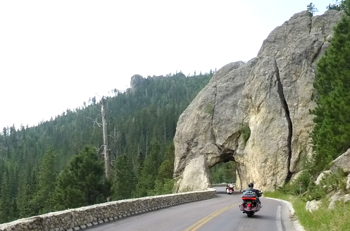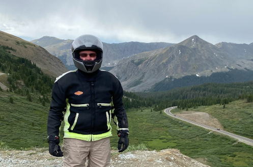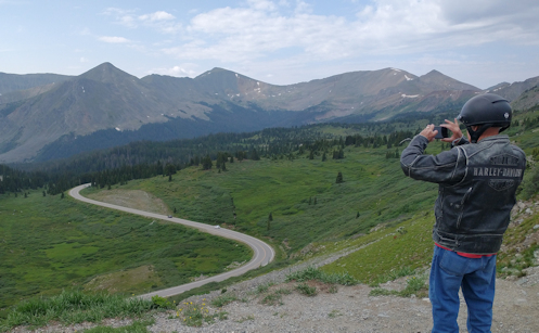
Bill gets some pix on top of Cottonwood Pass.
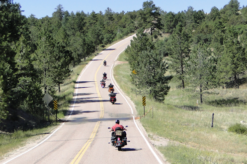
We headed out of Buena Vista at a reasonable hour headed up over Cottonwood Pass. It wasn’t as cold as the day before but once again, late July or not, I was darn glad to have my electric vest on. Since they finally paved the other side of this pass it has become a very popular route for a lot of people but the crowd wasn’t too thick.
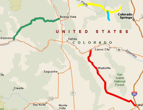
Heading down, though, we had options and I thought I had gotten it all worked out. Once we got past Gunnison we had the issue of a bridge across the Blue Mesa Reservoir being out of service . . . or not. There were two possible detours. One was to get to Almont coming down off Cottonwood Pass and turning north to Crested Butte and taking the unpaved Kebler Pass. They use a lot of magnesium chloride on that road so it’s really hard-packed, like really rough pavement. I’ve been over it and it’s not bad.
The other is to head out of Gunnison and take the road at the east end of the reservoir south toward Lake City and then, before coming to Lake City, take the Lake City Cutoff, which goes down to US 50 on the far side of the bridge. But the cutoff is not paved either.
The third alternative was that I thought I had found information saying that the bridge was actually open just one lane at a time for light traffic, such as motorcycles and passenger cars. We headed for the bridge.
At the turn-off to head for Lake City the road straight ahead had a sign that said it was closed. Not a good sign. We went past it. You could still go in because there were campgrounds and fishing areas you could get to on this side of the bridge. But we kept seeing signs saying the road ahead was closed. Not a good sign at all. We kept going.
Sure enough, we came to where the road really was closed. There was a guy there telling people what their alternatives were and he told us we should hurry back and take the Lake City road and then the cutoff. He said the cutoff opened for westbound traffic at 12:30 p.m. and if we didn’t make it there in time we would have to wait two hours for the next opening. We didn’t have much time so we hustled.
Until we got behind a couple really slow, large vehicles. Dang! Well, we got there in time and didn’t even have to stop, they just waved us on through. And then it was 15 miles of rough gravel. I was on my V-Strom so for me it was no issue. Dennis didn’t like it on his BMW but he just figured it had to be. Bill, on his Harley, absolutely hated it. He said later if he’d known what it was going to be he would have turned around and gone home or something. Anything but that 15 miles of gravel. He was not a happy camper.
I had actually been surprised they had gone for it. When I told them what the guy at the blockade had told me I was not expecting Dennis to just say simply, “Let’s do it.” But he did. He and Bill hate gravel. And Bill just followed us. Bill prefers to just follow. This time he wasn’t so glad he had done so.
The way I looked at it, this was supposed to be a Colorado adventure tour, where we stop for all the tourist attractions we typically just ride right past. Our first day was doing a hot springs. Our second day was zip-lining. Now our third day was getting off the pavement into the backcountry. Kinda.
One way or another we made it to Montrose, our stop for the night.
Biker Quote for today
The joy of riding a motorcycle is out of this world. The thrill of riding in the hills and mountains is an opiate addiction. — Avijeet Das