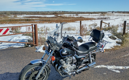
Yeah, it looks like winter out there but technically it’s still only fall. In other words, it’s going to get worse before it gets better.
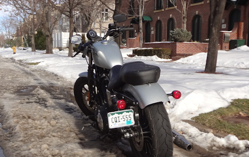
The temperature was in the 50s, hardly a cloud in the sky, and I had not ridden the Honda in November yet. My assignment was clear.
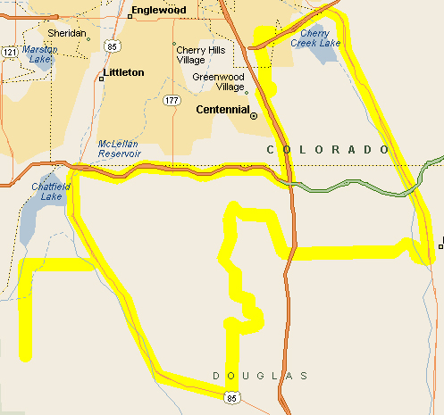
For once I actually had a route planned out in advance. I headed west on Belleview to Santa Fe and then south. It was about then that I remembered that the last time I went this way I couldn’t get through. There was major roadwork in progress where Santa Fe crosses C-470 and I had gone around and around trying to figure a way to get where I wanted to go. Either I was going to have to find another route again or else I’d get to see what they had done.
The construction was finished so I got through, but what exactly they had done was not at all clear to me. What the heck was all that about? I was expecting a whole new interchange with C-470 or something but that was not the case. I’m assuming I’ll never know.
Just south of that interchange, however, they had shifted the road a bit. The gas station and other shops that used to be right along the road are now accessible only by turning off the main road onto a bit of frontage. Making them more difficult to get to but making the road a little safer I’m sure, eliminating all that pulling on and off right onto the main road.
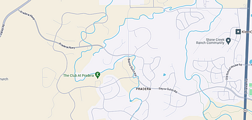
I continued on south on US 85, with nothing much new to be seen here. Reaching Castle Rock, I crossed I-25 and took Founders Parkway just to the left turn onto Crowfoot Valley Road, the most direct route between Castle Rock and Parker. This road has seen huge changes since I started riding it, going from a small two-lane with a lot of open country to having housing developments just about everywhere. At one point I passed a farm that used to be all alone out there and now there is a row of houses looking down on it from the ridge above, going on and on and on. How long ago was that farm isolated? Two years? Yeah, a lot of change around here.
It was a potentially chilly day so I had worn my electric vest but had not felt the need to turn it on yet. Castle Rock is higher than Denver, being down toward the Palmer Divide, so I was definitely feeling the cool here. I considered turning the vest on but it just really wasn’t necessary.
I ran up Crowfoot Valley Road till it turns into Motsenbocker Road at Stroh Road and up to where it bends west on Todd Drive. Right there there was construction going on that looks as though they’re connecting to the northeast to Parker Road across a new bridge. That will be interesting to explore when it’s done.
Todd took me to Jordan Road, which I took up to Arapahoe, then east to Parker Road and on home. About 60 miles–an hour and a half. Nice day for a ride.
Biker Quote for Today
Why motorcycles are better than women: You can’t get diseases from a motorcycle you don’t know very well.