In Cherry Creek State Park you can wonder, “where’s the city?”
The forecast for Tuesday was for a record high temperature for the date so of course I had to go ride. So did a lot of others; I saw quite a few motorcycles that day.
As so often happens I had no idea where I was going to go. I started heading south on Yosemite and had the idea to cut over to Dayton and take the road through Cherry Creek State Park over to Parker Road and then keep going south on Parker. I paid for a parks pass with my vehicle registration on the V-Strom this year and I figure I need to use it and get my money’s worth.
Of course, the last time I tried to go through the park, coming from the Parker Road side, I couldn’t get through because they appear to be replacing a small bridge. Surely that project was finished by now. Wrong.
The road goes through the park, past a lot of picnic areas and hiking trails, then past the turn-off to the model airfield, where two radio-controlled model planes were in the air. No drones on this day but I suspect this area gets used for drones now more than model airplanes. Then on to the turn-off for the shooting area, where you can take your guns and do target practice.
This was where the road was blocked going through the park. So I went up the short road to the shooting area, expecting to hear gunshots as I drew near, but I didn’t. What I did encounter was the unmistakable odor of weapons being discharged. I hadn’t expected that. And then as I turned around I did hear a few pop-pops of the guns. OK, back out of the park onto Dayton and south.
I went to Orchard and then east, to Peoria and then south to Arapahoe Road. Turned east on Arapahoe and then continued east past Parker Road. I got to wondering where Arapahoe goes as you follow it all the way east. Had I ever done that before? Maybe now is the time.
And go further east it does, on and on and on. I got to thinking that maybe I had been out this way before and that eventually Arapahoe would bend north and cross Smoky Hill Road, and the further out I got the more it looked familiar and I suspected I was right. It crossed under E-470 and eventually came to Powhaton Road, where I recognized that Arapahoe from here just went into the neighborhood across Powhaton and was no longer an arterial. So I turned north on Powhaton.
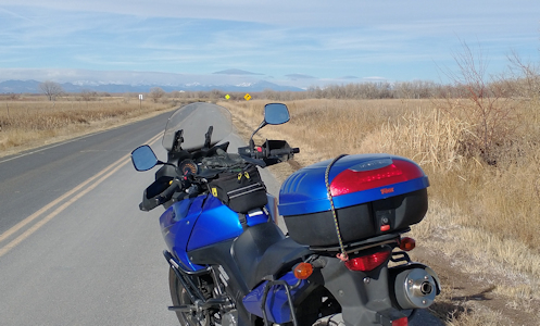
Powhaton, at least at this moment, is where the city truly ends. I rode north with houses right there on my left and nothing but prairie to my right. At first it was a four-lane road but eventually it narrowed to where it was two lanes without even a shoulder. As I went along I came upon a large, severe-looking building on the east side of the road, all by itself. What is that, I wondered? It looked like a prison. Getting closer I could see the sign out front: Infinity Middle School. OK. I’m sure a lot of the kids at that school would agree with my initial assessment.
Continuing north, Powhaton ends at Quincy. I turned west and was immediately back on familiar turf. I’ve come into town on Quincy many times. So many times, in fact, that this time I decided to do something different. At Chambers I turned north and went up to Hampden and then turned west on that. At least it was a change of scenery. Then I hit Parker, up to I-225, and home. And yes, we did set an all-time high for the day. What a great day to be out riding!
Biker Quote for Today
Twist the throttle and roll on.