Posts Tagged ‘Colorado roads’

Rider Publishes My U.S. 6 Article

Monday, December 5th, 2011

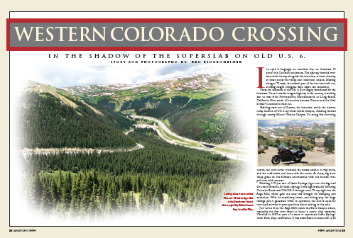
The opening spread of the story in Rider

Hooray, hooray! It took a long time but Rider magazine has published my feature article about crossing western Colorado on old U.S. 6, in the shadow of the superslab.

I had heard from Donya Carlson that it would be in the January 2012 issue, and I knew it should be arriving in my mail any day now. But over the last several days I’ve been in communication with three people who had already received their issues of Rider and seen my piece, while my issue had yet to arrive! Well, the mailman was here about 10 minutes ago and I finally got mine. Yes!

Now I’m hard at work on my next piece for Rider. Judy and I went on vacation to Seattle and British Columbia this summer and rented a Harley out of Vancouver to go riding for a few days. It was part of the plan all along to pitch the story to Rider, so I made sure to shoot a lot of pictures and take a lot of notes.

Once we got back I sent a letter pitching the idea, and they liked it. Now I need to get it written and select the photos to go with it and send it along. If they like it and want to publish it they will tell me that, and then, if things go like they did before, the note will say I can expect to see the piece in print in 12 to 18 months.

So I’m in the middle of the first draft right now, and I’ve got the photos narrowed down to about 40 or so. The article will go through three or four revisions and I’ll winnow the photos down to about 15. Then I’ll be eagerly awaiting a note that I hope will say they like it. If they do you will probably see it in print in 2013. Meanwhile, I want to be pitching them another story idea a whole lot sooner this next time.

Recent from National Motorcycle Examiner
International Women & Motorcycling Conference to return in 2012

Biker Quote for Today

Time spent on a motorcycle is not deducted from your lifespan.

Byways, Byways, We’ve Got Byways

Thursday, October 20th, 2011

Do you ever feel like going for a ride on your motorcycle but can’t figure out where to go, because you’ve already been everywhere, at least locally? I know I get tired of doing the same old routes again and again.

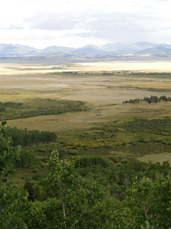
View of South Park from Boreas PassThat’s when it can be good to turn to somebody else’s idea of a good route. And with the modern day convenience of the internet, that can mean Byways.org.

Scenic and historic byways are routes that probably include roads you’ve been on, but perhaps you’ve never combined them in quite the same manner. Take the Lariat Loop. I’ve heard of that route for many years but never really looked into where it goes until today. It starts in Golden, goes up Lookout Mountain and then snakes over to Bergen Park, to Evergreen, and down to Morrison. Then it follows CO 93 back to Golden. I’ve been on all those roads, but have I ever ridden that route all at one time? No.

So Byways.org lists 11 major byways in Colorado, along with 14 others that it says “may be incomplete or contain byways that overlap.” To give you an idea of what’s there, here’s a sampling.

Frontier Pathways Scenic and Historic Byway — Down west of Pueblo, this route runs to Westcliffe, past Bishop Castle, and past the Jackson Hill Stage Stop.

Santa Fe Trail — This ride comes in from Kansas and heads down into New Mexico following–what else?–the old Santa Fe Trail. One nice thing about Byways.org is that it shows you the continuation of roads like this because it covers all the states.

West Elk Loop — Starting and ending at Carbondale, this loop heads up over McClure Pass to Hotchkiss, takes the road through Crawford that runs along the north rim of the Black Canyon of the Gunnison, crosses the dam and heads east into Gunnison, and then turns north to Crested Butte. From Crested Butte, it goes over Kebler Pass back down to CO 133 and back over McClure to Carbondale.

Of course, you don’t need to double back to Carbondale. Heck, you don’t need to do the loop at all. The point is, at least for me, to look at these byways with the idea of identifying roads that perhaps you have overlooked. Or maybe learn about spots along the way that you were unfamiliar with and worth a stop the next time you’re out that way.

Plus, this sort of site strikes me as an excellent resource when you’re planning a trip to an area you are not as familiar with as you are your own home state.

Or you can just continue to ride the same old roads. Totally up to you. Just thought I’d offer an idea.

Recent from National Motorcycle Examiner
Study says 138 million electric two-wheelers by 2017

Biker Quote for Today

Adventure: The pursuit of life.

The Fall Color/Cemetery Dual-Sport Tour

Thursday, September 29th, 2011

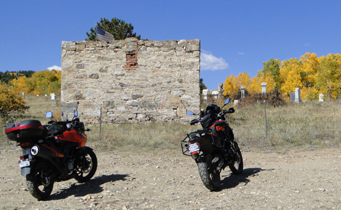
V-Strom and F800GS at old cemetery above Central City

Had a terrific time with Ron Coleman of Western Dual Sport Motorcycle Adventures today dual-sport riding in the hills west of Boulder and around Central City. He was on one of his V-Stroms and I was on his F800GS. Oh, and I dumped the thing twice. Details in due time.

Ron dubbed this the Fall Color/Cemetery Tour for very literal reasons. The aspen are at their peak of color about now and here’s an interesting thing you may not know: cruising around in the hills above Central City there are numerous old cemeteries, with gravestones dating back to the mid-1800s. They’re actually very picturesque, with some very ornate markers.

We headed out of Boulder going up Boulder Canyon but then turned off onto Magnolia Drive. This road climbs very steeply with numerous switchbacks that must have a road pitch of at least 15 percent. It was nice to be on a bike that was light and had great low-end torque. Up over a crest and the mountains to the west came into sight and the pavement ended. We wound our way along and then reached the Peak-to-Peak Highway just north of where the road up Coal Creek Canyon hits it.

Heading south on the Peak-to-Peak, we turned off just before reaching Black Hawk onto Apex Valley Road. Where Apex Valley Road appears to end, a hard left took us up Upper Apex Road and after awhile we came out into a clearing on a ridgetop where there were three cemeteries. What was surprising was that there were also some very new condos up there. Ron said he believes they were built to house casino workers when gambling was legalized in Black Hawk and Central City.

We headed down toward Central City but turned off on a gravel road that carried us along a ridge overlooking the town. At one point Ron stopped, took a hard right, and went down a badly washed out road that had softball-sized rocks and about 6 inches of sand. In retrospect, I should have made the commitment to do it and just gone for it. But I didn’t. I was very hesitant and lacking in confidence, and I high-sided. That bike flipped me like a rag doll but I landed totally unhurt and the bike was not damaged either. We got it back up and went on our way.

From Central City we took the parkway over to I-70 and on to Idaho Springs for lunch, where we met up with Jacque, a friend of Ron’s who I had ridden with before. She was on her F650GS. We continued west just to Fall River Road and then, after probably less than a mile on that road turned off onto the York Gulch road. This brought us to another old cemetery where, when I put my feet down to stop, I ended up just falling over because my feet didn’t make contact with the ground. Ron pointed out after we picked the bike back up that there was a rut right where my foot was expecting something solid. Once again, no injuries, no damage.

Following that road further we ended up right back at the other cemeteries above Central City and retraced our path down Upper Apex and Apex Valley Road, back to the Peak-to-Peak. We headed north but then turned east on South Beaver Creek Road, unpaved, which ran into CO 72 coming up Coal Creek Canyon. Took that road down to CO 93 at Rocky Flats and then on back to Boulder.

What a great day to be out in the mountains in the dirt. So good, in fact, that we’re going to do it again next week.

Recent from National Motorcycle Examiner
Honda debuts fuel-efficient motorcycle engine with ‘powerful, throbbing torque’

Biker Quote for Today

Rule 1 of motorcycling: Get back on the bike. Sooner or later, you will.

Great Dual-Sport Gunnison Weekend

Monday, September 26th, 2011

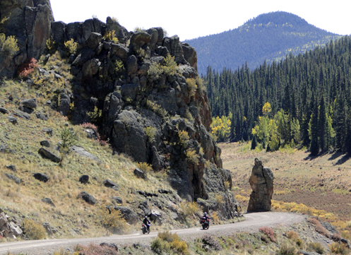
Coming down off Carnero Pass

I went dual-sporting again this weekend with Kevin Smith over in the Gunnison area. Kevin lives over there and rents V-Stroms through his company, Colorado Mountain Moto. Last year we rode Cinnamon Pass. This year we rode Carnero Pass.

Never heard of Carnero Pass? Neither had I. But it’s the perfect example of what I keep saying, that I want to do a lot more dual-sport riding because I know there are a lot of fabulous roads in this state that I’ve never been on because they are not paved.

Oh, and just to make that last statement seem a little foolish, Kevin’s wife Janet rode with us–on her Ninja. Now, Kevin says this Ninja 500R is really more a standard than a sportbike, but still, we were on dual-sports and Janet was on her Ninja. It’s a matter of attitude. Some people say “A touring bike is whatever bike you’re on when you go touring.” I guess you can say that a dual-sport bike is any bike you’re on when you go dual-sporting. This is the bike Janet has so it’s the bike she rides wherever she wants to ride. This is not the first gravel mountain pass road she’s been on on that bike.

Now, I still wouldn’t have wanted to have been on that road with my Concours. But my CB750 is a different story. That bike just handles better on gravel than the Kawi. And if that Ninja could do this ride my CB could, too.

So where did we go? We headed east out of Gunnison just a few miles to where we turned off on CO 114, which runs down over North Cochetopa Pass to Saguache. We went over the pass but before we got as far as Saguache we turned off onto Saguache County Road 41G. This is the road that goes up over Carnero Pass. Carnero is almost as high as Slumgullion Pass, which we crossed later, but you’d never know it. I guess we had done most of our climbing coming up North Cochetopa, and so even though we down then a ways, it didn’t seem like that much further up to Carnero after we got off CO 114.

Coming down, though, we had a pretty good descent as we made out way toward Del Norte, where we finally reached the pavement again. In the interim we rode some very nice roads and saw some terrific scenery and just generally enjoyed a day out away from pretty nearly anyone else. We did go back to Gunnison via South Fork, Creede, and Lake City, though so that was all paved and populated. The aspens are turning, though not quite at their peak yet, and it was a beautiful autumn day, though it did get blustery in the afternoon. What a great day to be out on some great roads. I love living in Colorado. (You can read more about it and see pictures from the ride on Examiner, via that link immediately below.)

Recent from National Motorcycle Examiner
Dual-sport riding out of Gunnison

Biker Quote for Today

The quickest way from Point A to Point B is not on a straight line, it’s on a motorcycle.

New Book of Colorado Rides Is Very Comprehensive

Thursday, September 22nd, 2011

The Complete Guide to Motorcycling Colorado contains colorful in-depth descriptions of 172 different rides that can be combined in a variety of ways to create the best trips for all riding styles and interests.”
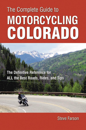
Cover of The Complete Guide to Motorcycling ColoradoSo says the blurb that came with this new book from Whitehorse Press and of course, of all possible reviewers, I wanted to see what it’s all about. First off, what 172 rides could the author, Steve Farson, possibly have compiled? Here on the Passes and Canyons website I list 33 rides on my Great Roads page, and just a few more on my Dirt Roads and Side Trips page.

One thing I knew from the start is that he includes a lot of dirt roads. OK, that will certainly add to the number in a big way. There are a lot of great unpaved roads in this state that are wonderful for a dual-sport bike. You could do an entire book just on them. Also, it turns out, Farson breaks some segments out into individual rides that I lump together as a group. My Peak-to-Peak Highway and Adjoining Canyons page is a perfect example of that. That page includes the entire series of roads running from Estes Park down to U.S. 6 as well as Clear Creek Canyon and five others. So OK, now I’m starting to see how he reached that 172 number.

The bottom line there is that this book is comprehensive. And I can tell you from my own experience building this website, Steve Farson must have put an enormous amount of effort into compiling all this information. He doesn’t just show you the routes and give you an idea of what you’ll see, he also delves into history and tells you a lot about the areas. Along with current photos of these roads there are also numerous old black and whites from 100 years ago or more showing the then and now.

Farson breaks the state up into seven regions and addresses each individually. At the end is also a Colorado Statewide section that offers suggested routes linking together a bunch of the individual rides that he discusses separately. For instance, there are the Weekender Trip to the Northwest and Weekender Trip to the Southwest, both of which start in Buena Vista. He even breaks them down into suggestions for how to make these rides either one-nighters or two-nighters.

The sections for each region begins with a “Regional Overview” with a map showing all the routes highlighted. In the Southwest regional section, for instance, that’s nearly every road on the map because that whole part of the state is just that spectacular. It lists the “Rides in This Section” and then proceeds through them. Each ride gets at least one page and most cover two. Some extend to three pages and each has at least a map and one photo.

Next comes “Recommendations,” comprising groupings such as “Backroad Journeys,” “Especially Twisty Rides,” “Circling Tours” and “Linked Dirt-Road Adventures,” which are pretty much what the names imply. The section wraps up with “Favorite Rides,” which is broken down into categories such as “Most Scenic Spots,” “Best Cruising Journeys,” “Best Sporting Curves and Sweepers,” Best Dirt-Road Adventures,” Little-Known Gems,” and “Worthy Destinations.” Each of these is a simple listing of the rides with the ride number so you can turn to it.

What can I say? This is an impressive book. Yes, there are some dirt roads that are not included, but there’s no way you could include them all. And yes, he includes some roads that I don’t consider all that big a deal, such as Poncha Pass. But Farson uses that word “Complete” in the title, so you can’t fault him for including it. The one caution I would offer is on Guanella Pass, which the book does not mention is closed to through traffic. It has been closed for a couple years now and the last word I’ve heard is that they do not intend to reopen it. If you plan a trip with that as part of your route you’re going to be doing some significant backtracking.

Update: I just heard from Steve Farson and he gave me more current information on Guanella Pass than I had had before. Says Steve, “Guanella Pass opened this past spring. The work to stabilize the slope on the north side of the pass is complete. The work to pave the entire north side is almost complete (Oct 1 completion). In the meantime there are three hour windows on weekdays when they close the pass, then the rest of the time it is open, including weekends. It is quite something to ride the north side now. Almost park like. If Jim Gorden, owner of the Tumbling River Ranch on the Grant side finally relents, the south side of the pass down below Geneva Park might eventually be paved as well.” Thanks for the update Steve.

It’s a terrific reference book. I know that for myself, as I get more and more into dual-sport riding, I intend to use it to find some good dirt roads to ride. Use it hand in hand with this website and between the two of us I think you’ll find just about everything you’ll need to plan your Colorado trip.

Recent from National Motorcycle Examiner
Brammo adds electric cycle rentals in Europe

Biker Quote for Today

There’s no adventure in turning around.
Help on Website Offered by Others

Friday, May 9th, 2008

I want to take this opportunity to thank a few people who have very generously offered me photos and other information that has helped make this Passes and Canyons, Motorcycle Touring in Colorado website better and more complete.

Most recently, Andy Simons has sent me a considerable number of his photos from different roads around the state. I’ve got some of them up on the site already but there are quite a few more that will take me awhile yet to put to use. You can see his work on these pages now: Arkansas River Valley; Monarch Pass, Montrose area, and CO 92 from Hotchkiss to Blue Mesa Reservoir.

What I find really exciting is that Andy has sent me some photos of some roads I’ve never been on. Just recently I started adding a few roads that are not paved but are suitable for the more adventurous street-bike rider. Larry Matkovich, who runs Larry’s Custom Cycle in Canon City, got me started on this by sending me some info on a few such roads. Thanks here, then, to Larry as well. The material Andy has sent me will enable me to expand that section.

By the way, Andy is quite the motorcycle traveler and an avid photographer. If you want to see more of what he has done you can check him out on Smugmug.com and Angelfire.

I also want to thank guys like Brad Betts and Steve Shards who have written asking me for information as they plan their trips to Colorado. There is no better way for me to know what topics I should write about than for you to ask me for something in particular. Brad’s questions generated my most recent two posts and Steve’s questions resulted in the whole New Zealand Rides the Rockies series of posts.

There have been other folks along the way who have helped make this website what it is and I offer them my thanks as well. Keep those cards and letters coming in. I’m always eager to do what I can to assist.

One other thing. You may have noticed this “Biker Quote for Today” bit that I now end each post with. In case you wonder where these quotes come from, I have started copying down interesting/relevant quotes that people use in their signatures on motorcycle web forums. So thanks to all those folks as well for providing us all with their quotes.

Biker Quote for Today

People take different roads seeking fulfillment and happiness. Just because they’re not on your road doesn’t mean they’ve gotten lost.

New Zealand Rides The Rockies – Day 4

Friday, February 29th, 2008

Recap: Steve and some buddies are coming from New Zealand in 2009 for some motorcycle touring in Colorado and Utah. This series of posts lays out their proposed routes, with my comments. Your comments are welcome as well.

Day 4

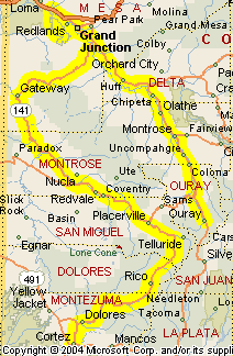
Leaving Ouray this morning, our Kiwi band heads north on US 550 through Montrose, and Delta, and on up to Grand Junction. Their plan is to ride the Rim Rock Drive route through Colorado National Monument, and then head back south, taking the Unaweep Tabeguache Scenic and Historic Byway through Gateway and Naturita, past Telluride and over Lizard Head Pass down to Cortez. This is going to be a bit of riding, totaling about 335 miles. Here’s the map. Click to see a larger version.

Ouray to Cortez via Colorado National Monument

The ride up US 50 is uneventful and fairly fast. A significant portion of this road has been made into four-lane divided highway in recent years. Once they reach Grand Junction it will be necessary to enter the town and stay on the US 50 bypass on the south side before turning off onto Glade Park Road, the road that leads to Colorado National Monument. In the Monument, Rim Rock Drive is clearly marked, winding its way though and exiting to the north toward Fruita. Colorado National Monument is described as being a little bit of red-rock Utah within Colorado, and that’s not a bad description.

That’s not the only bit of red-rock Utah in Colorado that our crew will see today, however. Leaving the Monument they will head back east on I-70 to rejoin US 50 and backtrack a few miles to the south, to CO 141 and the Unaweep Tabeguache Scenic and Historic Byway. Along this road you’ll pass through farmland, areas of wild rock formations, and ultimately to a stretch that you would swear was Utah, except that red-rock cliffs don’t stop at the state line and this is still Colorado. Who knew? Additionally, one of the more interesting historical sights is the hanging flume, an old water channel built onto the sheer-rock cliffs. This is one of those things you’ll look at and wonder “How in the world did they do that?”

For a while after leaving the river this route crosses some high prairie and you’ll probably make some pretty good time. A little east of Naturita you leave CO 141 and pick up CO 145 to Norwood and Placerville. After passing through Placerville you start going up and what you’re really doing is coming around the back side of the mountains that enclose Telluride. Telluride itself is not actually on CO 145, so you have to take the county road about 5 miles to the town. Do. The setting for this little mountain town is simply awesome. And if you have the time, take the free gondola up to get a good look from above.

Heading south from Telluride, the next pass is Lizard Head Pass. Off to your right, high up on the ridge, you’ll see the rock formation that gave it the name. From there it’s down hill, down the valley, on to Cortez, where today’s ride ends.

Alternate Route

I have just one suggestion for this day, and it really only works when you consider the route the remainder of this trip will be taking. This is Day 4 and on Day 5, Steve and crew are heading over into Utah. When they return to Colorado on Day 7 there is not a lot on the agenda as they head for a night in the Eagle/Vail area. It might make good sense to skip Colorado National Monument on Day 4 and swing through there on Day 7, starting at the Fruita end and coming out at Grand Junction. Then on Day 4 you would just come north to the turn-off to CO 141 and the Unaweep highway. That would trim about 50 miles and at least an hour and a half off an otherwise long day, and add more interest to Day 7. Just a thought.,

New Zealand Rides The Rockies – Day 3

Wednesday, February 27th, 2008

Recap: Steve and some buddies are coming from New Zealand in 2009 for some motorcycle touring in Colorado and Utah. This series of posts lays out their proposed routes, with my comments. Your comments are welcome as well.

Day 3

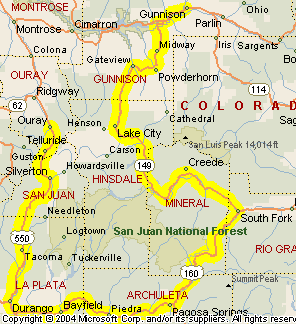
Our biker buddies are leaving Gunnison today, making just a partial loop ride. The plan was originally to do another day trip and spend a third night in Gunnison, but that has been changed, and I think the new plan is a lot better. They’ll end up tonight in Ouray, which is a very nice place to stop. The ride will cover about 270 miles. If they pushed on back to Gunnison it would be another 90 miles, 60 of which they would then retrace the next morning. This is definitely a better plan. Here’s the map. Or click the link to view the larger map.

Gunnison to Ouray

The day begins with a short jaunt west on US 50, just to the eastern end of the Blue Mesa Reservoir. Here you find CO 149, which goes south to Lake City and beyond. Lake City is a pretty little town that is famously home to Texans and the Alferd Packer Massacre Site. For whatever reason, Texans who like to vacation in Colorado have settled on Lake City as their main spot. I even heard a story some years ago that the state of Texas was considering acquiring property around here and creating a Texas state park. That was probably bull, but you get the picture.

As for Alferd Packer, he is Colorado’s only convicted cannibal. He and some other men were stranded by snow in the winter of 1874 and he was the only survivor. It turned out he had survived by eating his companions. The University of Colorado at Boulder has named the cafeteria in its student union the Alferd E. Packer Memorial Grill. There’s a monument that marks the site as you head south out of town.

Heading south out of town on CO 149, you soon cross Slumgullion Pass and then Spring Creek Pass. Once over Spring Creek Pass you will definitely want to stop and check out South Clear Creek Falls. It’s just a quarter mile off the highway on a good paved road. No fees as I recall.

Further along on CO 149 the route leads to Creede. If you just stay on the highway you’ll go past the town but that would be a mistake. Stop here for lunch, or at least for ice cream. Ice cream is very big in Creede.

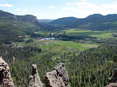
CO 149 runs into US 160 at South Fork and our riders here take a right. This goes up over Wolf Creek Pass and down to Pagosa Springs. Wolf Creek Pass is another of those great passes you come to Colorado to ride. Here’s an example of what you’ll see coming down on the west side.

Wolf Creek Pass

From Pagosa Springs US 160 leads west over Yellowjacket Pass, another low pass, and on to Durango. Durango is another town that would be well worth staying at for a day or two, but that’s not on the agenda today.

Heading north out of Durango on US 550, our riders will cross two lower passes, Coal Bank Pass and Molas Pass, before descending into Silverton. This part of Colorado seems thick with picturesque towns and Silverton is another of them. It’s also the home of a big hang-gliding festival each summer.

Continuing north, the road crosses Red Mountain Pass. You may get tired of me saying this, but this is another great pass to ride. Plus, one of the really spectacular parts of it is the descent into Ouray. I definitely prefer to take this road north to south rather than going the other way.

Ouray is an excellent place to stop for the night after a day in the saddle. Good restaurants and hot springs are a terrific way to end the day. Be advised that unless you stay at one of the motels that have hot springs on their property you will have to pay to soak. We stayed at the Box Canyon Lodge one time and that is one I could recommend. If anyone else has recommendations please leave a comment with your thoughts. Thanks.

An Aside

For those of you who have been here before and are surprised to see the change in the layout, let me explain. I just updated to a new version of WordPress, the blog application I’m using, and it blew away all my customizations. Now it’g going to take me a while to make this thing look the way I had it. Bear with me.