Posts Tagged ‘Colorado motorcycle roads’

Route Recommendation For Three-Day Colorado Ride

Thursday, February 19th, 2015
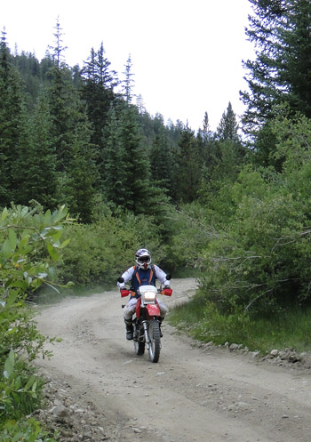
The OFMC on a ride

The OFMC on a ride.

It’s common for me to receive emails planning Colorado trips, asking for suggestions on riding routes. It’s interesting for me because everyone’s plans are different, everyone has different interests, amounts of time to spend, and starting and ending points. I look at their particulars and see what I can come up with.

Here’s a query I received recently, and my response. I’m always hoping that other folks who read this will say, “Wow, I’ve never done that road. Maybe I will.” Or maybe you’ll leave a comment telling me what you think a much better route would have been. Maybe you’ll turn me on to something I’m not aware of.

Anyway, here’s the exchange.

Hey Ken!
Love your website!!
I don’t know if you have the time to answer individual inquiries but we thought we’d give it a shot!

We’re planning a mid-July 2015 ride to Colorado after our yearly ride to Red Lodge, MT and the Beartooth mountains.

Our plan is to leave Red Lodge and ride to Estes Park (stay in Estes Park) and then ride Rocky Mountain National Park.
After our tour of RMNP we’d like to go down and ride Pikes Peak.

There are a lot of roads leading from Estes Park to Colorado Springs but since this is our first ride to CO – we have absolutely no clue which ones would be the absolute best for a day ride from Estes Park to Pikes Peak and back again the same day.

Unfortunately we’ll only have about 3 days for the Colorado portion of our ride.
Some of the young ones have to get back to something they call work!

If you have any time to help us out – it’d be GREAT!!

Thanks much!!

Greg

My reply:

Greg–

Here’s what I would suggest. It appears to be around 325 miles, maybe a bit more. In July if you get an early start the days are long so it could work. It may be a bit longer than you would like. I’m attaching a map.

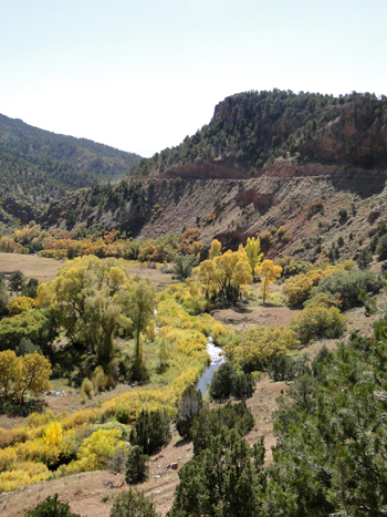
Head west out of Estes over Trail Ridge Road, down to Granby, and then take US 40 to Winter Park, over Berthoud Pass, down to I-70 and take I-70 west to Georgetown. Go into Georgetown and take Guanella Pass over to US 285 at Grant and then east on that to Pine Junction, where you go south on 126, to 67, to Woodland Park and US 24. That will take you to the well-marked turn-off to Pikes Peak. Once you come down off the mountain, continue east on US 24 through Manitou and catch I-25 briefly north to Monument. Get off at Monument and take 105 north to Sedalia, where you’ll hit US 85. Continue north. In the Denver suburbs you’ll hit C-470. Take that around Denver to the north and west and where C-470 ends you’ll be on US 6. Take that up Clear Creek Canyon to the Peak to Peak Highway and take the Peak to Peak the rest of the way back to Estes.

Be advised, that’s a lot of riding. A possible different approach would be to take the Peak to Peak out of Estes and at the turn-off past Black Hawk, where the road splits and one way goes to Golden and the other way goes to Idaho Springs, go to Idaho Springs and on to Georgetown and then back on the route. You’ll be backtracking on your way home that evening but you’ll save a good bit of time not going the Trail Ridge/Granby/Berthoud Pass route.

Whatever you do, have a great time!

Recent from National Motorcycle Examiner
Motorcycle race where you would never expect it

Biker Quote for Today

PMS – The Silent Killer. Parked Motorcycle Syndrome symptoms include pacing back and forth in the garage, irritability, headache, and nausea. If you or a loved one is suffering from any of these symptoms, get out for a ride. Prolonged exposure to a parked motorcycle can drive you completely insane.

Interesting Dirt Route Como to Salida

Thursday, April 19th, 2012

This is not the first time I’ve said this but I’ll repeat myself: I’ve got to get a dual-sport motorcycle.

Riding dirt from Como to Salida

  Riding dirt from Como to Salida

The trigger this time is a ride I didn’t do, because I didn’t have a dual-sport. I was contacted on Monday by a guy named Milan, who heard of me through Ben at House of Motorrad. Milan told me he works as a ski guide in winter and wants to start doing Colorado motorcycle guiding in the summer. He asked if he could get a link to his site on my site and, by the way, wanna go for a ride?

Milan lives in Telluride and was headed back that way from Golden and proposed taking some dirt from Como to Salida. I said I’d love to, but not on one of my street bikes. He replied, “You could probably take a street bike on the Hartsel dirt- very easy.”

As for me, I replied, “I know better than to take my Concours on anything rougher than hard-packed gravel.”

Milan nudged, “I’ll be leaving Golden area about 9 am. It is a hardpacked gravel.”

I demurred. My Connie does not like gravel, even hard-packed, for very long. So I didn’t go.

Good choice. I heard from Milan today, saying, “You made the right choice by not coming, there was a stream crossing (about 6″ deep) and some ruts in another part of the ride.”

But I was curious what route he took. That’s it there on the map, although there’s no detail at this scale, though it gives you an idea. According to Milan, “I rode 285 to Como, took a right on Elkhorn Road (F.R. 15) to Hartsel. Then took County Road 53 to Forest Road 175 – that dropped me right into Salida.”

So OK, if I ever get that dual-sport I have another route to check out. Some day.

Recent from National Motorcycle Examiner
Indiana governor offers motorcycle-buying advice

Biker Quote for Today

After riding in the rain thru Bosnia, I think this newfangled front fender idea wasn’t so bad. I’m not as covered in mud as I usually am. That’s an idea that may just take off in popularity. My chopper still ain’t gonna get one tho.


On the Shelf Road, Finally

Monday, October 17th, 2011

For the first couple years that I was working on this website the focus was entirely on paved roads. I didn’t have any off-road experience, plus there was plenty to keep me busy just putting up info on the paved roads, so I didn’t touch the gravel.

The Shelf RoadThen I got an email from Larry Matkovich, who runs Larry’s Custom Cycle in Canon City, suggesting I add some info on gravel roads (“dirty” roads as he called them) and he offered to provide me the scoop on some, along with a rating system he had devised. Thus was born the Dirt Roads and Side Trips page on the site.

The very first dirt road Larry introduced me to was the Shelf Road, which runs north out of Canon City to Cripple Creek. And although I’ve had it listed on the site for probably three years now, I had never been on it. Until yesterday.

I’m here to tell you, this is a good ride. Using the system he devised, Larry rated this road a 2, “Doable but not recommended for sport bikes, full dressers, some cruisers especially 2-up.” I might be a little more generous, maybe giving it a 1, “Fair gravel road, a bit more skill required, but OK for all bikes.”

Either way, it is a little rough in some places, with a good bit of washboard, but it’s doable. It’s better on a dual-sport, but if you’re on a street bike you can just take your time and ride around the potholes. Kind of like my friend Janet Linn does when she goes over mountain passes on her Ninja.

And boy, yesterday, with the fall colors, it was a beauty, as you can see in the photo. The weather is getting dicier so any of this kind of riding you intend to do you’d better do soon. Yesterday was a good one. It may be the best we’ll see for awhile. Hope you were out riding.

Recent from National Motorcycle Examiner
Hoka Hey finishers did get money

Biker Quote for Today

Go ahead . . . Get married, have kids, drive a van. LOL.

New Book of Colorado Rides Is Very Comprehensive

Thursday, September 22nd, 2011

The Complete Guide to Motorcycling Colorado contains colorful in-depth descriptions of 172 different rides that can be combined in a variety of ways to create the best trips for all riding styles and interests.”

Cover of The Complete Guide to Motorcycling ColoradoSo says the blurb that came with this new book from Whitehorse Press and of course, of all possible reviewers, I wanted to see what it’s all about. First off, what 172 rides could the author, Steve Farson, possibly have compiled? Here on the Passes and Canyons website I list 33 rides on my Great Roads page, and just a few more on my Dirt Roads and Side Trips page.

One thing I knew from the start is that he includes a lot of dirt roads. OK, that will certainly add to the number in a big way. There are a lot of great unpaved roads in this state that are wonderful for a dual-sport bike. You could do an entire book just on them. Also, it turns out, Farson breaks some segments out into individual rides that I lump together as a group. My Peak-to-Peak Highway and Adjoining Canyons page is a perfect example of that. That page includes the entire series of roads running from Estes Park down to U.S. 6 as well as Clear Creek Canyon and five others. So OK, now I’m starting to see how he reached that 172 number.

The bottom line there is that this book is comprehensive. And I can tell you from my own experience building this website, Steve Farson must have put an enormous amount of effort into compiling all this information. He doesn’t just show you the routes and give you an idea of what you’ll see, he also delves into history and tells you a lot about the areas. Along with current photos of these roads there are also numerous old black and whites from 100 years ago or more showing the then and now.

Farson breaks the state up into seven regions and addresses each individually. At the end is also a Colorado Statewide section that offers suggested routes linking together a bunch of the individual rides that he discusses separately. For instance, there are the Weekender Trip to the Northwest and Weekender Trip to the Southwest, both of which start in Buena Vista. He even breaks them down into suggestions for how to make these rides either one-nighters or two-nighters.

The sections for each region begins with a “Regional Overview” with a map showing all the routes highlighted. In the Southwest regional section, for instance, that’s nearly every road on the map because that whole part of the state is just that spectacular. It lists the “Rides in This Section” and then proceeds through them. Each ride gets at least one page and most cover two. Some extend to three pages and each has at least a map and one photo.

Next comes “Recommendations,” comprising groupings such as “Backroad Journeys,” “Especially Twisty Rides,” “Circling Tours” and “Linked Dirt-Road Adventures,” which are pretty much what the names imply. The section wraps up with “Favorite Rides,” which is broken down into categories such as “Most Scenic Spots,” “Best Cruising Journeys,” “Best Sporting Curves and Sweepers,” Best Dirt-Road Adventures,” Little-Known Gems,” and “Worthy Destinations.” Each of these is a simple listing of the rides with the ride number so you can turn to it.

What can I say? This is an impressive book. Yes, there are some dirt roads that are not included, but there’s no way you could include them all. And yes, he includes some roads that I don’t consider all that big a deal, such as Poncha Pass. But Farson uses that word “Complete” in the title, so you can’t fault him for including it. The one caution I would offer is on Guanella Pass, which the book does not mention is closed to through traffic. It has been closed for a couple years now and the last word I’ve heard is that they do not intend to reopen it. If you plan a trip with that as part of your route you’re going to be doing some significant backtracking.

Update: I just heard from Steve Farson and he gave me more current information on Guanella Pass than I had had before. Says Steve, “Guanella Pass opened this past spring. The work to stabilize the slope on the north side of the pass is complete. The work to pave the entire north side is almost complete (Oct 1 completion). In the meantime there are three hour windows on weekdays when they close the pass, then the rest of the time it is open, including weekends. It is quite something to ride the north side now. Almost park like. If Jim Gorden, owner of the Tumbling River Ranch on the Grant side finally relents, the south side of the pass down below Geneva Park might eventually be paved as well.” Thanks for the update Steve.

It’s a terrific reference book. I know that for myself, as I get more and more into dual-sport riding, I intend to use it to find some good dirt roads to ride. Use it hand in hand with this website and between the two of us I think you’ll find just about everything you’ll need to plan your Colorado trip.

Recent from National Motorcycle Examiner
Brammo adds electric cycle rentals in Europe

Biker Quote for Today

There’s no adventure in turning around.

Reconsidering North Cochetopa Pass

Thursday, July 28th, 2011

This whole thing is a little confusing. I’ve always known the pass on CO 114 between Gunnison and Saguache as North Pass, but my friend John calls it North Cochetopa Pass. On top of the pass it uses that name on the sign. But I find it called by both names in various places. Go figure.

North Cochetopa PassEither way, I had been over it but when we rode over it yesterday I was very surprised to find it much nicer than I remember. Just as I remembered, it was a gentle climb through pine forests from Saguach, and no spectacular views. Nice, but I’ve never considered it worthy of giving it its own page here on this website.

What I had forgotten was going down on the Gunnison side. The road quickly descends from the heights and exits the pine forest to wind its way down a ranching canyon. You have brown hills rising on both sides and the bottom land is covered in meadows, hay fields, and pasture. The home of many happy horses and cows.

Then the canyon narrows. All of a sudden you’re riding some great twisties between towering rock canyon walls, with the narrow canyon bottom taken up equally by the river and the road. The canyon then opens up again, and later it gets tight and steep. One road sign tells it all: Trucker beware–tight turns next 8 miles.

The bottom line is that if you’re out this way it’s worth riding this pass. It’s an alternative to Monarch Pass, and while Monarch is more spectacular, if you’ve been over Monarch before and haven’t been on North Cochetopa, and particularly if you’re coming up from Alamosa, you can go wrong taking this road. Enjoy.

Recent from National Motorcycle Examiner
OFMC ride hits the high spots, literally

Biker Quote for Today

Chrome don’t get ya home.

Cruising Colorado with the OFMC

Monday, July 25th, 2011

OFMC on the side of Grand Mesa

The OFMC is off on its annual trip and we’re mostly doing Colorado again. We have, however, dipped down into New Mexico, spending last night here in Chama and tonight outside of Espanola. Then it’s back to the home state.

It started like a river, with a stream that met other streams and grew. Four of us left Denver Friday morning, met up with a fifth in New Castle, and then were joined there by two more. Yesterday our eighth member met up with us here in Chama. We have taken some of the main roads everyone takes and we have gotten off on some smaller roads many of us never knew existed. For instance, did you know that behind the hills that New Castle and Rifle back up to there are roads connecting those communities? They’re country roads going through some nice country and they’re a great alternative to the interstate.

We also wanted to avoid U.S. 50 down from Delta through Montrose and on to Ridgway. That one-time two-lane road is now a four-lane expressway and no fun. So John led us on CO 348 which winds through the Olathe corn country. How that road came to be considered a highway I have no idea. It zigs and zags like a ragtag bunch of country roads someone, for a joke, decided to call a “highway.”

Saturday night in Telluride was a hopping place. The place we had reservations screwed up, despite John having called two days before to confirm his reservations, and had us down for one room for two nights. No, we needed two rooms for one night. So they opened up what we took to be a private condo in the place and three of us who had that room had one of the fanciest motel rooms we’ve ever had.

Yesterday it was on over Lizard Head Pass, through Durango and Pagosa Springs to where we turned south into New Mexico, to here. Today it’s back toward Antonito over Cumbres Pass and then we’ll head right back into New Mexico. We’re taking a roundabout route or else today’s ride would be only 75 miles and not all that interesting.

Time to go ride.

Recent from National Motorcycle Examiner
On the road with the OFMC

Biker Quote for Today

Officially old enough for an Electra-couch.

Exploring More Colorado Dirt

Monday, July 18th, 2011

Once again, Judy and I were up in the mountains this past weekend, in her new Subaru Forester, checking out some dirt roads. A dual-sport bike is really high on my wish list but until that happens we’re using her high-clearance, all-wheel-drive vehicle to scout out some roads that might make for some good riding eventually.

Dirt bike on Weston Pass
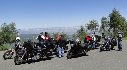
We knew we were going to be coming from Aspen over Independence Pass, so looking at the map, Weston Pass presented itself as something to consider. This road runs over from a little south of Leadville to just a little south of Fairplay. It’s a short-cut that eliminates the drive down to Buena Vista and then back up over Antero Pass on U.S. 285. Of course, with roads like this one, the short-cut takes about twice as much time as the long way around, even though it’s probably one-quarter the distance.

So let me tell you now, Weston Pass would be great on a dual-sport bike. The ruts and potholes and rocks and all the rough stuff that held our speed down much of the time to around 5 mph would just be fun on a proper dirt bike or dual-sport. And in fact, we did see and talk with one guy going over the pass on his bike. That’s him in the picture. I didn’t get his name but it was good to talk with him because he reassured us our car would get over the pass OK. The eastern side of Weston Pass is easy but the western side, which is the side we went up, was very rough. We saw a sign down on the eastern side warning that the western side of the pass road was not maintained for low-clearance vehicles. They weren’t kidding about that.

In the meantime, if you do have a dual-sport, it’s a nice road, going through some terrific country. I have a strong feeling that the more we go out on these roads in this Subaru the more my “need” for a dual-sport is going to increase. And I know that a bike will go on roads that we wouldn’t dream of taking the Forester on, so that will open up even more possibilities. In the meantime, I’m going to have to depend on getting off in the dirt with my friends Ron Coleman, of Western Dual Sport Motorcycle Adventures, and Kevin Smith of Colorado Mountain Moto. They rent dual-sport bikes so if you’re like me and don’t have your own that is an option.

Judy and I figure the next dirt road we want to check out is Boreas Pass, from Como there in South Park over to Breckenridge. Again, I doubt it’s particularly challenging on a bike, but we’ve never been over it so we’re going to go. And some day I will get that bike.

Recent from National Motorcycle Examiner
Repeal of peculiar helmet law vetoed

Biker Quote for Today

Loud Pipes Kill Trails

All Motorcycle Maps Are Not Created Equal

Thursday, July 14th, 2011

It was not a motorcycle trip but my wife, Judy, and I were out running around the mountains last weekend and had a chance to really compare some maps I had brought along. We were in her new Subaru Forester, which is an all-wheel-drive vehicle with high clearance, so we wanted to do some dirt, and take some roads we hadn’t been on before.

Motorcycle maps
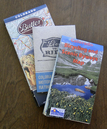
I brought along three maps that I figured would be useful. One is the Colorado Motorcycle Skill Rating Map that was put together largely by ABATE of Colorado and the Motorcycle Roadracing Association for the Colorado Department of Transportation (CDOT). Another was the Colorado Bicycling and Scenic Byways Map, also produced by CDOT. The third was the Butler Motorcycle Maps Colorado map.

With Judy playing navigator, I drove. We went over Ripple Creek Pass, on the Flat Tops Trail Scenic Byway, which runs from Yampa over to Meeker. Later we went partway back along that road to Buford and took the Buford to Newcastle Road. Then we drove the Colorado River Road from Dotsero to a little north of State Bridge on CO 131, and finally over the Trough Road, which runs from State Bridge to Kremmling. The first two are rough roads that you would not want to take a street bike on (though we have in fact ridden the Flat Tops Byway on street bikes–bad idea!), while the other two are just fine for street bikes.

All in all, we had a great time, saw some great scenery, and gathered a lot of information that will eventually end up in the Dirt Roads section of this website. What I hadn’t really thought about, though, was what a good test this was for the maps. They all three were helpful in their way, but the word from the navigator is very clear: The Butler Maps Colorado map is the best.

What that means, very simply, is that the one you pay money for is better than the two free ones. That stands to reason, and is appropriate, but of course was not something you could just assume. But we put them to the test and that’s the verdict. And let me make the point here as well that this is not a verdict biased by the fact that Butler advertises on this site. I’m not sure Judy is even aware of that. She just switched back and forth between the three again and again and at one point told me in no uncertain terms that I should tell everyone that the the Butler map was the best. So there you go. I’ve passed the word along.

Recent from National Motorcycle Examiner
Piaggio MP3: A parallelogram of wheels

Biker Quote for Today

I’m slower than a dude riding one-handed on a DR350 while running a video camera. -Bk.Rd.Rnr