Riding For The Fun Of It
Monday, June 5th, 2017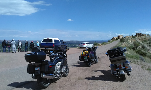
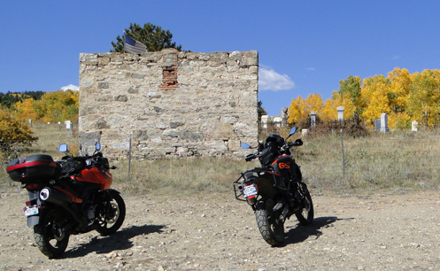
Some of the folks on this ride had never been up on Skyline Drive, at Canon City.
Just home yesterday from a four-day ride with a bunch of folks. It was Willie’s birthday (and our wedding anniversary) so what the heck, why not go for a fun little excursion.
I’ve mentioned Willie and Jungle numerous times before. They live in Eagle and Willie runs a motorcycle tour company called Ball O’ String Custom Adventure Tours. Willie did the planning and organizing for this excursion so we knew we were guaranteed to have a good time.
We met up the first night down in Pueblo, Judy and I having taken the scenic route through the mountains to get there, rather than the interstate. At that point we had one Yamaha, two beemers, and us on my Concours. Plus there were a few folks in cars. Hey, no need to exclude people just because they don’t ride.
We had a birthday/anniversary party at the home of friends in the area and got the trip off to a good start.
Next morning we headed west out of Pueblo on CO 96, otherwise known as the Frontier Pathways Scenic & Historic Byway, to Wetmore, and then south until we hit the Greenhorn Highway, CO 165. This took us by Bishop Castle, though we didn’t stop at this point, on to Lake San Isabel and our quarters for the night at the San Isabel Lodge.
After unloading and settling in we headed back to Bishop Castle where we were to meet more folks. Just as we arrived the skies opened up so it got a bit wet and muddy, but what the heck. Everyone who had never seen Bishop Castle was properly impressed and those of us who had been there were–as always–interested in the ever-changing progress Jim Bishop has made since our last visits.
While there we also spoke with a couple guys on beemer dual-sports, one of whom had ridden the day before from Billings, Montana, to Denver, and the two of them had come here and were headed on yet to Creede that day. Serious riders here.
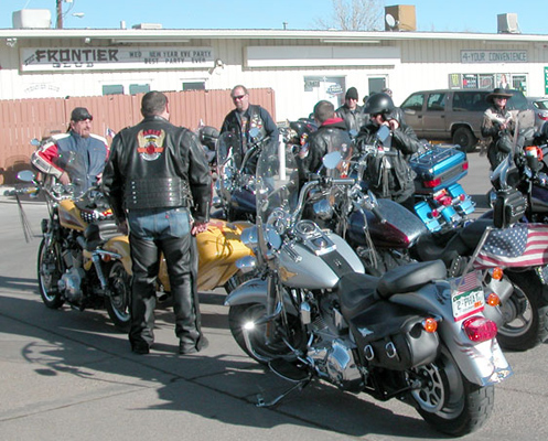
Back at the San Isabel Lodge we now had another Concours and two Harleys added to the group. One of the cabins had a huge main room, dubbed the Grand Ballroom, where everyone could gather and more birthday partying ensued.
Come morning some of the group rode directly to Cripple Creek but the majority of us went to Canon City where we rode the Royal Gorge train up through the canyon and back, with lunch served. Then it was on to Cripple Creek, with a detour to do the Skyline Drive loop. Then west on US 50 to pick up the back route to Cripple Creek.
Still more people joined us in Cripple Creek, so when we headed out to a dinner buffet there were 19 of us altogether. And once again Willie was serenaded with “Happy Birthday.”
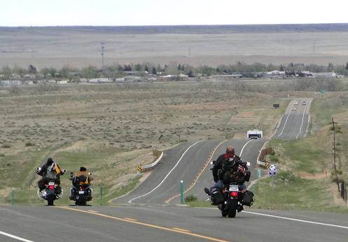
Sunday morning then it was time for folks to go their separate ways. Judy and I headed north to Divide to pick up US 24, to Woodland Park, and then north the way we had come down originally. Lots more people–and a heck of a lot of motorcycles–on a Sunday than on the Thursday morning we had come down. And then back to Denver and home on US 285. It was a good little 450-mile, four-day run. And now, as always, we’ve got a whole lot of stuff to catch up on here at home. Ah, travel!
Biker Quote for Today
To every biker girl her helmet is her crown.
 That’s when it can be good to turn to somebody else’s idea of a good route. And with the modern day convenience of the internet, that can mean
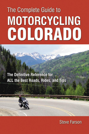 So says the blurb that came with this new book from
 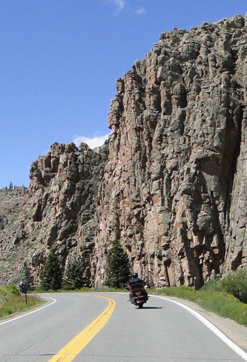 Either way, I had been over it but when we rode over it yesterday I was very surprised to find it much nicer than I remember. Just as I remembered, it was a gentle climb through pine forests from Saguach, and no spectacular views. Nice, but I’ve never considered it worthy of giving it its own page here on this website.