Posts Tagged ‘Golden Gate Canyon’

Never Took This Road This Direction Before

Thursday, September 10th, 2026


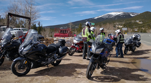
Up at the turn-off from Squaw Pass to go up Mount Blue Sky.

Nick and I headed out for our second ride of his visit, this time on Friday of the Labor Day weekend. No way was I going to take us out I-70.

Again in the cool of the morning we crossed town on Hampden/US 285 and turned north on CO 93 just up to the turn onto CO 46, the road up Golden Gate Canyon. As expected, almost no traffic up here. Yes!

We cruised up to the Peak-to-Peak Highway and turned south on CO 119 to run down to Black Hawk. At Black Hawk we turned up the road to Central City. Through Central City to pick up the Central City Parkway, which we would take over to I-70.

The Central City Parkway was a greenfields road project financed by the casinos with the intention of bringing gamblers more easily to the casinos. It’s up high and it’s two-lane divided highway full of sweepers.

Approaching I-70 we could see the road below and it was choked with traffic leaving the city for an early start on the holiday. Just as I knew it would be. Fortunately, we only needed to get on it for less than two miles and then we got off at Idaho Springs. From the middle of Idaho Springs we crossed the highway and headed up CO 103, up past Echo Lake on the road to Squaw Pass. More nice road and great weather. Who could ask for better?

Just past Echo Lake it was time to make a decision. Nick had some interest in going up to the top of Mount Blue Sky (formerly Mount Evans). The issue was the cost. They have a toll gate at the bottom of the road and even for a motorcycle is would cost $17. Do we both want to ride to the top, just to look around a few minutes and come right back down? Are we $17 dollars interested?

We had been sort of riding with a couple on another bike since Idaho Springs. They must have been thinking the same thing. We all pulled off into this parking lot by the entrance and Nick and I decided no, so we got back on the bikes and took off. A bit later the couple on the other bike passed us going over Squaw Pass. Decision made on both counts. If you want to do Mount Blue Sky, do it in a car where the whole car load goes up for the one price.

So Squaw Pass is a nice ride and it brings you back down to the Evergreen Parkway where we faced another decision. Going left we could get back to I-70 just for a short distance and then get off and take old US 40 back down to CO 93. Or we could go left a very short distance and turn down Kerr Gulch and go through a nice wooded area and end up back at Kittredge. Or, and this is what we did, we could go right into Evergreen but then turn up Little Bear Cub Creek Road up and over to Turkey Creek Road.

I was particularly interested in this because while I have been over this road several times coming to Evergreen, I had never been on it going the other way. This would be a first.

They say a road looks entirely different going the other way and I would say this was not entirely different but it sure was different. It really does give you a different perspective. And through all of this we were successfully avoiding all the early holiday traffic.

You get down to Turkey Creek Road and it quickly brings you to US 285. Not a lot of choice here. So there we were coming back into town in the heat of the day and at rush hour. And once again it was miserable.

Once we got past Broadway and were now on city streets we were on a stretch I have wondered about for a long time. I know that going west on this road I always get in the right-most lane because it moves the fastest from Colorado Boulevard to Broadway. I have often looked at the right-most lane eastbound wondering if it also moved faster. Nick had tried that twice now and didn’t seem to gain anything but I figured OK, let’s try it.

Nope. It was just as slow as the other lanes. So when we got to Colorado, where that lane ends, I turned south on Colorado down to Quincy, which runs sedately through the wealthy Cherry Hills Village area. This is heavily patrolled so you can’t go fast but it’s prettier and there’s a heck of a lot less traffic. And from there we made it on home. Nice day’s ride. We’re toughening Nick up for this upcoming four-day ride. Those easterners think 150 miles is a long day’s ride. That doesn’t cut it out here.

Biker Quote for Today

Get a motorcycle. You will not regret it. If you live. — Mark Twain (sort of)
The Heat Breaks

Thursday, August 20th, 2026


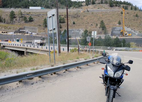
Once completed I-70 at the foot of Floyd Hill will take a flyover through what used to be a hillside in order to smooth out a sharp turn. You can see where the pillars will be built for the westbound lanes. The pillars for the eastbound lanes are already in place.

It has been so blazing hot for so long that I just haven’t been interested in getting out on the bike. Sure, it’s cooler once you get up in the hills but that long slog across town coming home has just been killer. Guess what? It finally cooled off. I went riding.

Heading west across town in the morning was cool and comfortable. I got to Morrison and headed on up Bear Creek Canyon and immediately found myself behind someone in a U-Haul truck. A professional trucker might have pushed that thing around the tight turns at a good clip but this guy was no pro. And there’s almost no place to pass.

This was the slowest trip up the canyon ever. But that wasn’t all bad because the reason things have cooled off is that we have had torrential rains–and we have really needed rain. But with rain comes sand and gravel washing down onto the road. Back in June there were torrential rains up here and this whole road got washed out in several places. This time, however, while there was some sand and gravel, the worst was where unpaved driveways come down to the road. Some were pretty bad but you could see it coming and adjust.

Fortunately I was only going as far as Kittredge. At Kittredge I turned off onto the road up Kerr Gulch. Kerr Gulch Road was much cleaner and there’s never more than minimal traffic so that was great. I got up to Evergreen Parkway and headed north the short distance to where I turned onto old US 40 running up Mount Vernon Canyon and then down the steep decline over Floyd Hill to where US 40 meets US 6.

This is a real point of interest these days. I-70 is right alongside US 40 coming down Floyd Hill and, uncharacteristic of most interstates, at the bottom of the hill you need to slow way down for a sharp left-hand turn into Clear Creek Canyon. Well, it is uncharacteristic of interstates to have such a turn and after all these years they are doing something about it. They have cut off the hilltop and are erecting tall pillars to carry the interstate on a more gently curving arc high above the existing roadbed. It’s a pretty impressive sight. I stopped and shot a couple pictures.

Then I headed down into Clear Creek Canyon to pick up the Peak-to-Peak Highway over toward Black Hawk. So far the sky had been clear and blue but now storm clouds were starting to form. At Black Hawk it looked like it could rain at any time but just a few miles further and the sky was clear again. Weather in Colorado is very localized.

The Peak-to-Peak was clean and clear and up high like this things were very nicely cool. I was planning to head down through Golden Gate Canyon, however, and the last time I was on that road it was lousy with sand and gravel. Odd, because none of the other roads were–just Golden Gate. What would it be like this time?

Clean and clear. Nice. But now the clouds were forming again and looking threatening. It could be a race down the canyon to see if I could get ahead of them. I won the race.

Now south toward Morrison again and then east across town. Yeah, it was a good bit warmer–a bit too warm, I’d say–but nothing like the furnace it has been. Nice to finally get out for a ride.

Biker Quote for Today

You might be a Yuppie biker if you think that’s actually a *suntan* that makes real bikers so dark-skinned.

Earliest Ever First Ride In The Hills

Thursday, March 19th, 2026


Stopped along the Peak-to-Peak.

With Denver looking at record highs it was a certainty that the RMMRC would be doing a ride. I was going to go, then I wasn’t, and then I did. I’ll tell you that story later.

The high for Wednesday was supposed to be in the 80s. In March! I still dressed warmly because you never know how much cooler it will be at higher elevations.

The plan was to ride up to the Peak-to-Peak highway, to Estes Park for lunch. I headed out and it was still a bit cool so I turned on the electric vest. When I got out to C-470 by Morrison the winds were extreme. The presence of the foothills and the hogback blocks and rechannels the wind and sometimes out there it gets fierce. It was fierce Wednesday morning. I knew, though, that once we got into the canyon we’d be more protected.

Six of us gathered at the Conoco in Golden, with one more expected. He didn’t show and we left at the designated time. This group is serious about departing when we say we intend to. We went up Golden Gate Canyon to get to the Peak-to-Peak.

Golden Gate Canyon was lousy with sand. It may have been the worst I’ve ever seen. But we got up to the Peak-to-Peak and it was completely clean. Mike, who was leading the ride, had spoken before we left about potential hazards. Sand and gravel, possibly black ice but more likely not, with probable wet corners. Of course deer. He was right. There was no ice or snow near the road but melting snow off the road drained across in places.

The wind had abated in the canyon and up on the Peak-to-Peak it was just normal. It really is that wall of rock of the foothills and the hogback. Nice. Didn’t really want to have to deal with that all the way to Estes.

It was definitely cooler in the high country and I was glad I dressed warmly. But it was a beautiful day and except for the bare deciduous trees you might have thought it was summer.

We stopped at the road down to Jamestown to say good-bye to one rider. Guess he had other things to do. Then on to Estes.

The place we intended to have lunch was not open on Wednesdays. Oops. We’ll go somewhere else. We needed to do a U-turn and while I’m normally quite good at that, sometimes my coordination is off. It was off and I dropped the bike. Dang. I was unhurt but as I rode off to where we had chosen to go I realized my left foot peg had broken off. Have you ever ridden having to free-shift? Normally you just rock your foot up on the peg to upshift but now I had to grope to find the lever and flip it up or down. But I found I could rest my foot on the portion of the bracket that did not break off.

Just as we were parking who should ride up but Gray, the guy who hadn’t shown up at the meeting place. He had gotten the time wrong, so he just came up on his own. It was just by chance that he found us. So we were back to six.

After lunch Bruce took a look at my absent peg and suggested we might move the buddy peg up to the front. He got the buddy peg off but it is not identical to the main peg and didn’t quite fit. With some jerry-rigging and duct tape, though, he worked out a kludge and I had a workable peg again. Thanks Bruce.

We started back, with plans to go down Coal Creek Canyon rather than Golden Gate Canyon, which we had come up on. Along the way we got behind a slow-moving car. Mike, who was leading, is a go-fast guy, so of course he passed. So did the rest of us, except Gray, who was in the rear. I kept watching but though he had plenty of opportunities to pass he never did. Guess he was happy just cruising on his own. So now we were five again.

We had only seen a couple riders on our way to Estes but coming back there were a lot of them out. Who’s going to pass up such a nice day?

I feared Coal Creek Canyon would be just as bad with sand as Golden Gate but in fact it was just as clear as the Peak-to-Peak. What’s with Golden Gate?

We got down to CO 93 along the foothills and the hogback and mercifully the winds had abated. And boy was it getting warm. I unzipped my jacket and my sweatshirt under it. Tipped my visor up to get more airflow through my helmet.

People started peeling off and eventually I was by myself and made my way home. When I got there Judy informed me she had taken the cats to the vet herself. Big oops! I had totally forgotten I was supposed to do that.

Biker Quote for Today

“It’s all part of my spirituality, as the wind softly kisses my face, and the world travels beneath me.” — Jess “Chief” Brynjulson

Looking For The Sun

Thursday, May 25th, 2023

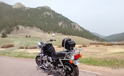
Not sure if you can make out the haze but those hills out to be a lot clearer.

Where is that rain when you need it? Last week I was complaining about the rain going on and on and now I was getting really tired of all the smoke filling the air from those forest fires in Canada. At least if we had the rain it would wash that smoke out of the air. Then it occurred to me that that may have been exactly what was happening last week. Without that rain we may have been living in and breathing that smoke as we are now.

Anyway, I decided it was time to take my first ride of the year up in the hills. Certainly all the ice and snow are gone, though there could certainly be sand and gravel to contend with. Also, maybe if I got up higher I could get above the smoke. Let’s give it a shot.

I headed up Bear Creek from Morrison and took Kerr Gulch from Kittredge over to pick up Evergreen Parkway near I-70. Then I picked up US 40 running alongside the slab, up Floyd Hill and down to US 6 coming up out of Clear Creek Canyon. Just FYI, there’s a good bit of construction going on on US 40 along here.

Up on Floyd Hill I was definitely not above the smoke.

I took US 6 down to where it branches off from the Peak-to-Peak Highway and made the turn toward Black Hawk. Now I was climbing and somewhat to my surprise it started getting darn chilly. I had not put on all the layers I had with me because it was so warm but now when I got to Black Hawk I stopped and did put on my vest. I’m guessing the smoke is blocking the warmth of the sun from getting down to the ground.

Up and further up till I reached my highest point, where CO46 meets the Peak-to-Peak coming out of Golden Gate Canyon. At this point I could see through the smoke enough to see that above it all it was a clear, sunny day but you might need to be up on top of Mount Evans to really experience it. And then I plunged back down into the haze.

Biker Quote for Today

You know you’re a biker when the wind in your hair and face makes you happier than a paycheck.

Escaping The Heat

Thursday, July 28th, 2022

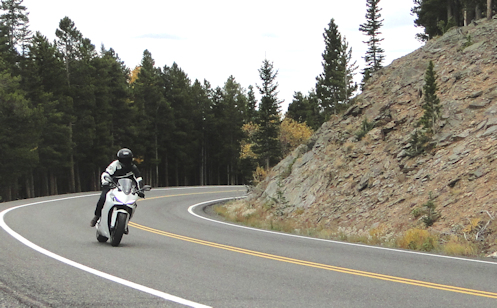
A rider on Squaw Pass.

When the temperatures are consistently in the high 90s there is one thing you can do to escape: take a motorcycle ride in the mountains. We did.

The Rocky Mountain Motorcycle Riders Club (RMMRC) tries to have rides going on nearly every week. The week before we did the Peak-to-Peak and the canyons running down from it. This time we overlapped that route but tended more to the south.

Six of us met in Golden and headed up Golden Gate Canyon. The temps heading up weren’t cool but it sure wasn’t 95 either. One note, there is a stretch with quite a bit of sand on the road. Be careful.

We reached the Peak-to-Peak and headed south to Black Hawk, then turned up toward Central City. We passed through Central City and took Central City Parkway over to I-70. Now it was pretty darn comfortable.

At I-70 we hopped over to Idaho Springs where we stopped for lunch. The place we were heading for was no longer in business so we went downtown. The place we had in mind there had no indoor seating but had one big table with a big umbrella outside. The heat outside would have been intolerable but the umbrella made all the difference. A couple thousand feet of elevation helped a lot, too.

From Idaho Springs we headed up and over Squaw Pass. Now we got some real elevation and some cloud cover, too. Nice.

The Squaw Pass road is one of those that separates the aggressive riders from the not-so-much guys. It has a lot of twists and turns and a lot of very tight turns, often posted at 15 or 20 mph. I was perfectly having them blast ahead just as fast as they liked. I’m in no hurry.

Back down to Evergreen Parkway and a right toward Evergreen, and then we skirted around the town via Meadow Drive. If you aren’t familiar with avoiding downtown by using Meadow Drive you ought to look it up. I can’t believe I went so many years and never knew about it.

Then we headed down to Kittredge but turned up Myers Gulch Road, which becomes Parmalee Gulch Road, bringing us out onto US 285. That just allowed us to stay in the hills a little bit longer.

And then we came down out of the hills expecting to get hit by a blast of heat but instead, as soon as we rolled out onto the flatlands we hit a rain shower. Not enough to get soaked, just enough to cool things off. I was on the Concours, which has a great fairing, so I hardly got wet at all. And the rain kept up until we got nearly to Federal. From there it was just a short cruise the rest of the way home and what little wet I had picked up just had time to evaporate–read: cool me off–by the time I was home.

I love it when everything goes in your favor.

Biker Quote for Today

The joy of riding a motorcycle is out of this world. The thrill of riding in the hills and mountains is an opiatic addiction.

An Interesting Route Combination

Monday, July 25th, 2022

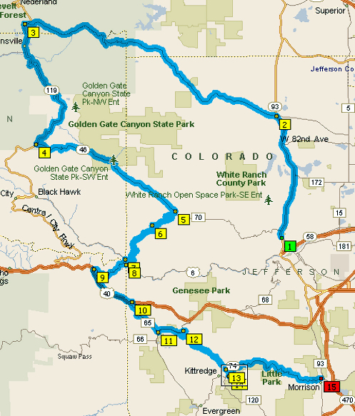
Our route.

I did a ride a couple weeks ago with the RMMRC and while none of the roads were new to me, the particular sequence was and it was an interesting route. I had known the gist of the ride beforehand but when I tried to figure out what Gray, the leader, had in mind I was way off. That map above shows the route but it can’t zoom to show you the detail.

We met first at the Full House Sports Bar and Grill for breakfast, then rode out to Golden, where we picked up a few more riders. Then we headed north on CO 93 to where we turned up Coal Creek Canyon, CO 72.

It was a great day to ride, with the weather cool enough in the morning that I wore my sweatshirt under my mesh jacket and was chilly. But with the heat we’ve been having, it was a welcome chilliness. Gaining elevation heading up Coal Creek it got even cooler and it did not get warmer as the day progressed.

We reached the Peak-to-Peak just south of Nederland and turned south. This in itself was interesting because almost any time I go up Coal Creek Canyon I turn north toward Nederland. We took the Peak-to-Peak down to Golden Gate Canyon and turned down that road.

Here’s where it gets interesting. We didn’t take Golden Gate all the way back down to CO93, we made the sharp left turn to go up Robinson Hill Road (CR69) and up into that area, where we met Douglas Mountain Drive (CR60), which took us down the really steep road where we again met the Peak-to-Peak, this time south of Black Hawk. This is a great road and if you haven’t been on it you owe it to yourself to ride it. Also, of note, at the top of the steep downhill there is a sign “Pavement Ends” and it used to do that. Since last year, however, since I was on it last, they’ve done some paving so the only portion that is not completely paved are a couple tights corners. Who knows why they didn’t pave those. But if you don’t like riding off the pavement, have no fear–this is a good road for a street bike.

We jogged left the very short distance to where old US 6 peels off from the Peak-to-Peak and heads up toward Idaho Springs. Where the road meets I-70 we took the old US 40 route up alongside I-70, which itself is a really nice climb. Over the top of Floyd Hill and down to the overpass across the slab onto CR65, which winds its way around to Bergen Park. There we jumped on Evergreen Parkway briefly, toward I-70, and turned down Kerr Gulch Road (CR23).

That brought us out just outside of Kittredge and we turned left down Bear Creek Canyon to Morrison. A really nice ride. And, by the way, it did finally get warm, making that cool morning all the more appreciated.

Biker Quote for Today

You know you’re a biker if you dream of owning a Harley dealership.