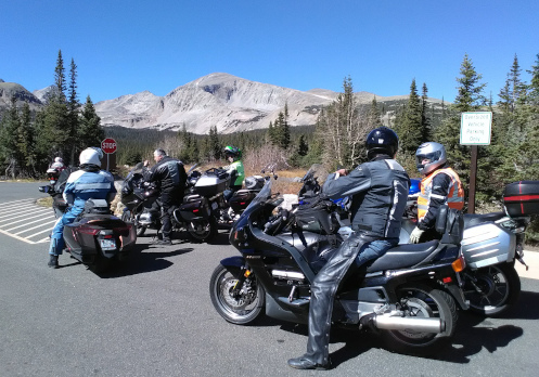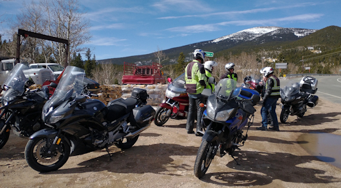
Stopped along the Peak-to-Peak.
With Denver looking at record highs it was a certainty that the RMMRC would be doing a ride. I was going to go, then I wasn’t, and then I did. I’ll tell you that story later.
The high for Wednesday was supposed to be in the 80s. In March! I still dressed warmly because you never know how much cooler it will be at higher elevations.
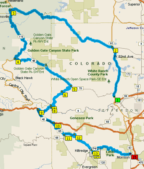
The plan was to ride up to the Peak-to-Peak highway, to Estes Park for lunch. I headed out and it was still a bit cool so I turned on the electric vest. When I got out to C-470 by Morrison the winds were extreme. The presence of the foothills and the hogback blocks and rechannels the wind and sometimes out there it gets fierce. It was fierce Wednesday morning. I knew, though, that once we got into the canyon we’d be more protected.
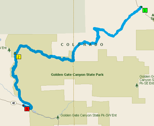
Six of us gathered at the Conoco in Golden, with one more expected. He didn’t show and we left at the designated time. This group is serious about departing when we say we intend to. We went up Golden Gate Canyon to get to the Peak-to-Peak.
Golden Gate Canyon was lousy with sand. It may have been the worst I’ve ever seen. But we got up to the Peak-to-Peak and it was completely clean. Mike, who was leading the ride, had spoken before we left about potential hazards. Sand and gravel, possibly black ice but more likely not, with probable wet corners. Of course deer. He was right. There was no ice or snow near the road but melting snow off the road drained across in places.
The wind had abated in the canyon and up on the Peak-to-Peak it was just normal. It really is that wall of rock of the foothills and the hogback. Nice. Didn’t really want to have to deal with that all the way to Estes.
It was definitely cooler in the high country and I was glad I dressed warmly. But it was a beautiful day and except for the bare deciduous trees you might have thought it was summer.
We stopped at the road down to Jamestown to say good-bye to one rider. Guess he had other things to do. Then on to Estes.
The place we intended to have lunch was not open on Wednesdays. Oops. We’ll go somewhere else. We needed to do a U-turn and while I’m normally quite good at that, sometimes my coordination is off. It was off and I dropped the bike. Dang. I was unhurt but as I rode off to where we had chosen to go I realized my left foot peg had broken off. Have you ever ridden having to free-shift? Normally you just rock your foot up on the peg to upshift but now I had to grope to find the lever and flip it up or down. But I found I could rest my foot on the portion of the bracket that did not break off.
Just as we were parking who should ride up but Gray, the guy who hadn’t shown up at the meeting place. He had gotten the time wrong, so he just came up on his own. It was just by chance that he found us. So we were back to six.
After lunch Bruce took a look at my absent peg and suggested we might move the buddy peg up to the front. He got the buddy peg off but it is not identical to the main peg and didn’t quite fit. With some jerry-rigging and duct tape, though, he worked out a kludge and I had a workable peg again. Thanks Bruce.
We started back, with plans to go down Coal Creek Canyon rather than Golden Gate Canyon, which we had come up on. Along the way we got behind a slow-moving car. Mike, who was leading, is a go-fast guy, so of course he passed. So did the rest of us, except Gray, who was in the rear. I kept watching but though he had plenty of opportunities to pass he never did. Guess he was happy just cruising on his own. So now we were five again.
We had only seen a couple riders on our way to Estes but coming back there were a lot of them out. Who’s going to pass up such a nice day?
I feared Coal Creek Canyon would be just as bad with sand as Golden Gate but in fact it was just as clear as the Peak-to-Peak. What’s with Golden Gate?
We got down to CO 93 along the foothills and the hogback and mercifully the winds had abated. And boy was it getting warm. I unzipped my jacket and my sweatshirt under it. Tipped my visor up to get more airflow through my helmet.
People started peeling off and eventually I was by myself and made my way home. When I got there Judy informed me she had taken the cats to the vet herself. Big oops! I had totally forgotten I was supposed to do that.
Biker Quote for Today
“It’s all part of my spirituality, as the wind softly kisses my face, and the world travels beneath me.” — Jess “Chief” Brynjulson