Posts Tagged ‘Colorado motorcycle roads’

Exploring More Colorado Dirt

Monday, July 18th, 2011

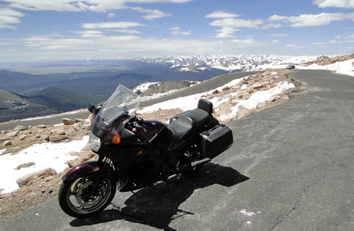
Once again, Judy and I were up in the mountains this past weekend, in her new Subaru Forester, checking out some dirt roads. A dual-sport bike is really high on my wish list but until that happens we’re using her high-clearance, all-wheel-drive vehicle to scout out some roads that might make for some good riding eventually.

Dirt bike on Weston PassWe knew we were going to be coming from Aspen over Independence Pass, so looking at the map, Weston Pass presented itself as something to consider. This road runs over from a little south of Leadville to just a little south of Fairplay. It’s a short-cut that eliminates the drive down to Buena Vista and then back up over Antero Pass on U.S. 285. Of course, with roads like this one, the short-cut takes about twice as much time as the long way around, even though it’s probably one-quarter the distance.

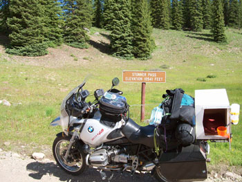
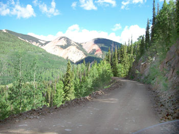
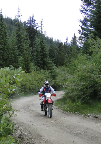
So let me tell you now, Weston Pass would be great on a dual-sport bike. The ruts and potholes and rocks and all the rough stuff that held our speed down much of the time to around 5 mph would just be fun on a proper dirt bike or dual-sport. And in fact, we did see and talk with one guy going over the pass on his bike. That’s him in the picture. I didn’t get his name but it was good to talk with him because he reassured us our car would get over the pass OK. The eastern side of Weston Pass is easy but the western side, which is the side we went up, was very rough. We saw a sign down on the eastern side warning that the western side of the pass road was not maintained for low-clearance vehicles. They weren’t kidding about that.

In the meantime, if you do have a dual-sport, it’s a nice road, going through some terrific country. I have a strong feeling that the more we go out on these roads in this Subaru the more my “need” for a dual-sport is going to increase. And I know that a bike will go on roads that we wouldn’t dream of taking the Forester on, so that will open up even more possibilities. In the meantime, I’m going to have to depend on getting off in the dirt with my friends Ron Coleman, of Western Dual Sport Motorcycle Adventures, and Kevin Smith of Colorado Mountain Moto. They rent dual-sport bikes so if you’re like me and don’t have your own that is an option.

Judy and I figure the next dirt road we want to check out is Boreas Pass, from Como there in South Park over to Breckenridge. Again, I doubt it’s particularly challenging on a bike, but we’ve never been over it so we’re going to go. And some day I will get that bike.

Recent from National Motorcycle Examiner
Repeal of peculiar helmet law vetoed

Biker Quote for Today

Loud Pipes Kill Trails

All Motorcycle Maps Are Not Created Equal

Thursday, July 14th, 2011

It was not a motorcycle trip but my wife, Judy, and I were out running around the mountains last weekend and had a chance to really compare some maps I had brought along. We were in her new Subaru Forester, which is an all-wheel-drive vehicle with high clearance, so we wanted to do some dirt, and take some roads we hadn’t been on before.

Motorcycle maps
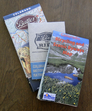
I brought along three maps that I figured would be useful. One is the Colorado Motorcycle Skill Rating Map that was put together largely by ABATE of Colorado and the Motorcycle Roadracing Association for the Colorado Department of Transportation (CDOT). Another was the Colorado Bicycling and Scenic Byways Map, also produced by CDOT. The third was the Butler Motorcycle Maps Colorado map.

With Judy playing navigator, I drove. We went over Ripple Creek Pass, on the Flat Tops Trail Scenic Byway, which runs from Yampa over to Meeker. Later we went partway back along that road to Buford and took the Buford to Newcastle Road. Then we drove the Colorado River Road from Dotsero to a little north of State Bridge on CO 131, and finally over the Trough Road, which runs from State Bridge to Kremmling. The first two are rough roads that you would not want to take a street bike on (though we have in fact ridden the Flat Tops Byway on street bikes–bad idea!), while the other two are just fine for street bikes.

All in all, we had a great time, saw some great scenery, and gathered a lot of information that will eventually end up in the Dirt Roads section of this website. What I hadn’t really thought about, though, was what a good test this was for the maps. They all three were helpful in their way, but the word from the navigator is very clear: The Butler Maps Colorado map is the best.

What that means, very simply, is that the one you pay money for is better than the two free ones. That stands to reason, and is appropriate, but of course was not something you could just assume. But we put them to the test and that’s the verdict. And let me make the point here as well that this is not a verdict biased by the fact that Butler advertises on this site. I’m not sure Judy is even aware of that. She just switched back and forth between the three again and again and at one point told me in no uncertain terms that I should tell everyone that the the Butler map was the best. So there you go. I’ve passed the word along.

Recent from National Motorcycle Examiner
Piaggio MP3: A parallelogram of wheels

Biker Quote for Today

I’m slower than a dude riding one-handed on a DR350 while running a video camera. -Bk.Rd.Rnr

A Cruise Up Mount Evans

Monday, June 13th, 2011

Atop Mount Evans

On a beautiful day like today I had to get out and ride. Plus, I owed an article to one of my editors and figured a piece about riding up Mount Evans would work just fine.

I know it can get cold up there, even when it’s warm down here in the city, so I put on long underwear and a turtleneck shirt. I also put on my electric vest but waited to turn it on until I needed it. Then I had other warm clothes in my bags.

Man, was I roasting before I got out of town. Getting up onto CO 103 over Squaw Pass it finally started getting cool and that was a welcome relief. I reached the turn-off to the mountain, up by Echo Lake, and wondered if I would hear what my friend Dom was told when he was up there just two days earlier, which was that it was so windy they didn’t recommend riding a bike to the top.

Nope, no such warning, and clearly none was needed. They did warn me about frost heaves at the 9-mile marker, near Summit Lake, but I know about those. Just think of them as whoops and you’ll be fine.

So I cruised on up and it was a glorious day. Sunny and warm, I never turned on the electric vest. The view of the Sangre de Cristos from the top was unbeatable. They just went on forever.

Of course, I don’t think you can ride this road without seeing at least one person going down so scared of the sheer drop-off on the edge that they straddle the center line. And I will note that there was one place where the asphalt was just dropping away over the side. Even I stayed close to the middle along that stretch.

And then it was home again. Nothing much, I just rode to the top of the world and back home, all in about five hours. What did you do with your day?

Recent from National Motorcycle Examiner
Willie and Harley: Two American icons tour together

Biker Quote for Today

Any motorcyclist caught holding up automobiles on a winding road will be forced to sell all fringed accessories, buy plaid pants and take up golf. — Peter Egan

Three Days Riding Colorado

Monday, March 1st, 2010

I am asked frequently to suggest routes for bikers planning to come ride in Colorado, and I’m always happy to comply. Chris Peterson is the most recent and here is his (abbreviated) question and my reply.

From there (Laramie) I was going to take three days to travel Colorado from north to south on the way to Arizona. I’d appreciate any can’t miss or gotta see’s or suggested routes to take.

Here is the map I sent him and my reply.

Map of three-day Colorado ride

Chris–Always happy to offer my suggestions. Here’s a map; I’ll run through it step by step.

Starting at Laramie, head southeast into Colorado on US 287 until you hit the mouth of the Poudre Canyon a little northwest of Fort Collins. Turn up CO 14 through the Poudre, over Cameron Pass and down into North Park and Walden. From Walden stay of CO 14 until you hit US 40 at Muddy Pass, between Kremmling and Steamboat Springs.

Go west on US 40 over Rabbit Ears Pass to Steamboat. Each lunch, perhaps. Then backtrack a bit to catch CO 131 that split off from US 40 just south of town, and head south on it to Toponas. From Toponas take CO 134 over Gore Pass to Kremmling, where you will reconnect with US 40. Take US 40 east to Granby and then turn north on US 34 through Rocky Mountain National Park and over Trail Ridge Road. This brings you down into Estes Park.

Take CO 7 south out of Estes Park, on the first leg of the Peak-to-Peak Highway. Where CO 72 takes off from CO 7, take it to stay on the Peak-to-Peak. After passing through Black Hawk you’ll intersect US 6 coming up out of Clear Creek Canyon. Go west and get on I-70 just east of Idaho Springs. At the second Idaho Springs exit, get off and so south on CO 103 toward Squaw Pass, but make the turn-off before the pass and go to the top of Mount Evans. Then backtrack to Idaho Springs and continue west on I-70 until you reach the Loveland Pass/US 6 turn-off just before you get to the Eisenhower Tunnel. Take US 6 over Loveland Pass, down past Keystone and turn off on the Swan Mountain Road that takes you along the south side of Dillon Reservoir.

This will connect you to CO 9, which goes up through Breckenridge and over Hoosier Pass, down to Fairplay, where you’ll meet US 285. Take US 285 west to Johnson Village and turn north through Buena Vista on US 24 to Twin Lakes. At Twin Lakes (Balltown, really), go west on CO 82 over Independence Pass and down to Aspen and Carbondale. At Carbondale, take CO 133 over McClure Pass down to Hotchkiss. At Hotchkiss, take CO 92 south through Crawford and along the north rim of the Black Canyon of the Gunnison. Cross the Gunnison over the dam that forms Blue Mountain Reservoir and then, if you desire, take US 50 east either into Gunnison (if you wish) or to the turn-off for CO 149 at the east end of the reservoir.

Take CO 149 south through Lake City and over Slumgullion Pass, down to Creede and to South Fork. At South Fork, pick up US 160 over Wolf Creek Pass and over to Pagosa Springs. Continue west on US 160 to Durango and then go north on US 550 over Red Mountain Pass to Ouray. From Ouray, continue north on US 550 through Montrose and now, on US 50, continue through Delta to Whitewater, where CO 141 goes off to the west to run down through Gateway as the Unaweep Highway. Stay on CO 141 to Vancorum and Naturita and then pick up CO 145 to Telluride. South from Telluride you’ll cross Lizard Head Pass and come down through Dolores to Cortez. From there you’re very close to the Four Corners area and Arizona. Also very close to Mesa Verde.

My mapping software shows this entire route as about 1,300 miles. That’s a lot to do in three days. Here are some shortcuts you could take. Rather than going over Rabbit Ears to Steamboat and then over Gore Pass to Kremmling, instead, turn south from Walden on CO 125 directly to Granby. Then pick up as before over Trail Ridge Road.

You could skip Mount Evans, but I wouldn’t.

Rather than take Hoosier Pass to Fairplay and then to Buena Vista, get back on I-70 briefly at Frisco, get off at Copper Mountain and take Fremont Pass through Leadville over to Twin Lakes and Independence Pass.

From Ouray, rather than doing the Unaweep loop, just go north as far as Ridgway and then take CO 62 over to Placerville and south from there to Telluride.

That should at least give you ideas to think about. I’d love to hear about your trip afterward.
_______________________
So there you go. That’s all good riding. If you don’t have three days pick any part of it and you can’t miss.

Recent from National Motorcycle Examiner
How green is your motorcycle?

Biker Quote for Today

If you can’t get it going with bungee cords and duct tape, God’s telling you to stop for the night.

Route for Five-Day Colorado Motorcycle Trip

Thursday, September 17th, 2009

I frequently am asked about routes for motorcyclists planning their trips to Colorado, and I’m always glad to offer critiques and suggestions. I figured I’d go ahead and share this recent request with everyone.

Hey Ken, coming to Colorado Oct 2 to do a 5 day ride.. Any suggested routes? Want to go through Vail and Aspen…thanks for your thoughts!

Colorado motorcycle trip map
My response
It appears you’re coming from Michigan, so I’m going to look at this from east to west and back east again. I don’t know if you’ve been here before or this is a first time so I’ll treat it as first time.

One thing you need to bear in mind is that in October it can get pretty cold at higher elevations, and snow is not out of the question. That said, here’s a route you might consider. The two end points are Loveland and Fort Collins, and you could start at either and end up at the other, doesn’t matter. We’ll start from Fort Collins.

Take CO 14 up the Poudre Canyon over Cameron Pass and down into North Park at Walden.
http://www.motorcyclecolorado.com/poudre_canyon_and_cameron_pass.htm
From Walden, stay on CO 14 down to Muddy Gap and then take US 40 over Rabbit Ears Pass.
http://www.motorcyclecolorado.com/rabbit_ears_pass.htm
This takes you to Steamboat Springs, which you might want to visit but if so you’ll then backtrack a couple miles to get to the next road.

Go south out of Steamboat on CO 131 to Toponas and then take CO 134 over Gore Pass to rejoin US 40 and go south a few miles to Kremmling.
http://www.motorcyclecolorado.com/gore_pass.htm

Go south from Kremmling on CO 9 to Silverthorne and pick up I-70 over Vail Pass and down to Vail. I’m guessing you want to stay a night.

Continue west on I-70 a short distance to the Minturn exit and take Tennessee Pass up to Leadville on US 24.
http://www.motorcyclecolorado.com/tennessee_pass.htm

Continue on to the Twin Lakes turn, at CO 82, and go over Independence Pass to Aspen.
http://www.motorcyclecolorado.com/independence_pass.htm

If you’re planning on staying in Aspen this will be a short day.

Stay on CO 82 to Carbondale and then go south on CO 133 over McClure Pass down to Hotchkiss.
http://www.motorcyclecolorado.com/mcclure_pass.htm

Pick up CO 92 to Delta and then US 50 toward Grand Junction. Before you get to GJ, turn off on CO 141 to Gateway and down to Naturita. This is the Unaweep Canyon scenic byway.
http://www.motorcyclecolorado.com/unaweep_canyon.htm

At Naturita, continue on CO 145 to Placerville and on toward Lizard Head Pass. Along the way you’ll want to run into Telluride and maybe spend the night. Then you’ll return to the road and actually go over Lizard Head Pass.
http://www.motorcyclecolorado.com/lizard_head_pass.htm

Take CO 145 down to Cortez, US 160 over to Durango, and then head back north on US 550 over Red Mountain Pass through Silverton to Ouray and Ridgway and Montrose.
http://www.motorcyclecolorado.com/red_mountain_pass.htm

At Montrose go east on US 50 past the Black Canyon of the Gunnison and Blue Mountain Reservoir to Gunnison and then past there over Monarch Pass and down to Poncha Springs.
http://www.motorcyclecolorado.com/monarch_pass.htm

Pick up US 285 and follow it north to Fairplay, then take CO 9 over Hoosier Pass to Breckenridge and to Frisco where you rejoin I-70.
http://www.motorcyclecolorado.com/hoosier_pass.htm

Go east on I-70 to the Empire exit and US 40 and then take US 40 over Berthoud Pass and down to Winter Park.
http://www.motorcyclecolorado.com/berthoud_pass.htm

Follow US 40 to Granby and then catch US 34, which takes you through Rocky Mountain National Park and over Trail Ridge Road, down to Estes Park.
http://www.motorcyclecolorado.com/trail_ridge_road.htm

Continue on down US 34 through the Big Thompson Canyon to Loveland.
http://www.motorcyclecolorado.com/big_thompson_canyon.htm

That ought to just about do it.

Now, there are some places I left out because I’m not sure how much hard riding you might like to do. Take a look at this and if you want to add more let me know and we’ll work it out. But be aware that mountain riding is slower than crossing the plains, and 250 miles in a day can be plenty. Especially as the days get shorter.

Enjoy.

Recent from National Motorcycle Examiner
Pikes Peak Motomarathon rides southern Colorado

Biker Quote for Today

Get your motor running, head out on the highway

17 Passes in 32 Hours

Monday, July 13th, 2009

Steve Smith had asked my assistance in planning his Colorado ride and he sent me this follow-up now that he’s back home. He rode some passes I’ve never been on. Makes it especially interesting. Here’s Steve’s report.

***************************************************

My trip started in the western North Carolina mountains on Friday, July 3. My dog and I made Oklahoma City that night thru some nice hot weather. Saturday, the 4th, we kept on to New Mexico and up thru Taos to Antonito, Colorado area. I was not sure just exactly where some of the campgrounds were located on your website, so I took the safe route and checked AAA where I found the camp ground at Mogote. The people were nice and had a free cook out that evening. The facilities were nice with a shower and nice shaded camping area for $18.

sport bikes
  Stunner Pass

The next morning I rode past the camp grounds that you mentioned and they looked very nice. My goal was to ride to the pass and find a sign and get a picture, so my first pass that morning was La Manga. It was a nice ride over to Cumbres for my second pass in just 30 minutes or so. I retraced my tracks back across La Manga to the forest road 250 and up to Stunner Pass. This road was very navigable but not recommended for a shiny Harley or Goldwing, due to the rocks and potholes. I was riding a loaded 1150 GS and it was slow going in a few places. As with all the roads in Colorado, they are all very scenic with great vistas. I kept going north up to the highway and made a left turn to Wolf Creek Pass for my 4th pass that day.

The next two passes were easy to achieve on a great road up thru Creede and on to Spring Creek Pass and then Slumgullion Pass for the 5th and 6th passes. Just past Slumgullion towards Lake City I made a right turn towards Los Pinos Pass. This road was even rougher than the road to Stunner but still was very scenic. At this pass the sign had disappeared so I have no picture of that one.

Once thru the pass it was about 29 miles out to Hwy 114 and to North Pass for my 8th pass. A u-turn took me back to Gunnison where I went up thru Crested Butte and on towards Kebler Pass. Before I got to that one there was a road off to the left to Ohio Pass. I found no sign but a nice rocky, pot-holed road for a couple of miles. Kebler was my 10th pass that day and the road on out to Paonia was a very nice gravel road. The aspen surrounding the Lupines and was a sight to behold. That evening I camped at the Redstone campground for $32. Yes I went over McClure Pass but since it was under 10,000 ft, I didn’t count it for that day.

By the end of the day I had ridden over 10 passes above 10,000 feet and was done with the pass counting in 10 hours.

sport bikes
  Los Pinos Road

The next morning, I left Redstone and ventured up thru the slow traffic at Aspen to Independence Pass. Wow, the views were great. My next pass was Tennessee Pass north of Leadville. I retraced my track back to Leadville for lunch and then up to Fremont Pass. I continued north to I-70 over Vail Pass and then on to Shrine Pass, just a short 3 miles from the rest area on a good hard packed road that any bike could handle.

Next in my sights was Loveland Pass and then to Guanella Pass south of Georgetown, but the road was closed for construction so I went to Berthoud Pass instead. That was my last pass, as I told my sister I would be at her house north of Woodland Park at 4 PM. The road down thru Deckers was very nice and I was able to beat or avoid some rain and hail.

My total account was 17 passes over 10,000 ft. I started around 8 AM on July 5th and was drinking a cool one by 4 PM the next afternoon or 32 hours total. In hindsight I could have done more if I wasn’t so packed down and left my dog at home, but we had an excellent ride thru some very beautiful country.

I would not recommend Stunner and Los Pinos Passes for an inexperienced rider. That may be done better in a car or truck. On the other hand, any bike could make it, but it may be missing some parts that get rattled off during the ride.

***************************************************

OK, so thank you Steve for that ride description. Now I’m going to have to find out where Stunner and Los Pinos Passes are.

Recent from the National Motorcycle Examiner
Could there be an Eco Mobile in your future?

Biker Quote for Today

If it can’t do some dirt, why bother?