I am asked frequently to suggest routes for bikers planning to come ride in Colorado, and I’m always happy to comply. Chris Peterson is the most recent and here is his (abbreviated) question and my reply.
From there (Laramie) I was going to take three days to travel Colorado from north to south on the way to Arizona. I’d appreciate any can’t miss or gotta see’s or suggested routes to take.
Here is the map I sent him and my reply.
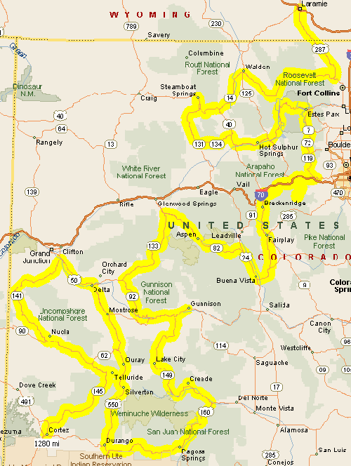
Chris–Always happy to offer my suggestions. Here’s a map; I’ll run through it step by step.
Starting at Laramie, head southeast into Colorado on US 287 until you hit the mouth of the Poudre Canyon a little northwest of Fort Collins. Turn up CO 14 through the Poudre, over Cameron Pass and down into North Park and Walden. From Walden stay of CO 14 until you hit US 40 at Muddy Pass, between Kremmling and Steamboat Springs.
Go west on US 40 over Rabbit Ears Pass to Steamboat. Each lunch, perhaps. Then backtrack a bit to catch CO 131 that split off from US 40 just south of town, and head south on it to Toponas. From Toponas take CO 134 over Gore Pass to Kremmling, where you will reconnect with US 40. Take US 40 east to Granby and then turn north on US 34 through Rocky Mountain National Park and over Trail Ridge Road. This brings you down into Estes Park.
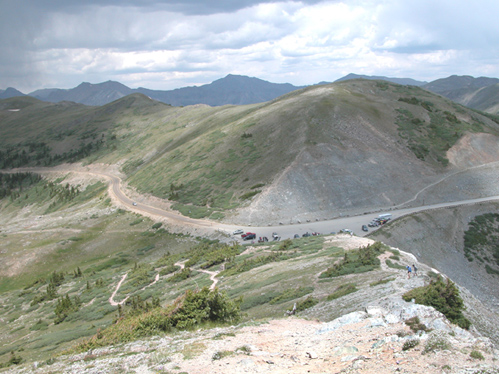
Take CO 7 south out of Estes Park, on the first leg of the Peak-to-Peak Highway. Where CO 72 takes off from CO 7, take it to stay on the Peak-to-Peak. After passing through Black Hawk you’ll intersect US 6 coming up out of Clear Creek Canyon. Go west and get on I-70 just east of Idaho Springs. At the second Idaho Springs exit, get off and so south on CO 103 toward Squaw Pass, but make the turn-off before the pass and go to the top of Mount Evans. Then backtrack to Idaho Springs and continue west on I-70 until you reach the Loveland Pass/US 6 turn-off just before you get to the Eisenhower Tunnel. Take US 6 over Loveland Pass, down past Keystone and turn off on the Swan Mountain Road that takes you along the south side of Dillon Reservoir.
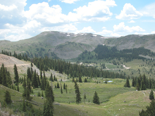
This will connect you to CO 9, which goes up through Breckenridge and over Hoosier Pass, down to Fairplay, where you’ll meet US 285. Take US 285 west to Johnson Village and turn north through Buena Vista on US 24 to Twin Lakes. At Twin Lakes (Balltown, really), go west on CO 82 over Independence Pass and down to Aspen and Carbondale. At Carbondale, take CO 133 over McClure Pass down to Hotchkiss. At Hotchkiss, take CO 92 south through Crawford and along the north rim of the Black Canyon of the Gunnison. Cross the Gunnison over the dam that forms Blue Mountain Reservoir and then, if you desire, take US 50 east either into Gunnison (if you wish) or to the turn-off for CO 149 at the east end of the reservoir.
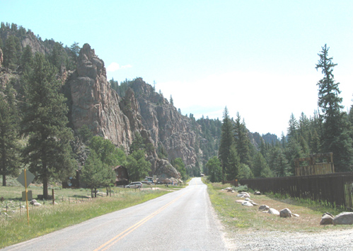
Take CO 149 south through Lake City and over Slumgullion Pass, down to Creede and to South Fork. At South Fork, pick up US 160 over Wolf Creek Pass and over to Pagosa Springs. Continue west on US 160 to Durango and then go north on US 550 over Red Mountain Pass to Ouray. From Ouray, continue north on US 550 through Montrose and now, on US 50, continue through Delta to Whitewater, where CO 141 goes off to the west to run down through Gateway as the Unaweep Highway. Stay on CO 141 to Vancorum and Naturita and then pick up CO 145 to Telluride. South from Telluride you’ll cross Lizard Head Pass and come down through Dolores to Cortez. From there you’re very close to the Four Corners area and Arizona. Also very close to Mesa Verde.
My mapping software shows this entire route as about 1,300 miles. That’s a lot to do in three days. Here are some shortcuts you could take. Rather than going over Rabbit Ears to Steamboat and then over Gore Pass to Kremmling, instead, turn south from Walden on CO 125 directly to Granby. Then pick up as before over Trail Ridge Road.
You could skip Mount Evans, but I wouldn’t.
Rather than take Hoosier Pass to Fairplay and then to Buena Vista, get back on I-70 briefly at Frisco, get off at Copper Mountain and take Fremont Pass through Leadville over to Twin Lakes and Independence Pass.
From Ouray, rather than doing the Unaweep loop, just go north as far as Ridgway and then take CO 62 over to Placerville and south from there to Telluride.
That should at least give you ideas to think about. I’d love to hear about your trip afterward.
_______________________
So there you go. That’s all good riding. If you don’t have three days pick any part of it and you can’t miss.
Recent from National Motorcycle Examiner
How green is your motorcycle?
Biker Quote for Today
If you can’t get it going with bungee cords and duct tape, God’s telling you to stop for the night.
 CDOT called on ABATE of Colorado to help put the map together, and ABATE pulled in the Colorado Sportbike Club so as to include that group’s perspective as well.
 I mention this thing every year, and I don’t want to beat a dead horse here, but there’s always someone who is hearing about it for the first time. So I’ll just recap.
 On Saturday,
  Sunday was a whole other gig. Working through Norton Colorado, a group of local Norton owners, Bob Ohman put together this eighth annual ride of
 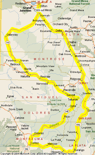 Well, the answer now is “Yes.” Thanks go to Gord Ripley, who has been using the site to plan his Colorado trip. He plotted the routes for the rides I’ve highlighted on the site and then sent me his GPS file. You can