Archive for the ‘Colorado motorcycle rides’ Category

Witter Gulch Road Is A Ride You Have Got To Do

Thursday, September 26th, 2019

As many times as I have ridden the Squaw Pass road I never noticed this one paved road heading off to the south. But now I’ve got to tell you about it.

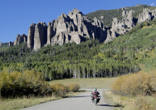
Witter Gulch Road

    Can you tell this road is steep?

I was riding with Bob and Robert, the Go Fast Buddies, on an RMMRC Wednesday impromptu ride. Bob proposed Witter Gulch, Robert said that sounded good, and I said I didn’t know Witter Gulch. Apparently that road connects to the Squaw Pass road but Dave wasn’t sure he could spot the turn-off. Then let’s go up it, Robert suggested. Just take the turn by the lake in Evergreen. OK, that will work.

So we got to Evergreen and the turn and Bob kept straight. Robert had been trying to signal Dave that this was the turn but now he just raised his arm, palm up, signaling “Well, OK.”

I guess Dave figured he could find the turn and wanted to go down, not up. We turned onto the Squaw Pass road and at a point where the road curves to the right there was a road to the left and he took it. We followed. This was indeed Witter Gulch Road.

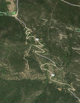
And what a road! Holy crap! You can see in that Google Maps image above how it is one switchback after another. It make sense. The Squaw Pass road at that point runs along a ridge and anything in either direction could only be down. A lot.

Down we went. This is a good road, with excellent pavement. But you’re never going to get up much speed. I hope and presume that Bob was scanning the road ahead because at each switchback he late apexed to the point of going way over into the oncoming lane, while Robert and I just slowed down enough to stay in our lane.

Then there was the point where my attention flagged for an instant and I realized I was scary close to the edge of the road at a point where beyond the asphalt there was only air. OK, put all other thoughts aside until you get down where it’s more level. Dummy.

We got down to Upper Bear Creek Road and now the road followed the creek. There were obviously expensive houses along Witter Gulch Road all the way but now we were into one of those areas where you look around and wonder where in the world all these people got all this money. Ten of me together couldn’t buy one of these houses.

We pulled off at the Evergreen Country Club and agreed it was time to head home. Then on down along Bear Creek to Morrison and off in our separate directions. Thanks for the tip, Bob. I’ll be going back to that road. And I may need to point it out on the website.

Biker Quote for Today

Vinyl Tension-o-meter. Using a vernier caliper you measure the amount of seat vinyl you have sucked into a ridge by rapid contraction of your butt cheeks as the result of a near accident. Also referred to as “pucker factor.”

I Blow It Again On The Dart Run

Monday, August 12th, 2019
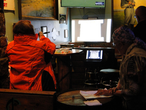
dart blow gun

You can’t tell because the image is washed out but that screen shows all 52 cards and whichever one the person blows the dart to hit is their card.

Continuing my recent series of scheduling screw-ups, I got it wrong on the Dart Run.

The Dart Run, I should explain, is a fundraising poker run put on each year by my own District 17 of ABATE of Colorado. I was prepared to be a volunteer working one of the stops on the run but they had all that pretty well settled so I figured I would do the run. That way I would at least contribute monetarily, plus I was intrigued at the whole idea of this variety of thrown/shot/whatever ways of selecting your card.

Those ways include a blow dart, ninja stars, bow and arrow, and I’m not sure what else. It sounded like fun.

Because I was not working the event I didn’t pay a lot of attention to the particulars. So Saturday when I wanted to know the schedule I went to the ABATE website and to the calendar. The event listing said 12 a.m., which I know is equivalent to midnight, but I also know not everyone is clear on whether noon is 12 a.m. or 12 p.m. I thought it a little odd to start a poker run at noon but I figured whoever put the event up on the calendar had made a mistake and really meant 12 p.m.–noon.

I showed up at The Shack, the starting and ending point at noon and there was not one bike in sight. I went in and asked and was told, “Oh yeah, they all left at 9:30.” OK. And I didn’t know the route but the waitress/bartender told me some place in the hills, then Wrigley’s and then the Rock Rest and then back to The Shack.

Now, The Shack is at the corner of Broadway and Mineral so I just headed west on Mineral, which turned out to be a road I may never have ridden that far on before. That was interesting all by itself. I got out to C-470 and went north and stopped at Wrigley’s. There was nobody there. I didn’t ask but just headed on to the Rock Rest.

At the Rock Rest I found Carol Downs who told me that actually, Wrigley’s was the first stop after The Shack, and then the group headed up to Rollinsville to a place up there. And that she had heard that it was pouring rain up there. So I hung out at the Rock Rest.

The Rock Rest itself is an interesting place. About 40 years ago I lived with my girlfriend just a short distance from there and we used to go dancing there on Saturday nights when they would have a country band playing. I haven’t set foot in the Rock Rest in perhaps 35 years. Here’s a shocker: it has changed. This funky little dive bar is now a popular local spot and it was busy on a Sunday afternoon.

Anyway, some of the folks made it down from Rollinsville and blew darts for their cards, while I did my best to shoot a usable picture in the poor light. Then I just figured I’d head on home.

But I mentioned to Carol that the website had said 12 a.m. and she said she had noticed the same thing just the day before. So hopefully future events will give an accurate starting time.

Biker Quote for Today

It’s a good day to have a good day.

OFMC Hits The Road For 2019 Trip

Thursday, August 1st, 2019
motorcyclists stopped along the road

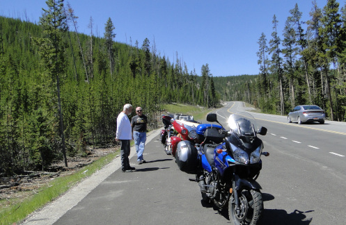
The OFMC (just three of us!) stopped along the road.

It was like the early days of the OFMC when Bill and Dennis and I took off for this year’s trip. Originally the group was three of us–Bill, John, and me. John no longer rides and a lot of others who used to ride with us have gone their separate ways so now we are back to three. We miss the camaraderie of the others but riding with three bikes–rather then ten–is a pleasure.

On a blazing hot day we headed west on I-70 and then north on U.S. 40 over Berthoud Pass and down to Winter Park and Granby. Just west of Granby we turned onto CO 125. This road goes over Willow Creek Pass to Walden, in North Park. I don’t have Willow Creek Pass on this website but after riding it a number of times I have concluded I need to add it. We’ll see if I get it done this year or not.

We have ridden Willow Creek Pass north to south before but I’m pretty sure this was the first time we’ve ridden it south to north, so it was sort of the first of several firsts on a variety of roads on this trip. And it was terrific. A really nice road through a very nice area–albeit with about a million dead pine trees–and almost zero traffic.

We stopped for lunch in Walden and as we were getting ready to head onward three other guys on bikes–younger guys–pulled in. Of course we talked. Like us in the old days, they were out for a week and had no plans as to route or stops. And like us back then, if there were no motels available they had their camping gear. The one difference was that they were on much more capable machines and their gear was probably better than even ours is today. For us in the beginning, gear consisted of two gym bags loaded with stuff tied together and thrown over the seat behind us, plus tent and sleeping bag bungeed on.

Heading north out of Walden we entered Wyoming and made our next stop at Saratoga. All we wanted besides to stretch our legs was shade–it was still blazing hot! Then on to Rawlins for the night.

In the morning we expected more heat so we didn’t put on anything for warmth. We were going to be crossing central Wyoming on U.S. 287 and that is usually a long, hot, dry run. And we got cold. In fact, we stopped twice in the first 80 miles to put on more layers because that heat just never showed up. Meanwhile, it was above 100 in Denver that day.

So north and west on 287 as far as Sweetwater Station and then north on WY 135 to Riverton. Then U.S. 26 to Shoshoni and U.S. 20 to Thermopolis. Then finally WY 120 to Cody, our destination for the day. And just a few miles out of Cody it did finally get hot.

Cody was a bustling place. Apparently the hundreds of motorcycles roaring up and down the main street were there in connection with the Beartooth Rally, which we had not been aware of. Of course, this is why we make our motel reservations in January, and this was not the only time we were glad we had done so.

Tomorrow would be crossing Yellowstone National Park. How ugly is that traffic going to be?

Biker Quote for Today

Do you really have to ask why I would want this big vibrating machine between my legs?? – Anonymous Female Racer

Finding Dual-Sport Roads To Ride

Thursday, July 18th, 2019
The DualSportMaps.com website.

The DualSportMaps.com website.

I was looking at old Examiner.com articles with an eye toward doing another Examiner Resurrection and I came across something I had forgotten about. A little preface first:

I totally loved the dual-sport ride I did with others in the RMMRC recently and was trying to figure out how to make more of those happen. I joined the group about three years ago with at least part of my intent being to meet up with other folks to do that kind of riding. But this is the first such ride in all that time.

I realize that if I want to do dual-sport rides I can take the initiative and put it out there and presumably others will join me. But the weak point in the chain is that I don’t know a lot of good unpaved roads to ride. I will frequently be heading somewhere else and see a gravel road going off somewhere and wonder where and whether that might be one to explore. But I don’t want to take a group out there only to find out that it runs up in the hills a ways and then dead-ends.

No, the obvious thing to do is to pre-ride the route first to make sure it’s something to take a group on, but that gets me back around to my first issue: needing someone to ride with. I don’t want to head off into the boonies on some lonely road all by myself and run into trouble, with nobody likely to come along to help me any time in the next three days.

End of preface.

So this old Examiner post I came across is about this website, DualSportMaps.com. And as I looked it over I figured that rather than posting the old piece I might as well do a new piece–and here we are.

DualSportMaps.com is a pretty basic site but it offers exactly what the name implies. It has some rides put up by the going doing the website but also–probably predominantly–rides put up by people like you and me. You start with a broad map and then zoom in and in to the area you are interested in and you see what there is on offer.

For instance, when I zoom in enough to get clear separation by state it shows two blobs in Colorado, one with 209 rides and the other with 268. Zoom in once more and you now see smaller blobs with 3, 34, 48, 68, 67, 77, and 19 rides. Keep zooming in and the blobs keep dividing until you are looking at individual rides. For example, the Bill Moore Lake ride north out of Empire is shown here.

Now, unless you register, the site doesn’t give you much information on the condition of the road. But it’s free so there’s no reason not to register and then a great deal of information becomes available. It would still be necessary to pre-ride the thing before leading a group there. And once again, that gets back to needing someone to go with me, but at least now I have a tool to explore and select the routes that look most promising. And then heck, if nothing else, Judy and I can go exploring in her Subaru Outback and then I could lead a group there.

Of course, this is exactly why I do these Examiner Resurrection pieces. Most of the stuff I wrote for Examiner years ago is old news and of no interest today. But some are what writers call “evergreen,” meaning they are timeless and just as relevant today as 10 years ago.

Biker Quote for Today

A lot of fun when you get it right but the other side of the coin is when you crash. — Mick Doohan

Cruising To Nowhere With The RMMRC

Monday, July 15th, 2019
bikers talking destination

Where do you want to go from here?

I’ve been doing a lot of RMMRC rides lately, which of course is the reason I joined the group, to have someone to ride with besides the OFMC guys, who do one big trip a year but little else. Most recently, I met the guys for a semi-regular Wednesday morning impromptu ride.

These impromptu rides are unplanned, it’s just a matter of meet for breakfast and then see what ideas different folks have in mind. Last week Dave was figuring he needed to pre-ride a route planned for Saturday through Walden and Rocky Mountain National Park. That was more than the rest of us were looking for so we bid him farewell and took a different route. I’m not sure whose idea it was but we headed out C-470 and up Deer Creek Canyon for starters.

About two-thirds of the way up Deer Creek we made a left onto a road I had explored once before, which appears to be called Pleasant Park Road. It’s hard to believe that was already five years ago that I went up that way but that link to my post then shows the date as October 2014.

Pleasant Park Road was better than I remembered it, so this was a good choice by whoever was leading. It’s really twisty, and does a good bit of climbing. The one thing to watch out for if you go this way is that there is a lot of gravel right smack in the middle of some of the tightest curves. The guys in front of me were whipping right along but I chose to slow down.

This road comes out to U.S. 285 a bit west of Conifer and we turned right, headed back toward town. However, at Turkey Creek Road we turned left and headed on up that twisty, winding canyon for more fun riding. When we reached Jefferson County Road 73, which runs from Conifer over to Evergreen, we pulled off for a stop.

“What do you guys want to do now, head back or go somewhere else?” was the question put forth. The consensus was to head back to town but hey, let’s all swing by BMW of Denver. OK.

That’s when one of the guys (whose name, embarrassingly, I still don’t know) exclaimed happily, “This is exactly the kind of group I wanted to find–a bunch of guys who are happy to just go out and ride somewhere and have a good time without having any plans.” (Or words to that effect.)

I couldn’t agree more. In the early days of the OFMC that’s exactly what we used to do. None of this planning a route and making reservations. John and Bill and I would get together and say “which direction do you want to go?” and then we’d make it up along the way. Those days are long gone.

So we headed on back to town but I peeled off before heading to the BMW shop. I don’t have one of those so that was of no interest to me. But I sure enjoyed the ride.

Biker Quote for Today

Sometimes the road you travel doesn’t lead to the destination you had hoped for. But if you can look back on the trip and still smile . . . then it was worth it.

Fun Off The Pavement

Monday, July 8th, 2019
biker after a spill

Norvin took a spill but was unhurt and there were plenty of folks to help him get back upright.

OK, now, this is the kind of riding that I bought the V-Strom for. And finding people to do this with is a large part of why I joined the Rocky Mountain Motorcycle Riders Club.

I met up on Saturday with three guys at Performance Cycle and we were joined by three others in Sedalia. This ride was billed as a non-technical dual-sport ride. You bet I clicked the button to say “count me in.”

Leaving Performance we headed south on I-25 to Happy Canyon Road, down to U.S. 85, where we turned north to Sedalia. Our bikes included two 650 V-Stroms, two Africa Twins, one GS 650, a Super Tenere, and a street bike that I guess I didn’t bother to look at to see what it was. Or else I don’t remember.

With everyone gathered, we headed west out of Sedalia on what I see is called Jarre Canyon Road for a ways before it seems to just become CO 67. Once it gets past the Rampart Range dirt-biking area the pavement ends and we were on our first stretch of gravel. It’s good gravel and while I was concerned it might be muddy due to all the rain we have had, it turned out only to be a bit wet. I only slid once going down this really steep grade (19% I’m told) when I downshifted thinking I was in third but was actually in second, so it was a bit of a jolt to hit first.

CO 67 brought us out to the Platte River onto pavement at the Platte and we wound our way on around to Deckers, where we stopped for a break. Then we turned north for a short distance on Douglas County Road 126, to Wigwam Creek Road, which heads over toward Tarryall Reservoir. This was our second stretch of gravel, and by far the longest of the two.

Now, I had had this stretch in mind for some time as a potential ride because a couple years ago Judy and I had driven this road in her Subaru. At the time, though, there were large stretches where it was deeply rutted and largely washed out, and would have been challenging on a bike. It has since been graded and was a good road all the way.

So we headed up the gravel, me in third position, and within less than a half mile I came around a bend to see Norvin, the group leader, on his side at the side of the road. Whoa, what happened?! He said he hit some sand with his front wheel and the whole thing just went right out from under him. Norvin was unhurt and the bike was pretty much undamaged, except the latch for his right side bag, which he reattached. This was a good example of why it’s nice to have friends along. He was back up and ready to go quickly.

But only a very short distance. That bag attachment was more badly damaged than he thought and in very short order the bag was just hanging loose. So we stopped again and someone produced a bungee cord. That did the trick and all was well.

The rest of the ride on this road was beautiful. This whole area got burned in one of the really big fires a few years ago but with all the rain it was deeply green everywhere. And the one very small upside of forest fires is that they open up the view and you can see rock formations and vistas that for decades had been blocked by trees.

We met the pavement again at Park County Road 77, Tarryall Road, and turned south to U.S. 24 at Lake George. Lunch time, at the Bla Bla Blah Cafe. Yes, that is its name. After lunch I believe the plan had been to head back north past Tarryall to U.S. 285 at Jefferson and home via that route, but the sky up that way was black and threatening so the decision was made to head east on U.S. 24. Three members of the group turned north at Woodland Park on CO 67 but I stayed with the others on U.S. 24 down into Colorado Springs.

Cindy, who lives in the Springs, peeled off there and Norvin and Kevin and I got on I-25 up to Monument. We turned east on CO 105 over to CO 83 and then north. Coming along past Castlewood Canyon State Park I could see over in the foothills how black and wet it looked and was very glad I had opted for this route. I came up CO 83 to I-225 and got into some rain going past Kennedy Golf Course but then I was home and dry.

This was a terrific day. I really, really want to do more of this.

Biker Quote for Today

While the big GS is a competent street mount, and great on back roads, don’t even think about riding it fast off road. This would be as absurd as a fat transvestite running in high heels.