Archive for the ‘Colorado motorcycle rides’ Category

Ripple Creek Pass

Thursday, November 5th, 2020
Ripple Creek Pass

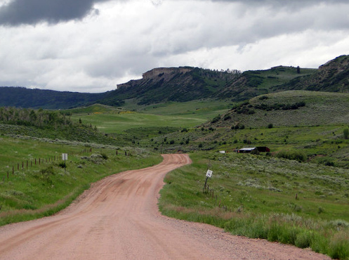
Ripple Creek Pass is beautiful but not the kind of road you want to take a highway bike on, unless you’re very adventurous.

In the early days of the OFMC we were still exploring the roads around Colorado. Nowadays we’ve been pretty much everywhere so it’s rare to find ourselves on new roads, although it does still happen on occasion.

One early experience we had, that turned out to be something we did not expect, was Ripple Creek Pass.

John and Bill and I were headed to Utah on our bikes. Having been that way so often before, John, our master of maps, was looking for a route we hadn’t been on. He found it in Ripple Creek Pass.

Colorado 131 comes down from Steamboat Springs to hit I-70 at Wolcott. About midway on that route, at the small town of Yampa, the Flat Tops Trail Scenic Byway heads west, crossing over Dunckley Pass and Ripple Creek Pass as it skirts the Flat Tops Wilderness. At its western terminus, 65 miles away, the road comes out to Meeker, along CO 13.

“Let’s take this road,” John said. “There’s about 10 miles of gravel but it shouldn’t be too bad, and the country we’ll be going through should be spectacular.”

Bill and I were game, so off we went.

Heading out of Yampa the road was good, smooth gravel, the kind you can ride a street bike on all day with no problem. We wound over some hills and through some ranching valleys, enjoying the high plains beauty of western Colorado.

Then the road started climbing, and it also started getting rougher. Washboard became the norm, not the exception. This was the kind of surface that dual-sport motorcycles are made for, but not street bikes. No big deal; we can handle 10 miles. Except, hadn’t we already gone almost 10 miles? That pavement was going to look good.

The further we rode, the more civilization gave way to nature. Pine forest and mountainsides replaced grassy valleys, and we continued to climb. The washboard continued, the miles passed by, and the fillings in our teeth were in danger of being shaken loose. We were well past any 10 miles by now.

Up over Dunckley Pass we rode and down the other side. The origin of the name Flat Tops Wilderness was evident in those un-pointy mountains to the south of us. Heading up Ripple Creek Pass, this was nature at its grandest but by now our minds were not so much on the scenery as on the seemingly endless miles of rough gravel. Our master of maps had read this one wrong.

Along the way John went down on his brand new Honda Shadow. He was leading and decided to pull over and ran into deep sand. That’s why it’s good to have buddies along when you’re riding this sort of road.

Over Ripple Creek Pass we fared and down to Buford, where the long-awaited pavement finally showed its face. We had ridden fully 50 miles on gravel that was now smooth, now wretched. Our faith in John’s map-reading skills was tested sorely. But for now, let’s just burn up some miles.
And don’t go proposing any unpaved roads again anytime soon.

Biker Quote for Today

We know you’re a poser if you don’t own a rain suit.

All Roads Lead To Patty Ann’s

Thursday, October 15th, 2020

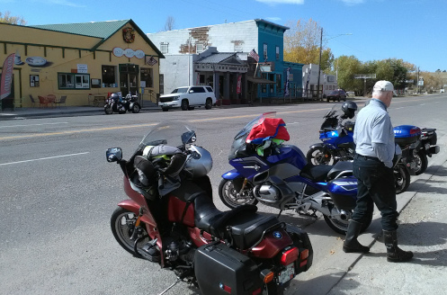
Parked across the street from Patty Ann’s in Kiowa.

A regular ride for the RMMRC is out to Kiowa to Patty Ann’s Cafe, where the folks are friendly and the food is very good. Such a regular ride that we really have to work to find different ways to get there and come back.

Sure, we could always ride down Parker Road to Franktown and take CO 86 east to Kiowa but what fun would that be? Fortunately there are a lot of different routes.

The one we took out there on Wednesday was another really basic one: out east on Quincy to the Bennett-Kiowa Road and then south. If you just took those two routes you would soon be bored out of your mind. But there are numerous north-south roads, intersecting numerous east-west roads and you can pretty much zig-zag your way and vary the route any number of ways. You end up in the same place.

This, of course, is the curse of living in one place too long. There’s not a road anywhere near you that you haven’t ridden several hundred times.

Years ago I used to be pretty footloose. I moved around. And even when I stayed in the same place I would go away frequently, for extended excursions. I was known for this. When some friends moved to Buffalo, New York, the wife told me she wasn’t saying good-bye to me because she knew I’d be showing up at their door at some point. That was 40 years ago and I have never seen those folks again.

As it turned out, I settled down. I bought a house. That meant staying in one place and having mortgage payments that had to be made or else. That meant jobs where they expect you to show up every day. Dang, footloose was fun.

So I started going on all these week-long summer trips with the OFMC, which we’ve been doing for 31 years now. But even that started getting repetitive. In 31 years you cover a lot of roads anywhere you can get to and back in a week and a day or two.

For a while I pushed the guys to try something like shipping the bikes a long way away and flying out and then riding home. Or renting a truck to haul the bikes one way and having a marathon drive out somewhere distant and then riding home. I never could get anyone to go along on that with me. I’ve given up on that, plus the OFMC is down to just three again and in 2019, as I was mapping out a route, they told me they were game for some big miles in order to reach some places we don’t generally go. Afterward, planning the 2020 trip, they told me “let’s not do such long rides this time.” OK guys, whatever you wish.

And you end up riding the same roads over and over again. Sometimes I want to move to another city just so I can ride different roads. That’s not going to happen. I’ll keep riding these same roads, and ultimately they all lead to Patty Ann’s. Heck, it’s not a bad destination.

Biker Quote for Today

You know you’re a biker if people have nearly died of starvation looking at all of your bike/run pictures.

So Where Do You Want To Go?

Thursday, October 8th, 2020
motorcycles on Guanella Pass.

The RMMRC on an earlier ride.

I headed over on Wednesday to meet up with the other RMMRC members who were going riding but when I got there I only saw one bike in the parking lot. I pulled over by a woman on a Harley who I did not recognize and she said she hadn’t seen any other bikes. I took a slow turn around the lot and only spotted one more.

Back over by her, she said she was going inside to use the restroom. I parked and walked over and saw the regular cast of characters at an outdoor table. I joined them. There was Robert but he is moving to Panama in less than a week and has sold his bike. Roy was there but not on his bike. Bob was there but not on his bike.

When the Harley woman joined us there were four of us who were on our bikes: her and me plus another woman and a guy on a Concours who I had seen before but whose name I did not recall at that moment. Paula, Valerie, and Gene, respectively, as I know now.

What this meant was that none of the usual leaders were riding and none of us had a plan. Think fast.

I was the one who came up with a plan. I have previously discussed a recent ride the RMMRC took where we rode Kerr Gulch, Witter Gulch, and Shadow Mountain Drive. I had never been on two of those roads and had only been on the third one time. I had mapped out a plan for a ride to take Judy on, essentially doing much of that original ride in reverse. Let’s do this, I proposed.

No one else had any ideas so it was no surprise they agreed to follow me. We headed out toward Morrison, figuring to go up to Kittredge and catch Kerr Gulch Road there.

Now, first off, being in the lead is a responsibility. When you’re just following along you don’t have to do much other than pay attention to the guy in front of you and the guy behind. Leading, especially in the city, means constantly keeping an eye out that you don’t lose anyone off the back end. With traffic and stoplights that can be challenging. This is part of why most people don’t like to lead. But I volunteered for it today.

We passed through Morrison and just on the outskirts of town we hit a roadblock. The whole highway was closed. Dang! What the heck are they doing up there? I still don’t know but, as the GPS says, recalculating.

It occurred to me that we could go back toward Morrison and take the road that runs over to U.S. 285, take 285 to the Parmalee Gulch road, and then take the turn that carries you over to Kittredge. We headed that way with me leading and Paula behind me. We got separated from the other two by cars. At 285 we couldn’t see either of them so we pulled over. After a minute or two Gene came along and said Valerie decided to go home. OK, now there were just the three of us. A pretty small ride by RMMRC standards.

So we followed that route, ignored the sign in Kittredge that said local traffic only, and turned onto Kerr Gulch Road. Up to Evergreen Parkway, a short jog south to get on the road over Squaw Pass, and then a turn down Witter Gulch.

Nearing Evergreen from the back side I pulled into the lot at the Evergreen Golf Course. Everyone was glad to take a break and get off the bikes, and Gene was enthused at what we had just ridden. He said he has ridden his bicycle on Squaw Pass many times and never even noticed that turn-off down Witter Gulch. I wasn’t sure Paula was as enthused because I know from experience that all those really tight turns are work on a big, heavy bike.

I told them my ride had one more leg but if they were ready to head home we were just outside Evergreen. They were game for one more so we rode into town, took the right toward Conifer, and then I had to find the turn-off. Coming the other way you see the sign for Shadow Mountain Drive. Over here, however, the road has become something else and I couldn’t remember exactly what. I warned them I might make a wrong turn.

We got to Brook Forest Road and I turned but very quickly considered turning back, thinking I had goofed. But I reconsidered and kept on and after awhile the road became Black Mountain Road and finally Shadow Mountain Road. That brought us back to CO 73 just outside of Conifer and U.S. 285. Now we turn for home.

It was a heck of a nice ride. There was still a lot more fall color than I expected and it was a beautiful day. A beautiful day up in the hills, that is. Coming down into town the smoke from the forest fires was so bad you couldn’t even see downtown. I don’t even want to think about what this crap is doing to our lungs.

So Robert is leaving the country, and new leadership is going to need to step up for the RMMRC. I guess I’m going to have to do my share. I did pretty well this time.

/Biker Quote for Today

Why motorcycles are better than men: Motorcycles don’t need Viagra.

Smokin’ Mama!

Thursday, October 1st, 2020
motorcyclists at Brainard Lake

Regrouping up at Brainard Lake.

Wednesday seemed like it would be a great day to ride, so Roy planned a fall color RMMRC ride up the Peak-to-Peak. As I headed out, though, going west on Hampden, I couldn’t even see the foothills. Either I was heading into a serious rainstorm or a ginormous cloud of smoke.

I assumed it was smoke from the forest fires, and counted on that because I did not have my rain gear with me. As I got further west I started smelling the smoke, so that question was answered.

As I approached C-470 I could see that the smoke was much much thicker to the north, where I still couldn’t see the foothills, versus the south where I could see the hills. Not good, considering that we were heading north.

When I got to the meeting place I immediately asked Roy if he had a Plan B. He said of course he did, but he apparently didn’t hear the “B” portion because he proceeded to detail the route originally set. That is, he definitely had a plan. Not a Plan B. I asked about the smoke but he didn’t think it was of any concern.

We headed up the Golden Gate Canyon road and I wondered if, as we got higher, the smoke would either clear or perhaps the wind would be blowing up there and chasing it away. In the meantime, it was killing my sinuses and I coughed constantly.

Up on the Peak-to-Peak it was better than down below but not good. But it wasn’t terrible. We headed north and whenever we came to places where we went down, such as coming into Rollinsville and Nederland, you could see the denser smoke in the lower areas and you could sure smell it as we came down.

Just past the turn-off to Ward we turned left to go up into Brainard Lake Recreation Area, our destination. I was a little surprised but the fact is I had never been there. It’s a really nice ride up to the lake and very pretty once you get up there. More importantly, we really seemed to finally shed the smoke as we climbed this little bit higher.

So we got up there and had the lunches we had brought and the sky was blue and sunny and it was beautiful. How nice. You couldn’t have asked for better. And the place was busy. Don’t all these people have jobs to go to? Apparently not. We didn’t.

Heading down it was startling how quickly we hit smoke again. We hadn’t even made it back to the ranger building where you pay your entry fee when it started looking and smelling smoky. And then by the time we were back down to the Peak-to-Peak we were right back in it.

From there we scattered. There are so many ways to get down from there. Some of us went down through Ward through Left Hand Canyon. Others headed for Coal Creek Canyon. Others, who knows?

Riding down Left Hand Canyon I realized I had only been this way a few times, not like the dozens or hundreds of times I’ve ridden the other canyons coming up to the Peak-to-Peak. It’s a nice ride and I realized I ought to be adding this canyon to my “The Peak-to-Peak Highway and Adjoining Canyons” page. Something else to add to my to-do list.

Biker Quote for Today

Top 10 signs that a computer is owned by a Harley rider: 02. — The keyboard is mounted at the level of the user’s chin and his seat tilts backward — ape-hanger keyboard!

Introducing Shadow Mountain Drive And Kerr Gulch Road

Thursday, September 17th, 2020

After rejoining U.S. 285 just near Conifer (see part one, “The Hills Are Full Of People“) we only stayed on it going west long enough to get off again just past Conifer at CO 73, which runs from Conifer north to Evergreen. After just a few miles we turned west on Shadow Mountain Drive, which is Jefferson County Road 78.

map of Shadow Mountain Drive

Shadow Mountain Drive is a nice side trip.

Now, I had been on that stretch between Conifer and Evergreen any number of times, and I had seen that turn-off and wondered where it went. I had it in the back of my mind to find out some day; well, today was that day.

Turns out this is a really nice road. It goes up, winds around a lot, and eventually comes out at Evergreen, although by the time it does it has morphed into Black Mountain Drive and then Black Forest Road. It rejoins CO 73 less than a mile from where you hit downtown Evergreen. And just as so many other roads we traveled this day, it demonstrated just how full of homes and people these hills are. So now I know.

At Evergreen we got on Evergreen Parkway north just a short way and then turned west on Stagecoach Boulevard. This winds its way up through the canyons, eventually reaching Witter Gulch Road. This is a very nice road that runs very steeply, with a lot of switchbacks, up to meet the Squaw Pass Road, CO 103.

I had only ever been on this road once before, on a different RMMRC ride, and that time we were going down. This time we were headed up, so it was very different. If you like tight twisties you need to go ride this road.

Here we turned east again, back down to where Squaw Pass Road meets Evergreen Parkway. Then we turned north.

In about two miles, going past Bergen Park, we came to Jefferson County Road 23, Kerr Gulch Road. This is the kind of road you’ll drive past forever without really even noticing. The only marking is a small sign that reads CR 23–there’s no indication where it goes.

map of Kerr Gulch Road

Kerr Gulch Road

Once again, this is a good road, not busy, quite scenic and it runs down to Kittredge, on Bear Creek Road, which runs up from Morrison to Evergreen. Who knew this was here? You’re even less likely to notice this road down at the Kittredge end. It’s a little east of the main part of town and looks just like any of the other roads that run off into the hills to the homes around there. For anyone heading up Bear Creek, looking to get over eventually to I-70, this is a terrific short-cut. But who even knew it was there? I sure didn’t.

From Kittredge we turned east toward town, and once we emerged from the canyon at Morrison it was time for everyone to split up and head their own ways home. This was a heck of fun day’s ride.

Biker Quote for Today

You know you’re a biker if anyone who doesn’t ride is just ‘OK.’

The Hills Are Full Of People

Monday, September 14th, 2020
Model T and motorcycles

The Phillips 66 in Morrison is a big meeting place and this morning it was packed with two different bike groups as well as a group driving their Model T Fords.

Kudos to Bob for planning and leading an RMMRC ride that went well off the beaten track and introduced me to roads close to town that I had never known existed. One over-riding aspect of this route was the demonstration of just how fully built out the hills west of Denver are. I had heard before that if you flew in a small airplane above the foothills you would see that there are people everywhere. This ride really proved that out.

We started out from Morrison, jumping on C-470 briefly to get over to U.S. 285 heading southwest. Very shortly we turned off at the Tiny Town exit onto Turkey Creek Road. Just past where Deer Creek Canyon Road runs off to the left we made a right turn that took us up into the heavily developed (relatively speaking) area between Turkey Creek Road and 285. Following a variety of local roads we looped through the area and ended up back on Turkey Creek Road probably only a mile or so from where we got off. But in the interim we would around through a very nice area on some nice roads. With houses all along the way.

Continuing south and west on Turkey Creek Road we then turned off to the south on Hilldale Drive and into another area of houses. Here, though, the road climbed and we ended up on what is aptly named City View Drive. The city and the plains are clearly visible from up here, as is U.S. 285 off to the north.

City View Drive

This aerial view doesn’t really show you what City View Drive is like but it goes high and you can see a long way.


This is where things got a bit out of kilter. Looking at the map today I see what I think must have been Bob’s planned route. If you make the right turns–GPS probably your best bet–you can work your way over to Pleasant Park Road and back onto 285 at Conifer. Bob’s GPS was not serving him well. We made several wrong turns, ended up on dirt roads and generally groped our way until we found our way back to where we had turned off Turkey Creek Road.

But we were still seeing some roads and some views we had never seen before. I had no complaint. I was on my Concours, which generally hates gravel, but in fact it really hates loose gravel. Because this was hard-packed dirt I had no problem.

Besides the demonstration of just how full the hills are of homes I was also struck by how very many people we saw out walking, either on their own or walking their dogs, along these roads. They were everywhere and for the most part they were very friendly and waved–and in one case even cheered– as we went by. I suspect they don’t get many motorcycle groups cruising through their neighborhoods.

We then followed Turkey Creek Road to where it terminates back at U.S. 285 over by Meyer Ranch Open Space Park. That ended the first segment of this ride and the other segments warrant their own space so I’ll save them for later blog posts following this one. There is one other thing I want to mention here, though.

This was a fairly lengthy ride altogether. Bob had promised “111 miles, 1 million curves” and that really gives you an idea of what this ride was like. With that kind of promo I knew I would be most comfortable on the V-Strom but I had not yet ridden the Concours in September so despite knowing the V would be the better bike for the ride, I rode the Connie.

That was OK because I’m a pretty skillful rider and I had no problem maneuvering that big bike through the many switchbacks and tight curves we traversed. To my surprise, though, by the time I got home I was exhausted. Riding a motorcycle is not a passive activity the way that driving a car can be, and hours of steering a big bike through serious twisties adds up to significant effort. I got home just in time to go to my appointment at the gym and by the time I was walking home from the gym I found myself stopping every place I found shade to rest. I was tired!

Biker Quote for Today

Top 10 signs that a computer is owned by a Harley rider: 03. — Expansion slots have Genuine Harley-Davidson bike parts installed in them.