Posts Tagged ‘Butler Motorcycle Maps’

Great Roads You Never Heard Of

Thursday, March 24th, 2016
Washinton Butler Map

North Cascades National Park looks to me like a must.

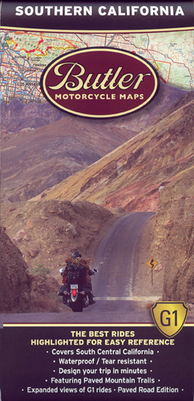
One of the things I look for most in a motorcycle roads resource is tips on roads I don’t even know exist. That’s one of the things I like best about the motorcycle maps made by Butler. As anyone who reads this blog knows, I’m an unabashed fan of Butler maps. In a very you-scratch-my-back-I’ll-scratch-yours manner, they give me all the maps they produce and I look them over and write about them. Make no mistake, if I thought they were crap I’d say they were crap, but I don’t and I don’t.

So the latest one I’ve been looking at is for the state of Washington. Washington is far enough away that the OFMC has never gone there on our yearly trips, though I’m lobbying for those of us who are now retired to remedy that deficiency. Let’s take any of the wives who are interested (I know Judy would be) and make a two to three week trip of it.

And there’s one place in particular I see us heading: North Cascades National Park. Now this is kind of funny. I worked for three years at the National Park Service, on planning documents dealing with a couple hundred different park units. I’m pretty sure I worked on this one. So how did it slip by me?

More specifically, here is what Butler has to say about this yellow stripe (the best roads) called “North Cascades Highway”:

Highway 20 slices through North Cascades National Park — you won’t have to ante up the typical park fee to ride this beauty. It’s not terribly demanding, but no problem — the scenery is off the charts: glaciers and glacial lakes, dense forests, and giant rock formations abound. The route is roughly 80 miles and without services, so fuel up on either end of the park before making the trek. The road is wide, curves gently and often sees little traffic. Truly, this journey carries with it some of the most spectacular mountainous scenery of any road in the continental U.S. — in fact we rate it in the top 5 “must do” motorcycle routes in the entire country.

Yow! Top five in the entire country? I’m going to Washington! Are you other guys coming with me?

Of course, that’s not all Washington has to offer. I’ve always wanted to go to the Olympic Peninsula, but I see from the map that there is surprisingly little in the way of good motorcycle roads there. Fine, just go for the peninsula, not the riding.

Where the best riding is, it appears, is around Mount Rainier and Mount St. Helens. That’s the really good stuff. And then the northeast corner of the state has a heck of a lot to offer, as well. Tie that in with Montana and Idaho, where there is also fabulous riding in this area, and you could spend a month.

Off in the southeast corner of the state, on the other hand, it’s almost all flat and open. Best to go around this either to the north or west, where you have mountains. Still, just in the very corner, there is one patch of yellow, which is Oregon 3 coming out of that state and becoming Washington 129. This is Rattlesnake Pass, “a canyon climbers’s dream.”

This is the kind of stuff you could miss. That’s why I love these maps.

Biker Quote for Today

Push your limits until you crash.. then back off just a bit.

Butler Maps Alaska; I Drool

Thursday, October 10th, 2013

Part of this relates to the simple fact that Alaska is the only U.S. state I’ve never been to. Then, to not only go to Alaska but ride around there on a motorcycle is, in my mind, about the ultimate.

Butler Maps' treatment of Alaska

The Alaska map from Butler.

So the boys at Butler Maps have been there and they’ve really done that in a big way. And then they sent me the map so I could drool.

One thing you notice right away looking at the map is that a large portion of the state is left out, essentially the entire western portion of the state. I understand that, though. Working as I do at the National Park Service (when we’re working, which we’re not as of this writing thanks to the government shutdown), I am aware that while there are several national parks and other federal lands over there, they are only accessible by air or water. There would probably be a whole lot more routes on this map if that were not the case.

And I should also add that the map does give you a lot of routes in British Columbia and the Yukon Territory as well–no extra cost! Basically, it shows you some roads to get to Alaska from the Seattle area, as well as some side trips along the way.

Another thing that can be deceptive at first is that unlike so many other Butler maps, there are not a lot of big stretches of yellow-highlighted roads. Those are the best, so you want to see a lot of yellow on your map. But then if you think about it you realize that this is Alaska. It’s huge. And it’s on the same size map as, say, Colorado. So those numerous little yellow squiggles actually encompass hundreds and hundreds of miles of choice motorcycle roads. And connecting the yellow squiggles are a lot of red squiggles, which are the merely great rather than stupendous roads. And oh man, is there a lot of red!

Frankly, I’ve never heard of Haines, a little way south of Skagway, but the biggest single stretch of yellow is the Haines Highway that runs northwest from that town. Now you’ve really got my interest. That’s one of the very best thing about these Butler maps. They tell you where the good stuff is.

On the back side of the map there’s a lot more information. Enlarged maps show sections highlighted on the overall map. If you’re riding a dual-sport or adventure motorcycle to/in Alaska you’ll want to pay particular attention to the Dual Sport Adventure Roads Reference Guides that are included with several sections. Not only are these routes pointed out, there are some tips that are very useful.

For instance, on the Elliot Highway/Steese Highway section it tells you you had better have at least 161 miles worth of gas or you’re going to be in trouble. On the Dalton Highway you need 250 miles worth of fuel.

  • Road to Rampart: This road has many stream crossings and marshy bogs. It is more appropriate for 4x4s but doable on a bike if you want a challenge.
  • Alascom Road: Another short but stunning out and back ride. Treat yourself to 360 degree views.
  • Grogg Creek Road: A ride up Grogg Creek Road is a great lesson in stream crossing.

OK, now it’s time to commence dreaming. And now my dreams can be a lot more specific. I think that makes them more likely to come true, doesn’t it?

Recent from National Motorcycle Examiner
AIMExpo will debut in Orlando Oct. 16-20

Biker Quote for Today

Get lost to find yourself.

Butler Motorcycle Maps Adds Southern California

Thursday, November 4th, 2010

Just a quick note here to let you know that Butler Motorcycle Maps has just added Southern California to the list of motorcycle-touring maps it offers. Already available are Colorado, Wyoming, Idaho, Utah, and Montana. They will also soon have a Rocky Mountain states map combining all five of those mountain states in one map. These things are sizable already so I’m wondering if that one is going to be huge.

Butler Motorcycle Maps - CaliforniaI’ve written previously about these maps so I’ll just recap here. In addition to being tough and waterproof, these maps have all the best motorcycle roads in each state highlighted and detailed. I know they’ve done a good job of this because I have ridden extensively in the Rocky Mountain states and there isn’t a road I would add that they don’t already have. And they have a few I’m not familiar with. I’d say that’s a pretty strong recommendation.

As for this new one, Southern California, this is where it really gets interesting for me. I don’t know California very well, and I especially don’t know SoCal. I look at this map and I think, “Oh man. Look at that. And that. And that. I want to go there.” But you know, without something like this map, if I did go there I wouldn’t have any idea where to go. Clearly the main strength in these maps is cluing in people who are unfamiliar with an area as to what the area offers.

For instance, I was riding in SoCal just a couple weeks ago, and while I was on a tour where I couldn’t just split off and go somewhere else, I see from this map that we were very close to some really nice roads. Not that the roads we were on weren’t nice, mind you. We did, after all, ride Big Sur, and go to Yosemite, and ride across the Golden Gate Bridge. But I had no notion that there were some other very good motorcycle roads that we just went right past. Next time I have a chance to get out that way I’m definitely taking this map.

I will make note here, for purposes of full disclosure, that I have an ongoing relationship with the folks at Butler. They have paid for one small ad on 1 page on my 100+ page website, and they do give me these maps for free, with the hope that I’ll write about them. Rest assured, though, that if I thought these things were crap I’d say so. But you won’t hear that from me because it’s not true.

Recent from National Motorcycle Examiner
Dual book review: American GP champions and Valentino Rossi

Biker Quote for Today

Don’t die wondering, die wandering.

Butler Motorcycle Maps Pass the Test

Thursday, August 19th, 2010

You need to understand that I’m very hard on maps. As far as I’m concerned, they’re disposable, and ripping is just part of the gig.

Enter Butler Motorcycle Maps. These guys are riders who decided to make motorcycle-specific maps, by motorcyclists, for motorcyclists. So far they have released maps for Colorado, Utah, Wyoming, and Idaho.

The way I fold mapsThere are two things that make these maps attractive to motorcyclists. First, they highlight the best roads in each state based on what they know we like, i.e., scenery, twisty roads, two-lane, and all that. Second, they’re durable. They’re not printed on paper. It’s probably some kind of plastic, but whatever it is, they are waterproof and tear-resistant. Good things to have out on a bike.

Of course this is where my style of usage comes into play. I have a tank bag that has a map display on top. The problem with the map display is that it is not sized to fit any map conveniently. Conveniently, in my mind, would be something that allowed you to use the basic folds of the map and show two panels. The display on my bag is too short and too narrow, so I end up folding maps every which way to make them fit. (See the photo above.) The consequence of that is that they tend to rip along the folds and fall to pieces quickly.

I was in Sturgis last week, and on Thursday I left and went to Yellowstone. The Butler guys had a booth in Sturgis that I just happened to stumble upon. I was already familiar with them because they had comped me a couple maps and had taken out an ad on the Passes and Canyons website. I stopped in to say hi and they gave me the two latest maps, Wyoming and Idaho.

I then proceeded to use the Wyoming map as I made my way to Yellowstone and then home to Denver. It didn’t fit any better than any other map in my display so I manhandled it the way I do all maps.

The result? When I got home I opened it out, smoothed it off, and refolded it along the original folds and it’s good to go. Now, it looks a bit rough. You’d never mistake it for new. It has wrinkles and creases, and it didn’t want to fold back perfectly and probably won’t ever again. But it’s absolutely usable, it’s not torn, and I suspect it will hold up to that same treatment many more times.

What’s more, it is also good in its other function of highlighting the best routes. I’ve ridden all over Wyoming, so there are almost no roads highlighted on the map that I’m not familiar with. There is one, a bit of two-lane between Laramie and Cheyenne. So I know the roads they’ve marked and I agree with them. These are the best roads in Wyoming.

If this sounds like the sort of thing you’d be interested in, you can buy these maps for $14.95 either through their website or from selected dealers. Tell them Ken sent you.

Recent from National Motorcycle Examiner
Iron Mountain Racing tackles the ALCAN 5000

Biker Quote for Today

A bend in the road is not the end of the road . . . unless you fail to make the turn.