All Of Us Are Smarter Than Any Of Us
June 29th, 2023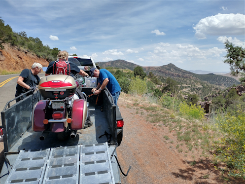
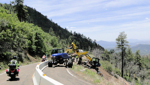
Strapping down Tom’s Kawi in Dave’s trailer.
When Tom pulled his Kawasaki off the road as we RMMRC riders were headed south on US 191 I had no idea why. But I was right behind him so I pulled off, too, as did Bruce, behind me, and Charley, behind him. Then Dave came along with his Ford F-250 and trailer and it fortuitously was one of the only places we had been past in quite a while large enough for us all.
The problem appeared to be that the engine was not getting enough fuel. Filter? Fuel pump? We couldn’t diagnose the problem right there so it was a simple decision to load the bike into the trailer. Dave had ramps and plenty of tie-downs, so let’s get it done. Right about then Bruce said he would ride ahead and let the others know what was going on, and off he went. The rest of us were thinking, gosh, maybe your muscle would have been good to have to get this thing rolled up into the trailer.
Fortunately, Tom had the idea that maybe he could start the bike and get enough out of it to ride it up into the trailer. We sure hoped so. And he did. The engine died just as soon as he was up but it did the work. Now just tie it down.
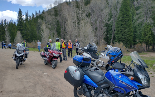
I’ve never been at all expert at using tie-downs so I just stood back and watched while the others did their thing. But I noticed a few things.
I had a boss once who was fond of the saying that all of us are smarter than any of us. That is, put our heads together and we’ll probably come up with better ideas than any one of us could do alone.
While the others were focused on “let’s run this line from this bar to that hook-up,” I was the one thinking “yeah, but do you really want to run it over that rail, rather than under it?” Or when I saw one tie-down hooked to a crash bar midway up and said, “don’t you think this is going to slip down and then be too loose?” With the response being, “yeah, let’s connect it above that joint so it can’t slip down.”
So I made a contribution. Which was better than standing there feeling useless.
Once everything was secure we took off and Tom had to have been of mixed feelings. On the one hand, his ride was over. He would be sitting in the truck with Dave the rest of the trip. On the other hand, oh my gosh, how expensive would the tow bill have been to have some truck come way the heck out there and haul him anywhere? Plus, then what? Sit in a motel for four days while the local shop is getting parts and fixing the bike? You couldn’t call the whole situation good luck but it turned out to be about the least bad luck he could have had. I’d be happy with that.
Biker Quote for Today
If I can’t be a good example then I guess I’ll just be a horrible warning.