Archive for the ‘motorcycle touring’ Category

Examiner Resurrection: A Terrific Motorcycle Sidetrip In Southwestern Utah

Monday, September 26th, 2016

For eight years I was a writer for Examiner.com–the National Motorcycle Examiner, if you will–and in that time I published somewhere in the neighborhood of 1,000 articles. That relationship ended about a year ago, so it was only a few days ago that I learned Examiner had shut down in July 2016, taking down all the many thousands (millions?) of articles done by many, many writers.

While a lot of my articles were timely and republishing them now would be useless, in my own opinion at least, some of the work I did was very good, remains relevant, and deserves to be resurrected. I had already been republishing some of the very earliest stuff because advances in technology had rendered some early work technologically incompatible, and it had been dropped. Now that list of potential resurrections has grown enormously.

A terrific motorcycle sidetrip in southwestern Utah

OK, you’re riding from California or Las Vegas, trying to make good time and cover a lot of ground, on your way somewhere east. You’re staying mostly on the interstate, but passing through southern Utah you hate passing all this beautiful terrain, and you need a quick fix of twisty roads. Do I have a treat for you!

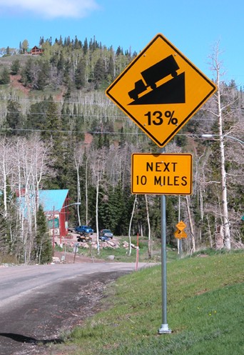
13 percent grade ahead

  Fun riding just ahead!

Cedar City is where you want to get off the superslab. Get onto Utah 14 and head east and you soon find yourself climbing through gorgeous canyons and winding and twisting to your heart’s content. Enjoy.

After about 18 miles or so you’ll want to catch Utah 148 going north. If you liked what you’ve seen so far, you’re in for an even better treat. This road winds through Cedar Breaks National Monument and the numerous view areas are all worth stopping for. The panaromic vistas range from deep, red canyons to mountain views that, on a clear day, extend over 100 miles.

You’ll come to the Brian Head summit, a bit over 10,000 feet in elevation, and see Brian Head itself just to the east. Later in the summer you might even want to ride the 3 miles of good gravel road to the summit, but in late May/early June when we’re visiting the road still has deep snow on it.

Over the hump, you come down into the ski resort town of Brian Head, where a sign warning of 13 percent grades gives you a hint of what is ahead. Down the hill you go, again winding and twisting, until you come out to the little town of Parowan, where you rejoin the interstate.

You’ve just enjoyed a 42 mile diversion from I-15 and only added half that distance to your trip. Oh yeah, you can take this route going the other direction, too.

This is the type of thing riding motorcycles is all about, isn’t it?

Biker Quote for Today

Give the world and its baggage the middle finger, then get on your bike and ride.
Endless Motorcycle Roads Down South

Thursday, June 2nd, 2016
Motorcycles In South Carolina

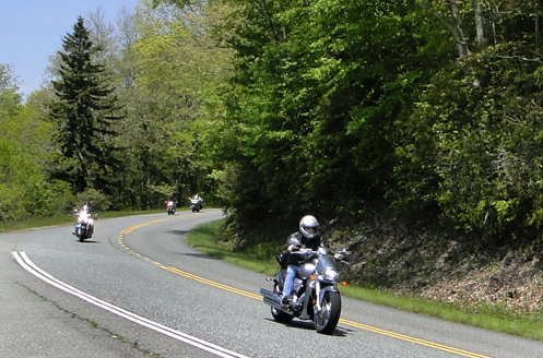
The South has endless curvy roads.

We just got back from a five state trip (Georgia, South Carolina, North Carolina, Tennessee, Alabama) and I’m left with two big thoughts on motorcycle riding down there.

1. It doesn’t matter where you go, at least in the hilly parts of the state every road in every direction is curvy, up and down, and through endless greenery and beauty.

2. When all you see is trees on both sides of the road, trees towering above you so you can’t see anything else, it doesn’t take long for one curvy stretch of road to look exactly like every other one, as if you were going in a circle all day.

Really, as long as you stay off the big highways, it doesn’t seem to matter where you go, the good riding is everywhere. If there are hills–which there are plenty of up in the northern areas where these five states all cluster together–the riding is good. But even when you know you’re going up a steep hill and there ought to be a terrific view out over the valley, you almost never get to see that view because of the trees.

Judy and I noticed this a long time ago. We were in South Carolina visiting my mother and when we got back to Colorado we were both overjoyed to see the sky again. Back there, all you see of the sky is that narrow strip overhead between the trees on both sides of the road. And those trees are tall.

We cruised along the Blue Ridge Parkway a short distance and at least there they have deliberately managed the forest to allow for some views. But when we went up to the top of Clingman’s Dome, the highest point in Great Smoky Mountains National Park, you could see a long way but one tree-covered hill looks a whole lot like every other tree-covered hill. It was nothing at all like the kind of views we’re accustomed to out here in the west.

We did get one tip, however, that you might want to remember if you’re planning a trip down that way. We were at Little River Canyon National Preserve and all we could see of this deep gorge was trees. We almost couldn’t even see the water. But the park brochure explained that winter was a good time to visit because with the leaves gone you can see the rocks. And the fall is good because you get riotous fall colors and, when at least some of the leaves have fallen, you can also see some of the rocks.

So time your trip for the fall. I’m betting it’s pretty spectacular about that time. And with so many roads to choose from, if you pick an out-of-the-way one, you won’t have to share it with 10,000 other motorists.

Biker Quote for Today

Killing bugs is a full-time job.

Ride The Texas Mountain Trail?

Monday, March 28th, 2016
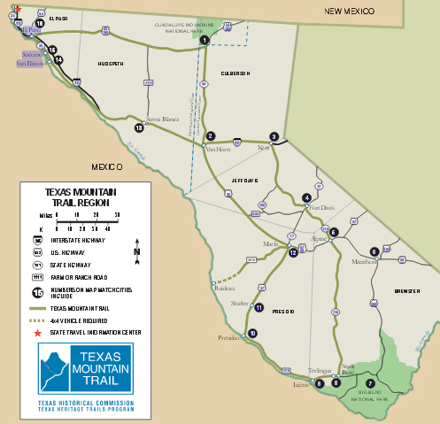
map of the Texas Mountain Trail

The Texas Mountain Trail.

I’ve been to Texas quite a few times but nearly always in the east or central areas. While it’s pretty flat in a lot of places there are some hills, especially in the Austin area and east over by Louisiana. But mountains? Texas has mountains?

Well, yes, it does, and I’ve now seen quite a bit of them. And they even have something called the Texas Mountain Trail, which seems like a natural draw for someone on a motorcycle. But it’s not quite that simple.

First off, these mountains are real, but they’re not like mountains in Colorado, or even in New Mexico. Whereas we have a lot of greenery, the mountains in Texas are almost entirely barren of greenery and are brown and very much like the desert. More cactus than pine, or even juniper.

That said, mountain roads inevitably have twist and turns and high vista points. Even in Texas. The other consideration is that in between the mountains it’s basically Texas, which is to say, pretty flat, dry, and hot. Even now in March we encountered temperatures as high as 98 degrees. So if you’re interested in riding the Texas Mountain Trail the time to do so is no later than March. February might be better. Or November.

We crossed into Texas just southwest of Carlsbad, New Mexico, and almost immediately reached Guadelupe Mountains National Park. These were real mountains and this is where we picked up the trail. And this was the highest point in all of Texas.

We headed south to Van Horn and then east on I-10 to Texas 118, which was where we first realized there was such a thing as the Texas Mountain Trail. We picked this route down to Fort Davis because the map showed a loop that was marked scenic. It definitely was. There was even some green in the hills. And Fort Davis was beautiful.

On from there to Alpine and we left the trail to go to Marathon and then south into Big Bend National Park. After a couple days on the east side of the park, looking across the Rio Grande about 40 feet into Mexico, we headed to the west side of the park and picked up the trail again. Coming out of the national park you’re almost immediately into Big Bend Ranch State Park. This is where the road got really extreme. At one point we passed a sign warning of 17% grades ahead. 17% grades!!

At Presidio, we and the trail turned inland again, toward Marfa, and that was really the end of the mountains as far as we could see. We followed that trail in green on the map all the rest of the way to El Paso but this was just gaps between the high points. So take the idea of this trail with a grain of salt.

Still, if you can get the bike out of the winter down to where it’s warm, at least some portions of the Texas Mountain Trail would offer a good destination. Just be ready to burn up a lot of miles between the high stuff.

Biker Quote for Today

Riding washes from the soul the dust of everyday life.

Great Roads You Never Heard Of

Thursday, March 24th, 2016
Washinton Butler Map

North Cascades National Park looks to me like a must.

One of the things I look for most in a motorcycle roads resource is tips on roads I don’t even know exist. That’s one of the things I like best about the motorcycle maps made by Butler. As anyone who reads this blog knows, I’m an unabashed fan of Butler maps. In a very you-scratch-my-back-I’ll-scratch-yours manner, they give me all the maps they produce and I look them over and write about them. Make no mistake, if I thought they were crap I’d say they were crap, but I don’t and I don’t.

So the latest one I’ve been looking at is for the state of Washington. Washington is far enough away that the OFMC has never gone there on our yearly trips, though I’m lobbying for those of us who are now retired to remedy that deficiency. Let’s take any of the wives who are interested (I know Judy would be) and make a two to three week trip of it.

And there’s one place in particular I see us heading: North Cascades National Park. Now this is kind of funny. I worked for three years at the National Park Service, on planning documents dealing with a couple hundred different park units. I’m pretty sure I worked on this one. So how did it slip by me?

More specifically, here is what Butler has to say about this yellow stripe (the best roads) called “North Cascades Highway”:

Highway 20 slices through North Cascades National Park — you won’t have to ante up the typical park fee to ride this beauty. It’s not terribly demanding, but no problem — the scenery is off the charts: glaciers and glacial lakes, dense forests, and giant rock formations abound. The route is roughly 80 miles and without services, so fuel up on either end of the park before making the trek. The road is wide, curves gently and often sees little traffic. Truly, this journey carries with it some of the most spectacular mountainous scenery of any road in the continental U.S. — in fact we rate it in the top 5 “must do” motorcycle routes in the entire country.

Yow! Top five in the entire country? I’m going to Washington! Are you other guys coming with me?

Of course, that’s not all Washington has to offer. I’ve always wanted to go to the Olympic Peninsula, but I see from the map that there is surprisingly little in the way of good motorcycle roads there. Fine, just go for the peninsula, not the riding.

Where the best riding is, it appears, is around Mount Rainier and Mount St. Helens. That’s the really good stuff. And then the northeast corner of the state has a heck of a lot to offer, as well. Tie that in with Montana and Idaho, where there is also fabulous riding in this area, and you could spend a month.

Off in the southeast corner of the state, on the other hand, it’s almost all flat and open. Best to go around this either to the north or west, where you have mountains. Still, just in the very corner, there is one patch of yellow, which is Oregon 3 coming out of that state and becoming Washington 129. This is Rattlesnake Pass, “a canyon climbers’s dream.”

This is the kind of stuff you could miss. That’s why I love these maps.

Biker Quote for Today

Push your limits until you crash.. then back off just a bit.

OFMC 2016 Trip Is Set

Thursday, March 17th, 2016
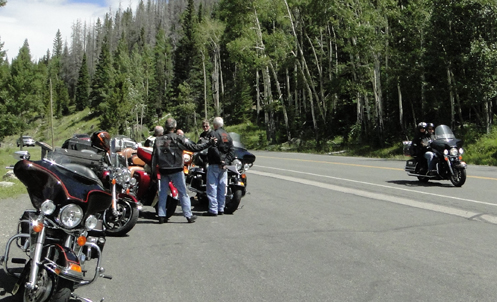
OFMC near Trail Ridge Road

Taking a road-side break on last year's OFMC trip.

We’re not taking off until July but when you travel with a large bunch of guys you have to plan ahead. Everyone has done their work making reservations so the 2016 OFMC trip is waiting to happen. Here’s the route.

First night will be Cripple Creek. This is a short run for the guys from the Denver area and not bad for John coming from Montrose. And these guys all like to make at least one gambling stop each year so this one comes right at the start.

Our self-appointed trip planner, John, had it in mind to do something very different this year, so when we leave Cripple Creek we will be heading east. All the way to La Junta. We’re riding the prairie!

From La Junta we head down to Santa Fe for two nights with golf intervening. That’s another common characteristic of these trips. It’s nice to spend two nights in one place once during the week.

We’ll leave Santa Fe and come back up to Colorado, to Durango, and then the next day west to Utah to Moab.

The last night will be the expensive one, at a vineyard inn in Palisade. Wine tasting and a concert in the courtyard included.

For John then it will be a short scoot back to Montrose and we’ll jump on the highway and blast back to Denver. Should be a good trip. We haven’t had a bad one yet. We’re all looking forward to July.

Biker Quote for Today

Favorite Rides Offers Ideas

Thursday, March 10th, 2016
Favorite Rides & Destinations logo

Rider's logo for Favorite Rides & Destinations

If you subscribe to Rider magazine as I do, you probably already know this. If not, then here you go.

An email told me this morning that Rider has created a new online offshoot they have named “Favorite Rides & Destinations,” which is essentially a re-purposing of articles they have published in the magazine. A conveniently collected grouping of stories by a variety of riders about some of the best rides they have done. Just in case you’re looking for ideas as to where to ride.

Looking through the pieces in this first issue I was particularly interested to see one titled “Wild Texas: A Winter Ride To Big Bend.” This was apparently in the May 2013 issue, though I don’t remember it. But I’m interested now because Judy and I are planning a trip to Big Bend in the next few weeks. How very opportune.

So maybe you’re planning a trip to one of these places. Always good to do a little research before you go. Here’s what this first issue includes:

  • Arkansas
  • Salt Lake City to Las Vegas
  • Vermont
  • Texas
  • Blue Ridge Parkway
  • Catskills area
  • South Dakota

This online publication appears to be intended as a quarterly edition. The first one is labeled “Spring 2016.” And of course I’m going to be very interested to see what they include in future editions. I’ve had a couple ride pieces published by Rider and I’d certainly be tickled to see them use one or the other of those. Not that they would be paying me anything more for doing so; when you sell them a piece it’s right there in the contract that they have the right to use it again elsewhere as they see fit. I’d just like to have them see fit to use my stuff.

Biker Quote for Today

A motorcycle is a bicycle with a pandemonium attachment, and is designed for the special use of mechanical geniuses, daredevils, and lunatics.

Butler Rides Appalachia

Thursday, January 14th, 2016
good motorcycle routes in southern Appalachia

Where you have mountains you have good motorcycle roads--it's just a fact.

The folks at Butler Maps are based in Colorado and so it’s no surprise that most of their map-making endeavors have focused on the western US. They are, however, occasionally tempted to stray. After all, not all the best motorcycle roads are out here. Most, perhaps, but not all.

Thus we have the map entitled “The Great Rides of Southern Appalachia.”

(By the way, just so it’s clear, Butler does not pay me to promote their maps. They do pay me to carry an ad on my Great Motorcycle Roads to Ride in Colorado page, and they do give me free maps. But I write about them in favorable terms because my wife and I both really love these maps. We never travel without them.)

The area covered by this map is pretty much the mountainous area where Tennessee, North Carolina, South Carolina, and Georgia come together. This is a part of the Smoky Mountain and particularly the Blue Ridge Mountains. It’s no shock then that the largest section of yellow-highlighted road (Butler’s best rating) is the Blue Ridge Parkway. But no one needs to tell you that’s a good road to ride, do they?

Nor should anyone need to tell you about the Tail of the Dragon, which is in this area, and you really ought to know about the Cherohala Skyway, which is just a little south of the Dragon. But what else do you know about the area? That’s where this map comes in.

So do you know about the Devil’s Triangle? This is a loop ride a bit northwest of Knoxville that looks pretty nice.

How about the Six-Gap in northeast Georgia? And then there’s the Moonshiner 28. Here’s what Butler has to say about that one:

Highway 28 stretches across the southwest corner of the state (North Carolina) and has a few different riding experiences depending on where you catch it. The stretch between Highlands and Franklin is arguably one of the most dramatic roads in North Carolina with towering waterfalls and perilous cliffs. Part of the road actually ducks behind a waterfall. From Franklin north, the road is slightly less dramatic in terms of views, but almost as much fun from a pure riding standpoint.

And then in the area where Tennessee and North Carolina connect it’s totally mountains and there is a great deal of yellow on the map. This area is near Asheville and we know there is a reason they hold that big motorcycle rally in Asheville each year. Well, these roads are the reason.

Then of course, Butler always now lists good dirt roads for those inclined in that direction. It’s all there with a ton of other information.

I guess next time I go visit my mother in Clemson, South Carolina, I’m going to need to get out of the house more.

Biker Quote for Today

Just because we aren’t riding doesn’t mean we aren’t friends.

You Mean There’s Good Riding In Texas?

Monday, December 14th, 2015
Texas Hill Country

Not one, but three twisted sisters. That sounds good.

From Colorado, taking a motorcycle trip in Texas is not unthinkable. If you head down toward Lamar, to the southeastern corner of the state, Texas is only 40 miles away across the Oklahoma panhandle. From Denver you can actually be in Texas in just a few hours. But then your trip is barely begun.

“Texas is a world all of its own. It takes a lifetime to drive from Eastland to Van Horn.” That’s a line from a Little Feat song. And they should know. Texas is BIG.

So where would you go to ride in Texas? You guessed it: I’ve got another new Butler Maps map, this one for the Texas Hill Country. And where exactly is the Texas Hill Country? Oh, just about 700 miles south of where you would be coming into the state. Down around Austin and San Antonio. And let’s face it, most of that is going to be just burning up miles. Unless you’re Iron Butt-inclined, this needs to be a trip of a full week or more.

And what do you find when you get there? Well, hills for one thing. And that generally means twisty roads running through canyons and valleys. That sounds good, doesn’t it? The biggest attraction as far as I can see is what they call the Three Twisted Sisters. I don’t think that needs explanation. Butler maps out a Three Twisted Sisters route that starts and ends in Kerrville, running 225 miles. A nice day’s ride.

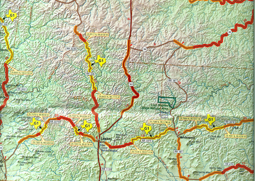
The map also shows three other day ride loops, a 131-mile ride out of Bandera, a 140-mile ride out of New Braunfels, and a 140-mile ride out of Luckenbach.

Perhaps surprisingly for Texas, the map also lists 28 dual sport adventure roads. Texas is known for not having a lot of public land but if you want to get off the pavement there are at least some places you can go. However, be warned. Here’s what Butler has to say about these roads:

They are best suited for advanced riders on bikes such as the BMW R1200GS or KTM 1190. Do not try these roads if your skills or machine are not up to the task.

Something on this map I don’t recall seeing on others are highlight text labeled “Don’t Miss This.” On the Bandera loop, for example, they list things like:

  • The Lone Star Motorcycle Museum near Vanderpool houses a treasure-trove of bikes dating from 1910 to the present.
  • The Apple Store in Medina is a great place to stretch your legs. Be sure to try their signature apple-cinnamon ice cream.

Texas really is a world all of its own. I guesstimate that this map covers maybe one-fifth of the state. In other words, there’s a whole heck of a lot more of it. And I’m sure there is some good riding in other places but I suspect Butler focused on the Hill Country because that’s the best. At least in a concentrated grouping. Considering how huge Texas is I welcome someone pointing me to the really good stuff so I don’t end up burning up thousands of miles on country that is not all that interesting.

One note though: if you’re going to go I suggest you do so in the spring or fall. I’ve heard that, just as riders put their bikes away for the winter up north, riders in Texas put their bikes away for the hottest part of the summer.

So am I going to go riding in Texas? Well, yeah, I’d sure like to. But will it happen? I honestly can’t say. We’re talking serious miles and I’m in the heart of some of the best riding in the world here in Colorado. But I’m definitely going to be considering it.

Biker Quote for Today

But officer, I only have two wheels so I’d have to do 110 mph to break the limit!