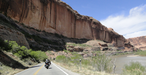
We took the scenic detour down Utah 128 through the Colorado River canyon to Moab and then returned north on US 191.
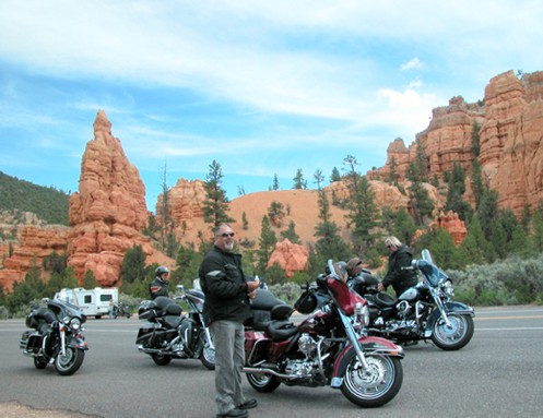
Maybe you noticed I did something on Thursday I haven’t done in many, many years. I missed posting. I was traveling on this RMMRC trip I’ve been talking about but that’s no excuse.
I’ve posted every Monday and Thursday for almost two decades now and while early on I was very irregular, that has not been true for a very long time. Usually when I’m going to be traveling I’ll write a bunch of posts before I go and schedule them to publish. This time around I just didn’t get it done. So I figured I would post from the road for a change.
When I’ve done that before I’ve taken a laptop along but our laptop has gotten quite old and balky. I tried cleaning it up but still couldn’t get enough performance out of it so I figured I’d have to use my tablet. I also took my Sony camera because while pictures from my phone are good, I still get the best shots with the camera. Then to access the images I remove the memory card and plug it into a USB adapter and plug that into the computer. Bring all that stuff along.
Wednesday night in the motel I pulled it all out, ready to go. Removed the memory card, plugged it in the adapter, and . . . the tablet does not have a USB port. Dang.
OK, Bruce had posted a couple shots to the RMMRC Meet-Up site and I figured he wouldn’t mind if I borrowed one of those. And I knew you could load an app on your phone to post to your WordPress blog so I downloaded the app. Launched the app and said go open this site and got a message. It said that because this blog is not hosted on WordPress.com you cannot use this app to post to it. Double dang.
Fine. I turned back to the tablet and launched my browser, then navigated to the blog. Because I’ve never done this with the tablet before it did not have the login and password memorized, but I have an encrypted password app on my phone. Open that app.
I was amazed. Somehow my blog user ID and password never got entered into the password app. Strike three, I am out. No Thursday post this week.
Obviously I’m in now but I won’t get ahead of the story. On Thursday the tale of this ride begins.
Biker Quote for Today
On a motorcycle, you’re immersed in life and everything is louder, brighter, quicker, and ridiculously dangerous. — Jon Robertson