Archive for the ‘Colorado motorcycle rides’ Category

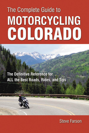
New Book of Colorado Rides Is Very Comprehensive

Thursday, September 22nd, 2011

The Complete Guide to Motorcycling Colorado contains colorful in-depth descriptions of 172 different rides that can be combined in a variety of ways to create the best trips for all riding styles and interests.”

Cover of The Complete Guide to Motorcycling ColoradoSo says the blurb that came with this new book from Whitehorse Press and of course, of all possible reviewers, I wanted to see what it’s all about. First off, what 172 rides could the author, Steve Farson, possibly have compiled? Here on the Passes and Canyons website I list 33 rides on my Great Roads page, and just a few more on my Dirt Roads and Side Trips page.

One thing I knew from the start is that he includes a lot of dirt roads. OK, that will certainly add to the number in a big way. There are a lot of great unpaved roads in this state that are wonderful for a dual-sport bike. You could do an entire book just on them. Also, it turns out, Farson breaks some segments out into individual rides that I lump together as a group. My Peak-to-Peak Highway and Adjoining Canyons page is a perfect example of that. That page includes the entire series of roads running from Estes Park down to U.S. 6 as well as Clear Creek Canyon and five others. So OK, now I’m starting to see how he reached that 172 number.

The bottom line there is that this book is comprehensive. And I can tell you from my own experience building this website, Steve Farson must have put an enormous amount of effort into compiling all this information. He doesn’t just show you the routes and give you an idea of what you’ll see, he also delves into history and tells you a lot about the areas. Along with current photos of these roads there are also numerous old black and whites from 100 years ago or more showing the then and now.

Farson breaks the state up into seven regions and addresses each individually. At the end is also a Colorado Statewide section that offers suggested routes linking together a bunch of the individual rides that he discusses separately. For instance, there are the Weekender Trip to the Northwest and Weekender Trip to the Southwest, both of which start in Buena Vista. He even breaks them down into suggestions for how to make these rides either one-nighters or two-nighters.

The sections for each region begins with a “Regional Overview” with a map showing all the routes highlighted. In the Southwest regional section, for instance, that’s nearly every road on the map because that whole part of the state is just that spectacular. It lists the “Rides in This Section” and then proceeds through them. Each ride gets at least one page and most cover two. Some extend to three pages and each has at least a map and one photo.

Next comes “Recommendations,” comprising groupings such as “Backroad Journeys,” “Especially Twisty Rides,” “Circling Tours” and “Linked Dirt-Road Adventures,” which are pretty much what the names imply. The section wraps up with “Favorite Rides,” which is broken down into categories such as “Most Scenic Spots,” “Best Cruising Journeys,” “Best Sporting Curves and Sweepers,” Best Dirt-Road Adventures,” Little-Known Gems,” and “Worthy Destinations.” Each of these is a simple listing of the rides with the ride number so you can turn to it.

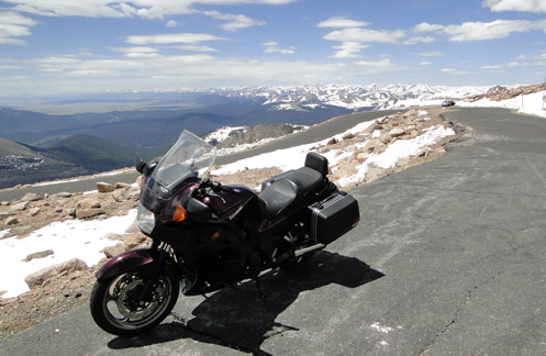
What can I say? This is an impressive book. Yes, there are some dirt roads that are not included, but there’s no way you could include them all. And yes, he includes some roads that I don’t consider all that big a deal, such as Poncha Pass. But Farson uses that word “Complete” in the title, so you can’t fault him for including it. The one caution I would offer is on Guanella Pass, which the book does not mention is closed to through traffic. It has been closed for a couple years now and the last word I’ve heard is that they do not intend to reopen it. If you plan a trip with that as part of your route you’re going to be doing some significant backtracking.

Update: I just heard from Steve Farson and he gave me more current information on Guanella Pass than I had had before. Says Steve, “Guanella Pass opened this past spring. The work to stabilize the slope on the north side of the pass is complete. The work to pave the entire north side is almost complete (Oct 1 completion). In the meantime there are three hour windows on weekdays when they close the pass, then the rest of the time it is open, including weekends. It is quite something to ride the north side now. Almost park like. If Jim Gorden, owner of the Tumbling River Ranch on the Grant side finally relents, the south side of the pass down below Geneva Park might eventually be paved as well.” Thanks for the update Steve.

It’s a terrific reference book. I know that for myself, as I get more and more into dual-sport riding, I intend to use it to find some good dirt roads to ride. Use it hand in hand with this website and between the two of us I think you’ll find just about everything you’ll need to plan your Colorado trip.

Recent from National Motorcycle Examiner
Brammo adds electric cycle rentals in Europe

Biker Quote for Today

There’s no adventure in turning around.

Mapping Software for Your Motorcycle Trip

Monday, August 8th, 2011

Microsoft Streets & Trips mapping software

OK, I’m going to shill a bit here but it’s a product I use and believe in and I’ll make it worth your while to read this.

I was contacted the other day by a fellow working with Microsoft to market their Streets & Trips application. He offered me a free 2011 version and also offered to provide free copies to a few of the folks who read this blog.

Now, the fact is, I’ve been using Streets & Trips ever since I starting building the www.MotorcycleColorado.com website back in 2005. Every map on the site was created using Streets & Trips. And when I got a new computer I bought a new version of the application because the old version wouldn’t run on the 64-bit processor in the new machine.

That’s all to say, I like it, it’s easy to use, and it does everything I need it to do. In fact, it does a lot I don’t even use it for. I don’t have a GPS unit but if you do you can use Streets & Trips to generate files for your GPS. Don’t ask me to explain what it does or how because, as I said, it’s not a feature I use, but it’s there. And honestly, the 2011 version is not a lot different from the 2009 version I’ve been running. But if you don’t have any version, getting your hands on the latest could be very cool.

So here’s the deal. As part of this marketing campaign, Microsoft is running a “Cruisin’ the National Parks Trivia Sweepstakes” through the end of this month. Visit the site, answer the trivia question put up each week, and you could wina $50 Visa gift card. On that same page there’s a button to “like” Streets & Trips on Facebook and for everyone who does Microsoft will be giving $1 to the National Parks Foundation.

And here’s your chance to pick up a free copy of the software. Leave a comment at the bottom of this blog post telling about the most amazing thing you’ve seen riding your motorcycle through a national park. Three of the best stories will be selected and you’ll get a copy. When posting your comment be sure to leave your valid email address because I’ll need to contact you to tell you you’ve won and get mailing info to provide to Microsoft so they can send it to you. Ready? Set? Go!

Recent from National Motorcycle Examiner

Year’s first Progressive International Motorcycle Show on the horizon already

Biker Quote for Today

Any adventure journey has secret destinations unknown to the traveler.

Reconsidering North Cochetopa Pass

Thursday, July 28th, 2011

This whole thing is a little confusing. I’ve always known the pass on CO 114 between Gunnison and Saguache as North Pass, but my friend John calls it North Cochetopa Pass. On top of the pass it uses that name on the sign. But I find it called by both names in various places. Go figure.

North Cochetopa PassEither way, I had been over it but when we rode over it yesterday I was very surprised to find it much nicer than I remember. Just as I remembered, it was a gentle climb through pine forests from Saguach, and no spectacular views. Nice, but I’ve never considered it worthy of giving it its own page here on this website.

What I had forgotten was going down on the Gunnison side. The road quickly descends from the heights and exits the pine forest to wind its way down a ranching canyon. You have brown hills rising on both sides and the bottom land is covered in meadows, hay fields, and pasture. The home of many happy horses and cows.

Then the canyon narrows. All of a sudden you’re riding some great twisties between towering rock canyon walls, with the narrow canyon bottom taken up equally by the river and the road. The canyon then opens up again, and later it gets tight and steep. One road sign tells it all: Trucker beware–tight turns next 8 miles.

The bottom line is that if you’re out this way it’s worth riding this pass. It’s an alternative to Monarch Pass, and while Monarch is more spectacular, if you’ve been over Monarch before and haven’t been on North Cochetopa, and particularly if you’re coming up from Alamosa, you can go wrong taking this road. Enjoy.

Recent from National Motorcycle Examiner
OFMC ride hits the high spots, literally

Biker Quote for Today

Chrome don’t get ya home.

Exploring More Colorado Dirt

Monday, July 18th, 2011

Once again, Judy and I were up in the mountains this past weekend, in her new Subaru Forester, checking out some dirt roads. A dual-sport bike is really high on my wish list but until that happens we’re using her high-clearance, all-wheel-drive vehicle to scout out some roads that might make for some good riding eventually.

Dirt bike on Weston Pass
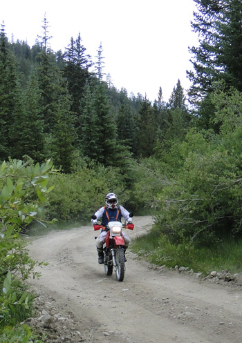
We knew we were going to be coming from Aspen over Independence Pass, so looking at the map, Weston Pass presented itself as something to consider. This road runs over from a little south of Leadville to just a little south of Fairplay. It’s a short-cut that eliminates the drive down to Buena Vista and then back up over Antero Pass on U.S. 285. Of course, with roads like this one, the short-cut takes about twice as much time as the long way around, even though it’s probably one-quarter the distance.

So let me tell you now, Weston Pass would be great on a dual-sport bike. The ruts and potholes and rocks and all the rough stuff that held our speed down much of the time to around 5 mph would just be fun on a proper dirt bike or dual-sport. And in fact, we did see and talk with one guy going over the pass on his bike. That’s him in the picture. I didn’t get his name but it was good to talk with him because he reassured us our car would get over the pass OK. The eastern side of Weston Pass is easy but the western side, which is the side we went up, was very rough. We saw a sign down on the eastern side warning that the western side of the pass road was not maintained for low-clearance vehicles. They weren’t kidding about that.

In the meantime, if you do have a dual-sport, it’s a nice road, going through some terrific country. I have a strong feeling that the more we go out on these roads in this Subaru the more my “need” for a dual-sport is going to increase. And I know that a bike will go on roads that we wouldn’t dream of taking the Forester on, so that will open up even more possibilities. In the meantime, I’m going to have to depend on getting off in the dirt with my friends Ron Coleman, of Western Dual Sport Motorcycle Adventures, and Kevin Smith of Colorado Mountain Moto. They rent dual-sport bikes so if you’re like me and don’t have your own that is an option.

Judy and I figure the next dirt road we want to check out is Boreas Pass, from Como there in South Park over to Breckenridge. Again, I doubt it’s particularly challenging on a bike, but we’ve never been over it so we’re going to go. And some day I will get that bike.

Recent from National Motorcycle Examiner
Repeal of peculiar helmet law vetoed

Biker Quote for Today

Loud Pipes Kill Trails

All Motorcycle Maps Are Not Created Equal

Thursday, July 14th, 2011

It was not a motorcycle trip but my wife, Judy, and I were out running around the mountains last weekend and had a chance to really compare some maps I had brought along. We were in her new Subaru Forester, which is an all-wheel-drive vehicle with high clearance, so we wanted to do some dirt, and take some roads we hadn’t been on before.

Motorcycle maps
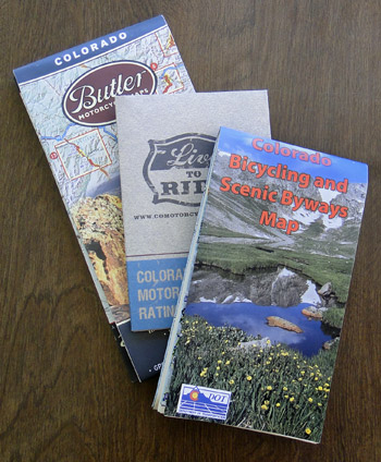
I brought along three maps that I figured would be useful. One is the Colorado Motorcycle Skill Rating Map that was put together largely by ABATE of Colorado and the Motorcycle Roadracing Association for the Colorado Department of Transportation (CDOT). Another was the Colorado Bicycling and Scenic Byways Map, also produced by CDOT. The third was the Butler Motorcycle Maps Colorado map.

With Judy playing navigator, I drove. We went over Ripple Creek Pass, on the Flat Tops Trail Scenic Byway, which runs from Yampa over to Meeker. Later we went partway back along that road to Buford and took the Buford to Newcastle Road. Then we drove the Colorado River Road from Dotsero to a little north of State Bridge on CO 131, and finally over the Trough Road, which runs from State Bridge to Kremmling. The first two are rough roads that you would not want to take a street bike on (though we have in fact ridden the Flat Tops Byway on street bikes–bad idea!), while the other two are just fine for street bikes.

All in all, we had a great time, saw some great scenery, and gathered a lot of information that will eventually end up in the Dirt Roads section of this website. What I hadn’t really thought about, though, was what a good test this was for the maps. They all three were helpful in their way, but the word from the navigator is very clear: The Butler Maps Colorado map is the best.

What that means, very simply, is that the one you pay money for is better than the two free ones. That stands to reason, and is appropriate, but of course was not something you could just assume. But we put them to the test and that’s the verdict. And let me make the point here as well that this is not a verdict biased by the fact that Butler advertises on this site. I’m not sure Judy is even aware of that. She just switched back and forth between the three again and again and at one point told me in no uncertain terms that I should tell everyone that the the Butler map was the best. So there you go. I’ve passed the word along.

Recent from National Motorcycle Examiner
Piaggio MP3: A parallelogram of wheels

Biker Quote for Today

I’m slower than a dude riding one-handed on a DR350 while running a video camera. -Bk.Rd.Rnr

A Cruise Up Mount Evans

Monday, June 13th, 2011

Atop Mount Evans

On a beautiful day like today I had to get out and ride. Plus, I owed an article to one of my editors and figured a piece about riding up Mount Evans would work just fine.

I know it can get cold up there, even when it’s warm down here in the city, so I put on long underwear and a turtleneck shirt. I also put on my electric vest but waited to turn it on until I needed it. Then I had other warm clothes in my bags.

Man, was I roasting before I got out of town. Getting up onto CO 103 over Squaw Pass it finally started getting cool and that was a welcome relief. I reached the turn-off to the mountain, up by Echo Lake, and wondered if I would hear what my friend Dom was told when he was up there just two days earlier, which was that it was so windy they didn’t recommend riding a bike to the top.

Nope, no such warning, and clearly none was needed. They did warn me about frost heaves at the 9-mile marker, near Summit Lake, but I know about those. Just think of them as whoops and you’ll be fine.

So I cruised on up and it was a glorious day. Sunny and warm, I never turned on the electric vest. The view of the Sangre de Cristos from the top was unbeatable. They just went on forever.

Of course, I don’t think you can ride this road without seeing at least one person going down so scared of the sheer drop-off on the edge that they straddle the center line. And I will note that there was one place where the asphalt was just dropping away over the side. Even I stayed close to the middle along that stretch.

And then it was home again. Nothing much, I just rode to the top of the world and back home, all in about five hours. What did you do with your day?

Recent from National Motorcycle Examiner
Willie and Harley: Two American icons tour together

Biker Quote for Today

Any motorcyclist caught holding up automobiles on a winding road will be forced to sell all fringed accessories, buy plaid pants and take up golf. — Peter Egan