Posts Tagged ‘Mount Vernon Canyon’

Exploring Off Old US 40

Thursday, June 14th, 2018
motorcycle in the mountains

Up on Genesee Mountain looking east toward the Sleeper house, which is in the picture but can’t be seen at this magnification.

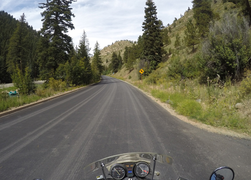
For my third ride since I won the Battle Back to the Bike, I headed out to Morrison, up 93 to I-70 and then got on old U.S. 40 going up Mount Vernon Canyon, right alongside I-70, at least for awhile. I had been up this way earlier this year but wanted to explore more.

For starters, once you get up to the buffalo overlook exit from I-70, it appears U.S. 40 merges at least for a few miles with I-70. But where does the road go on either side at that exit? I figured I’d find out.

First I went to the south side. The road to the left seemed to go into a housing development; I turned right. Right away there was a sign announcing Genesee Mountain Park, one of Denver’s mountain parks. Have I ever been here before? And does this road go anywhere beyond the park? Time to find out.

Things started looking familiar very quickly and I concluded I had indeed been here before, but it was either 40 years ago or perhaps only 30 years ago. So it was like a first visit.

The road climbed its way up Genesee Mountain to picnic areas, with signs for a trail, but then came to an end. Second question answered. Gonna have to backtrack. Heading back down I was surprised to look off to my right, to the east, and there was the Sleeper house. In case you’re unacquainted, this is a futuristic-looking house that was featured in an old Woody Allen movie, titled not surprisingly, “Sleeper.” But there it was, down below me, over on the crest of the next ridge. I’ve only ever seen it from I-70.

So back down to I-70 and across. Where does the road go over there? Does it go through to somewhere? I only remembered that I had been that way once before, also around 40 years ago, when my friends Jerry and Diane got married up there.

It didn’t take long. In about a tenth of a mile the road curved around to the left and there was the church they were married in. And beyond that there was a dirt road going to the left, a road into another housing development to the right, and a gate into a private property straight ahead. No choice but the interstate.

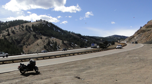
I passed the first exit on the slab, the Chief Hosa exit, and got off at the Evergreen Parkway exit. Crossing the interstate, I took the first right and was back on old U.S. 40. Now the highway curved far away from I-70 through some really pretty country. And I encountered a surprising number of bikers who also know of this road. It does come back to I-70 going up the east side of Floyd Hill and then loops down to meet U.S. 6 at the mouth of Clear Creek Canyon. I turned left, with 6 feeding onto I-70 and took that up to Idaho Springs.

At Idaho Springs I turned up Chicago Creek on CO 103 to go over Squaw Pass. It wasn’t long, however, when I smelled smoke and then noticed that the air around me was filled with a blue haze. Clearly there was a forest fire somewhere. Was it ahead of me on my route? I continued, assuming that they would have the road blocked if that were the case. As the road climbed toward Echo Lake I got a more expansive view and could see there was smoke filling the air for miles around. I learned later it was a fire over by Silverthorne.

Now the riding got really nice, and considering the hot weather down on the plains, it was very nice to find myself chilly.

Eventually, of course, I ended up down at Evergreen Parkway, took that to Evergreen and down to Morrison and back home. About 130 miles and a really nice down out on the bike. I love when that happens.

Biker Quote for Today

Do not look back. You’re not going that way.

Notes From Recent Rides

Monday, April 2nd, 2018
riding motorcycle up Guanella Pass

That instrument cluster in the foreground tells me I was on my Honda this day.

How is it that things come in bunches? I went out on my CB750 a couple weeks ago and three times during that one ride I had drivers in the lane to my right try take my lane, never mind that I was in it.

The first was the most egregious. This lady obviously did not look and she just pulled right over barely six feet in front of me. I blew my horn and shook my fist at her and she hit the gas. Made sure to get well ahead of me.

The next time was better. This guy seemed like he initiated his lane change and looked my way at the same time. He very quickly corrected and got back in his own lane.

The third was the least of the three: she signaled and had barely begun moving my way when she saw me and moved back.

You might ask whether I was at fault here. Was I paying no attention to being in these people’s blind spots? No, I assure you I was not. I pay a lot of attention to that issue, coming up on cars I’m overtaking cautiously and then hitting the throttle to blast past them quickly, getting into and out of their blind spots as rapidly as possible.

But there’s no avoiding being in their blind spot at least momentarily, and if that’s when they decide to change lanes and they don’t do a head-check, watch out!

Call Me The Breeze
That Saturday was an utterly gorgeous day so I did something kind of unusual: I went for a ride up in the hills. Normally I just never venture up to the high country on a bike until about May. This year, however, it has been so very warm of late, and we’ve had so little snow, that I figured I’d do it. Plus, I had just been up on the Peak-to-Peak the week before in a car and it was all clear.

So I was on the Concours and I headed up Mount Vernon Canyon on U.S. 40. It was a really nice run up to Genesee but when I got to that high point the wind was whipping a bit. I went on to Floyd Hill and the wind was howling. Of course, the Concours has complete bodywork so I always describe it as a sail. Not fun in high winds.

My original idea was to hit U.S. 6 in Clear Creek Canyon and then jump on I-70 just up to the exit for the Central City Parkway. I planned to take it over to Central City and then run down to Black Hawk, then go north on the Peak-to-Peak and back down to the flatlands via the Golden Gate Canyon road.

Well, considering the wind at Floyd Hill, going on up to Central City Parkway, which is higher and more exposed, was not at all appealing. So when I hit U.S. 6 I turned right and headed down Clear Creek Canyon. I could have then taken the left that would have taken me to Black Hawk and on to Golden Gate Canyon as planned but my gas gauge was acting weird so I was nervous.

Gas Or No Gas?
Ever since I had left home my gas situation was unclear. I always reset my trip meter to zero when I fill up but when I started off, the trip meter was reading about 80 miles while the gas gauge was showing near empty. Then as I went up and down hills the needle swung back and forth from half a tank to almost empty. I understand this, I’ve ridden this bike for for nearly 20 years, but I’ve never seen this kind of wild swinging. I was starting to wonder if a gas line had rotted through and was leaking. But I checked at a stop and found nothing dripping so I kept going.

I just kept heading down, to Golden, and made my way back home. I stopped and filled up on the way, and it only took 4.2 gallons. The Kawi holds 7.5 gallons. I was nowhere close to empty. But I filled it and set the trip meter to zero so now I know that next time, if things get weird again, there must be something wrong. Otherwise, I have no idea what was going on.

Speaking of gas issues, I had a different one on the previous Friday when I was out on the CB750. Normally I go to Reserve on that bike at about 145 miles. I was hitting 160 and going strong so I was wondering, watching closely for the first sign of the engine coughing so I could switch over.

I was coming up I-25 when it did seem to cough and I quickly flipped the petcock. But it didn’t take long before it started coughing even more. I hadn’t planned to get off at Orchard but in this case I did. On Orchard I got stopped at the first traffic signal and then the engine died altogether. I pulled over onto the sidewalk and considered my options.

The one thought I had been having was that maybe I had left the petcock set to Reserve ever since the last time I had had cause to use it. I put the kickstand down and got off to take a look. Sure enough, it was now set in the “On” position, not the “Reserve” position. I flipped it back to Reserve, pushed the starter button, the bike fired up and I rode on home.

No harm done, of course, but I know from experience what can happen if you have the lever set to Reserve without knowing it: you run out of gas entirely. Yes, I’ve done that.

Biker Quote for Today

You’re a biker wannabe if you’ve never ridden long enough to know that stock seats are never comfortable.

A New Route Up The Mountain

Thursday, March 15th, 2018
two highways side by side

That’s not just a frontage road along I-70, that’s U.S. Highway 40.

What, did some huge rainstorm carve out a new canyon? How is it possible that I could have gone up into the hills right here in the metro area on a new road?

This one has been hiding in plain sight: Mount Vernon Canyon.

If you’re like most people you just said, “What?”

Mount Vernon Canyon is the canyon everyone has been up and down through but never heard of. You know I-70? That’s Mount Vernon Canyon. But did you know that U.S. 40 also goes up through that same canyon?

All the way up to Genesee U.S. 40 runs pretty much right alongside I-70. Heading up the hill you won’t even see U.S. 40 because it is above you; coming down it is more visible. And while I recently came down part of that road for the first time, I had never gone up it. Until Saturday.

Where do you even get on this road? If you’re coming north on CO 93 out of Morrison you take the left on the north side of I-70; coming south from Golden you’re already on U.S. 40 and you follow the sign going to the right, west. (Don’t get confused; not the on-ramp to I-70.)

It’s a pleasant ride, with not a lot of traffic. Once you get to Genesee U.S. 40 merges with I-70 just for a short distance and you can then get back off the superslab at the exit for Evergreen Parkway. Cross to the south side of the interstate and then take the first right turn. This puts you back on U.S. 40 and you’ll cross back to the north side of the interstate and then for awhile you’ll get completely away from the big road.

The two roads do draw close together again after a bit, especially as you come up to Floyd Hill, and then U.S. 40 winds down Floyd Hill to meet U.S. 6 coming up through Clear Creek Canyon. U.S. 40 continues west from there but it is incorporated into I-70 so that’s the end of this nice alternative stretch of road.

Biker Quote for Today

Why bikes are better than women: Motorcycles don’t care if you are late.

Motorcycle Link for Today

When you need motorcycle tires, Toyo Tires are a good option.