Exploring Off Old US 40

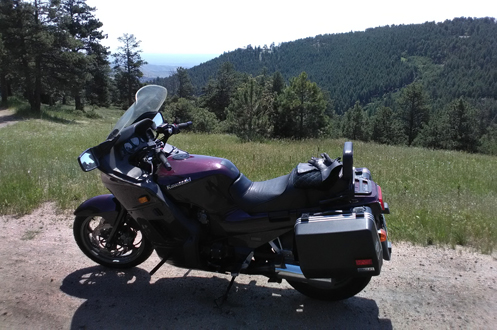
Up on Genesee Mountain looking east toward the Sleeper house, which is in the picture but can’t be seen at this magnification.
For my third ride since I won the Battle Back to the Bike, I headed out to Morrison, up 93 to I-70 and then got on old U.S. 40 going up Mount Vernon Canyon, right alongside I-70, at least for awhile. I had been up this way earlier this year but wanted to explore more.
For starters, once you get up to the buffalo overlook exit from I-70, it appears U.S. 40 merges at least for a few miles with I-70. But where does the road go on either side at that exit? I figured I’d find out.
First I went to the south side. The road to the left seemed to go into a housing development; I turned right. Right away there was a sign announcing Genesee Mountain Park, one of Denver’s mountain parks. Have I ever been here before? And does this road go anywhere beyond the park? Time to find out.
Things started looking familiar very quickly and I concluded I had indeed been here before, but it was either 40 years ago or perhaps only 30 years ago. So it was like a first visit.
The road climbed its way up Genesee Mountain to picnic areas, with signs for a trail, but then came to an end. Second question answered. Gonna have to backtrack. Heading back down I was surprised to look off to my right, to the east, and there was the Sleeper house. In case you’re unacquainted, this is a futuristic-looking house that was featured in an old Woody Allen movie, titled not surprisingly, “Sleeper.” But there it was, down below me, over on the crest of the next ridge. I’ve only ever seen it from I-70.
So back down to I-70 and across. Where does the road go over there? Does it go through to somewhere? I only remembered that I had been that way once before, also around 40 years ago, when my friends Jerry and Diane got married up there.
It didn’t take long. In about a tenth of a mile the road curved around to the left and there was the church they were married in. And beyond that there was a dirt road going to the left, a road into another housing development to the right, and a gate into a private property straight ahead. No choice but the interstate.
I passed the first exit on the slab, the Chief Hosa exit, and got off at the Evergreen Parkway exit. Crossing the interstate, I took the first right and was back on old U.S. 40. Now the highway curved far away from I-70 through some really pretty country. And I encountered a surprising number of bikers who also know of this road. It does come back to I-70 going up the east side of Floyd Hill and then loops down to meet U.S. 6 at the mouth of Clear Creek Canyon. I turned left, with 6 feeding onto I-70 and took that up to Idaho Springs.
At Idaho Springs I turned up Chicago Creek on CO 103 to go over Squaw Pass. It wasn’t long, however, when I smelled smoke and then noticed that the air around me was filled with a blue haze. Clearly there was a forest fire somewhere. Was it ahead of me on my route? I continued, assuming that they would have the road blocked if that were the case. As the road climbed toward Echo Lake I got a more expansive view and could see there was smoke filling the air for miles around. I learned later it was a fire over by Silverthorne.
Now the riding got really nice, and considering the hot weather down on the plains, it was very nice to find myself chilly.
Eventually, of course, I ended up down at Evergreen Parkway, took that to Evergreen and down to Morrison and back home. About 130 miles and a really nice down out on the bike. I love when that happens.
Biker Quote for Today
Do not look back. You’re not going that way.
Tags: Mount Vernon Canyon, Squaw Pass
