Archive for the ‘motorcycle touring’ Category

Clearing the Ice Away

Thursday, December 29th, 2011
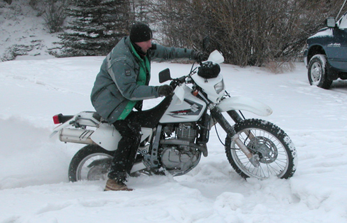
motorcycle in snow

Today is warm and sunny and that’s a good thing. We still have ice on our street, and more importantly, we still have ice between our driveway and the clear part of the street. I need that to be gone so I can get out on one of my motorcycles. By tomorrow it should be clear.

It’s the day after tomorrow that I’m particularly interested in. December 31 is the date for the Last Brass Monkey Run, as I’ve mentioned before. I’m planning to ride this year, and I’ll bet there are a lot of other people making similar plans. It’s not always possible but this year looks like a good one.

Of course, that also means I’ll almost certainly be out on both my bikes the following day. I make it a point to ride both bikes at least once every single month of every single year, and at this time of year you have to take advantage of the first opportunity you get. The weather can change and if you don’t ride today, tomorrow may not be an option. With good weather on January 1 you can pretty much assume I’ll be out riding.

Looking ahead to the new year, I’ve got some great trips planned. I’ve decided this is the year to expand my horizons, and to that end, I’m planning on heading to Ohio for the AMA’s Vintage Motorcycle Days. I’ve never ridden out in that part of the country, so this will be a long trip and it will be something completely new. Plus, I have a brother who lives in Ohio and he and a friend are in the process of opening a biker-oriented cafe in Michigan and of course he wants me to come out and tell the world about it. It’s a dirty job and all that. I’ve never ridden in Michigan before either.

But first we have some cold months to get through. All I ask is just a couple nice days in each of them.

Recent from National Motorcycle Examiner
Top Motorcycle Examiner stories of 2011

Biker Quote for Today

Yes, I have a problem — that there are 50 weeks of the year without Dakar!
The Bikers Are Coming

Monday, December 19th, 2011

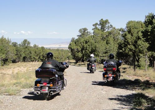
Motorcycling in western Colorado

Where are you going on your summer motorcycle trip in 2012? Are you already making plans?

A lot of people are, and many of them are coming to Colorado.

I know this because of the traffic patterns on this website. With last year being the one exception, traffic on the site reaches its lowest point in November and takes a sharp upturn in December. Then it climbs all the way through July or August before starting to decline again. Last year it actually dropped a hair in December from November, and then screamed higher in January. Who knows why.

I know the bulk of this increase in traffic is from people interested in coming here to ride because of the pages they visit and the exit links they click on. Right at this point, one of the most popular pages on the site is the Colorado Motorcycle Rentals and Tours page, and visitors click the links of numerous of the rental outfits listed there. Another popular page is Biker-Friendly Motels and Hotels. A third is Good for You to Know . . ., which discusses things like the type of clothing you should bring and other Colorado-specific riding information.

Of course, those of us who live here know how great a place Colorado is to ride. The group I ride with, the OFMC, takes a summer trip every year and some years we stay right here. It’s great to go to Montana or Idaho or Utah or any number of other states, but when you’ve got some of the very best right in your backyard, why not take advantage of it? Next year we are leaving the state, heading down to the North Rim of the Grand Canyon, but hey, we’ll have to ride through the Colorado mountains to get there. Oh, it’s a dirty job.

It’s not too early to start planning. And when winter has you cooped up and unable to ride, it’s nice to have something wonderful to look forward to. Come on summer!

Recent from National Motorcycle Examiner
Inflatable motorcycle suit proposed for crash survival

Biker Quote for Today

It’s not an adventure until someone says, “WTF are we doing here??”

Rider Publishes My U.S. 6 Article

Monday, December 5th, 2011

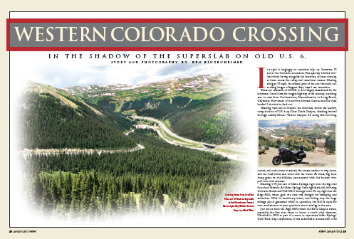
The opening spread of the story in Rider

Hooray, hooray! It took a long time but Rider magazine has published my feature article about crossing western Colorado on old U.S. 6, in the shadow of the superslab.

I had heard from Donya Carlson that it would be in the January 2012 issue, and I knew it should be arriving in my mail any day now. But over the last several days I’ve been in communication with three people who had already received their issues of Rider and seen my piece, while my issue had yet to arrive! Well, the mailman was here about 10 minutes ago and I finally got mine. Yes!

Now I’m hard at work on my next piece for Rider. Judy and I went on vacation to Seattle and British Columbia this summer and rented a Harley out of Vancouver to go riding for a few days. It was part of the plan all along to pitch the story to Rider, so I made sure to shoot a lot of pictures and take a lot of notes.

Once we got back I sent a letter pitching the idea, and they liked it. Now I need to get it written and select the photos to go with it and send it along. If they like it and want to publish it they will tell me that, and then, if things go like they did before, the note will say I can expect to see the piece in print in 12 to 18 months.

So I’m in the middle of the first draft right now, and I’ve got the photos narrowed down to about 40 or so. The article will go through three or four revisions and I’ll winnow the photos down to about 15. Then I’ll be eagerly awaiting a note that I hope will say they like it. If they do you will probably see it in print in 2013. Meanwhile, I want to be pitching them another story idea a whole lot sooner this next time.

Recent from National Motorcycle Examiner
International Women & Motorcycling Conference to return in 2012

Biker Quote for Today

Time spent on a motorcycle is not deducted from your lifespan.

Byways, Byways, We’ve Got Byways

Thursday, October 20th, 2011

Do you ever feel like going for a ride on your motorcycle but can’t figure out where to go, because you’ve already been everywhere, at least locally? I know I get tired of doing the same old routes again and again.

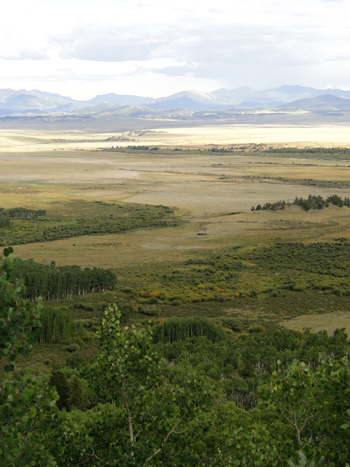
View of South Park from Boreas PassThat’s when it can be good to turn to somebody else’s idea of a good route. And with the modern day convenience of the internet, that can mean Byways.org.
Scenic and historic byways are routes that probably include roads you’ve been on, but perhaps you’ve never combined them in quite the same manner. Take the Lariat Loop. I’ve heard of that route for many years but never really looked into where it goes until today. It starts in Golden, goes up Lookout Mountain and then snakes over to Bergen Park, to Evergreen, and down to Morrison. Then it follows CO 93 back to Golden. I’ve been on all those roads, but have I ever ridden that route all at one time? No.

So Byways.org lists 11 major byways in Colorado, along with 14 others that it says “may be incomplete or contain byways that overlap.” To give you an idea of what’s there, here’s a sampling.

Frontier Pathways Scenic and Historic Byway — Down west of Pueblo, this route runs to Westcliffe, past Bishop Castle, and past the Jackson Hill Stage Stop.

Santa Fe Trail — This ride comes in from Kansas and heads down into New Mexico following–what else?–the old Santa Fe Trail. One nice thing about Byways.org is that it shows you the continuation of roads like this because it covers all the states.

West Elk Loop — Starting and ending at Carbondale, this loop heads up over McClure Pass to Hotchkiss, takes the road through Crawford that runs along the north rim of the Black Canyon of the Gunnison, crosses the dam and heads east into Gunnison, and then turns north to Crested Butte. From Crested Butte, it goes over Kebler Pass back down to CO 133 and back over McClure to Carbondale.

Of course, you don’t need to double back to Carbondale. Heck, you don’t need to do the loop at all. The point is, at least for me, to look at these byways with the idea of identifying roads that perhaps you have overlooked. Or maybe learn about spots along the way that you were unfamiliar with and worth a stop the next time you’re out that way.

Plus, this sort of site strikes me as an excellent resource when you’re planning a trip to an area you are not as familiar with as you are your own home state.

Or you can just continue to ride the same old roads. Totally up to you. Just thought I’d offer an idea.

Recent from National Motorcycle Examiner
Study says 138 million electric two-wheelers by 2017

Biker Quote for Today

Adventure: The pursuit of life.

Out for a Birthday Ride

Monday, August 15th, 2011

riding in British Columbia

One of the OFMC guys emailed us all asking if we wanted to go for a ride on Sunday (yesterday). I replied that yes, I was planning to ride, but I wouldn’t be with them. My Sunday ride was in British Columbia.

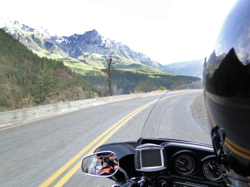
On an Electra Glide Classic, rented from EagleRider in Vancouver, we took off on a loop east through Hope, up to Lytton, to Lillooet, and up and over and down to Whistler. I know, you’ll need to look at a map to see this, or maybe I’ll have to figure out Google Maps and set up a link. Suffice it to say that a) it was a terrific ride, and b) it was an exhausting ride. The thing with Whistler is that there’s only one road and to go anywhere you either go and backtrack or you take a very long loop. We did the loop. It was dark by the time we got back to Whistler.

So the first thing I have to say about riding in British Columbia is that it’s different than riding in Colorado. In Colorado we have some canyons but mostly we go up over passes, down through valleys, then up over more passes. In BC you basically go up one canyon, up another canyon, down another canyon, and on and on. And the big difference is that their hills here are so steep they make ours look like bunny slopes.

Picture this. You’re riding along a highway that is cut into the side of a steep slope. The river is 1,000 feet below you and then as far ahead as you can see the mountain rises 4,000 or 5,000 or 6,000 feet above the road. And it’s all at a very steep angle. You do some climbing, and you do get down to water level on occasion, but mostly it’s following the shoulder of the hillside on and on, with lots of curves but little climbing.

When we did climb it was up over the pass between Lillooet and Whistler. By then it was getting dark and it got cold. And as we started to climb we started accumulating raindrops on the windshield. Oh, oh, we don’t need to get wet now. But it was never more than a few drops so not so bad. I still got a minor bit of hypothermia that had me shaking once we got to Whistler until I got some hot tea in me. But we got here. At last! And we have the bike for another day so we have to go riding again. And there’s really nowhere else to go but back over to Lillooet and do a loop over there. At least that will allow us to see all that in daylight.

Recent from National Motorcycle Examiner
Only a biker knows . . .: Motorcycle wit and wisdom, #18

Biker Quote for Today

Get on your knees every Sunday and pray the road throws you another curve.

Mapping Software for Your Motorcycle Trip

Monday, August 8th, 2011

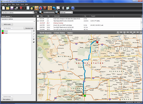
Microsoft Streets & Trips mapping software

OK, I’m going to shill a bit here but it’s a product I use and believe in and I’ll make it worth your while to read this.

I was contacted the other day by a fellow working with Microsoft to market their Streets & Trips application. He offered me a free 2011 version and also offered to provide free copies to a few of the folks who read this blog.

Now, the fact is, I’ve been using Streets & Trips ever since I starting building the www.MotorcycleColorado.com website back in 2005. Every map on the site was created using Streets & Trips. And when I got a new computer I bought a new version of the application because the old version wouldn’t run on the 64-bit processor in the new machine.

That’s all to say, I like it, it’s easy to use, and it does everything I need it to do. In fact, it does a lot I don’t even use it for. I don’t have a GPS unit but if you do you can use Streets & Trips to generate files for your GPS. Don’t ask me to explain what it does or how because, as I said, it’s not a feature I use, but it’s there. And honestly, the 2011 version is not a lot different from the 2009 version I’ve been running. But if you don’t have any version, getting your hands on the latest could be very cool.

So here’s the deal. As part of this marketing campaign, Microsoft is running a “Cruisin’ the National Parks Trivia Sweepstakes” through the end of this month. Visit the site, answer the trivia question put up each week, and you could wina $50 Visa gift card. On that same page there’s a button to “like” Streets & Trips on Facebook and for everyone who does Microsoft will be giving $1 to the National Parks Foundation.

And here’s your chance to pick up a free copy of the software. Leave a comment at the bottom of this blog post telling about the most amazing thing you’ve seen riding your motorcycle through a national park. Three of the best stories will be selected and you’ll get a copy. When posting your comment be sure to leave your valid email address because I’ll need to contact you to tell you you’ve won and get mailing info to provide to Microsoft so they can send it to you. Ready? Set? Go!

Recent from National Motorcycle Examiner

Year’s first Progressive International Motorcycle Show on the horizon already

Biker Quote for Today

Any adventure journey has secret destinations unknown to the traveler.

No Ride to Alaska

Thursday, June 23rd, 2011

Riding the ALCAN highway

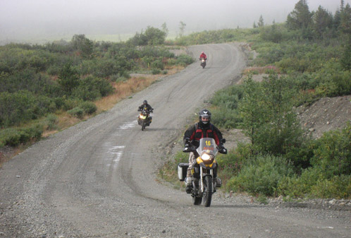
I had written before about possibly taking a ride to Alaska on a Kawasaki KLR650 that needs to get to Anchorage for this year’s Adventures for the Cures ride. Ain’t gonna happen. Dang.

Doing this would have cost a bunch of money, more than I can afford, but my friend Dan Patino of Go 2 Motorcycle Tours, who was to be riding the other bike, was confident that he could come up with the funding to defray our costs. Unfortunately his efforts were for naught. Thanks for trying Dan. I had also contacted one of my editors asking if they would be inclined to sponsor us but they put me off and I didn’t pursue it once it started looking unlikely that Dan’s efforts would be successful.

So now my sights are set on the annual OFMC ride, coming up in about a month. But first I have to get past this next four days of RiderCoach training. We’re back at it in full force on Thursday and the pressure will be constant until late Sunday afternoon. I feel pretty confident but I’m going to be overjoyed to have this ton of weight lifted off my shoulders. At the moment I just have this feeling of dread.

Recent from National Motorcycle Examiner
Ted Simon Foundation to promote good will among foreign cultures

Biker Quote for Today

Ride hard or stay home!

CDOT Motorcycle Skills Rating Map Points Out Roads

Thursday, June 9th, 2011

I recently acquired a copy of a “Colorado Motorcycle Skill Rating Map,” put out by the Colorado Department of Transportation (CDOT). It’s a concept taken from a similar map that is intended to give riders in South Dakota’s Black Hills an idea of how challenging those roads are. Whereas that map covers just the Black Hills, the CDOT map covers the whole state of Colorado.

Motorcycle Skills Map of ColoradoCDOT called on ABATE of Colorado to help put the map together, and ABATE pulled in the Colorado Sportbike Club so as to include that group’s perspective as well.

Unlike so many other state maps where the roads have different colors depending on whether they’re interstate, U.S. highway, state highways, unpaved, or whatever, this map shows all roads as either green (easy), orange (moderate), or red (difficult). Not surprisingly, the entire eastern part of the state is green. From the Front Range west it’s a mix of colors.

The truth of the matter is that for those of us who live here, the map offers little we didn’t already know. The main quibble we might have is that, accustomed as we are to riding in the mountains, for us, marking almost any road red is a stretch. That’s not the point, though. This is a map aimed at tourists, the people who don’t live here. And for many of them, the roads we whip around with confidence may be challenging indeed.

So the real benefit of a map like this for us is that if there are any red roads on the map that we haven’t been on, this is a heads-up that we need to head that direction. Beyond that, I’d love to have maps like this of every other state. I don’t care if a road is rated “difficult” or not. I just have a strong hunch that any road with that rating is likely to be a good motorcycle road and one I’d like to ride. And as well as I know Colorado and many of our neighboring states, there are a lot more states where I wouldn’t have any idea which roads are the best. Maps of this sort can provide that information.

Recent from National Motorcycle Examiner
Demo riding the Z1000 Ninja

Biker Quote for Today

A good ride is one from which you can walk away. A great ride is one after which you can use the bike again.