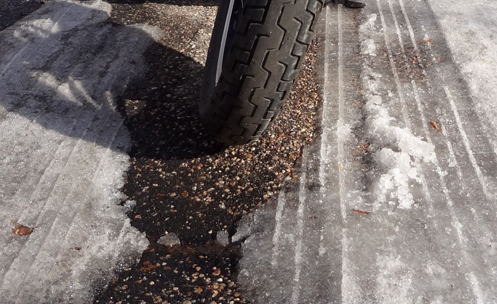
Archive for the ‘Colorado motorcycle rides’ Category

First Peak-to-Peak Ride For 2016

Monday, April 18th, 2016
Motorcycle along the Peak-to-Peak highway

Along the Peak-to-Peak.

Friday was hazy so the temperature never got up to what had been forecast but it was still nice enough I decided it was time to head for the hills.

I make it a point to just stay out of the hills all winter because even when it’s nice down here on the flatlands it can be cold and icy up there. Of course, if you ride on three wheels like Dom Chang then it doesn’t matter. I don’t, so it does.

I took the V-Strom up Clear Creek Canyon and it was a great day to be out. I didn’t wear any electrics because I figured it was warm enough I wouldn’t need them. That has been a mistake at times in the past but I was confident this time. Traffic was light and I didn’t have anybody behind me. I like not having anybody behind me on roads like that. And the people in front of me were making good time, no laggards.

Reaching Black Hawk it was still warm and I had not even seen snow in the shady areas. A little past Black Hawk and that all changed. Now the shady areas on the north-facing slopes had a lot of snow and the temperature dropped about 10 degrees. My legs were getting chilly because all I had there was jeans; on top I had layers.

All the way up Clear Creek Canyon and along the Peak-to-Peak the road was completely clear–no ice, no sand. But by the time I got to where the road down through Golden Gate Canyon peels off from the Peak-to-Peak there was snow everywhere (except on the road) and even cooler temps. I was looking forward to heading down.

And then there was sand in several places on the Golden Gate Canyon road. You’re definitely going to want to take it easy if you go up that road any time soon.

But what a great day it was to be riding up in the hills, nevertheless. Did you know the roads up there have a lot of curves? I’ve been riding down on the prairie the last few months and you don’t see near as many of those down here. Wonder why?

It was especially fun, too, being on the V-Strom. That bike is light and agile and you just zip around those curves. My other bikes are both heavier and just don’t have that feel to them. If I was in a place where I could only have one bike I could have the V and be plenty happy. But I’m glad I’m not in that place.

And then I was getting back near out of the canyon and I passed a guy on a Ural sidecar rig going the other way. I can’t help but wonder, was that you, Dom?

Biker Quote for Today

Meditation doesn’t mean you have to sit still.
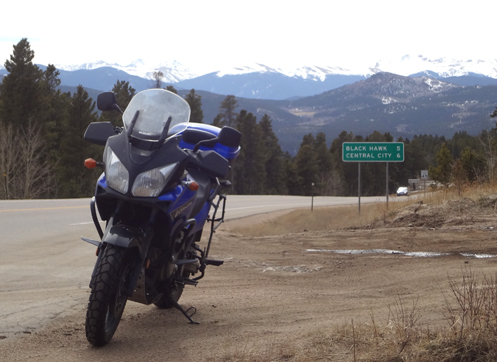
Examiner Resurrection: Cripple Creek To Salida, The Long (And Really Nice!) Way

Thursday, April 14th, 2016

This is another resurrection of a post on Examiner.com that has been removed due to upgraded, incompatible technology.

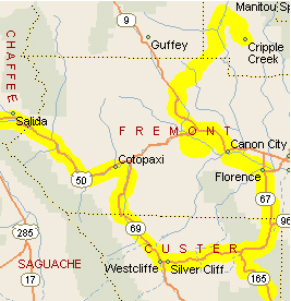
Cripple Creek To Salida map

Our route.

We took a particularly nice ride last Saturday, and while I wouldn’t expect anyone else to take the exact same ride, I want to offer it here so you can consider pieces of it whenever it might work for you.

We started out from Cripple Creek, where we had ridden to the previous day. Most people just take the main road in to Cripple Creek from the north, Colorado 67 from Divide and then county road 61. What you may not realize is that there is another road that heads northwest out of the town, toward either Guffey or Parkdale. This is county road 1 and we took it as far as the intersection of county roads 12 (to Guffey) and 11. We took 11. This brought us out on Colorado 9 a little north of where that road hits U.S. 50 at Parkdale.

At U.S. 50 we headed west just a short distance to where you see the turn-off to the south access to the Royal Gorge. This was a left turn onto county road 3. This little road winds and climbs through some beautiful country. It’s a tiny, narrow little strip of asphalt and there is almost no traffic on it at all, and it comes out on the south side of the Royal Gorge Bridge. Now, to continue without backtracking you’ll have to pay the entrance fee to the Royal Gorge, which is $23 per person, but if you’ve never been there you really ought to go see it once, and there’s no better route than this one. And heck, if you ask for a motorcycle discount you might get one. We did.

So we crossed the bridge and got back on U.S. 50 headed for Canon City. Just before reaching the town we took the turn-off to go up and over Skyline Drive, which is this gorgeous little one-lane, one-way road along the crest of the hogback on the west end of town. No charge and a fabulous ride. Coming down at the other end you drop right into town.

Next we headed east to Florence on Colorado 115 and turned south at Florence on Colorado 67. Colorado 67 feeds into Colorado 96 and when we hit the junction of Colorado 165 we headed south on it to Bishop Castle. This one-man project stands probably 150 feet high and has towers and a smoke-breathing dragon, as well as all sorts of climbing and exploration possibilities. It’s totally unique and you really have to see it to comprehend it. It will blow your mind.

We backtracked on Colorado 165, rejoined Colorado 96, rejoined U.S. 50 at Cotopaxi, and rode on it to Salida for the night. As the crow flies we probably hadn’t gone 50 miles but it was a full day of riding, we saw some terrific sights, and we rode some terrific roads. How could it get any better than that?

Biker Quote for Today

The best path through life is the open road.

OFMC 2016 Trip Is Set

Thursday, March 17th, 2016
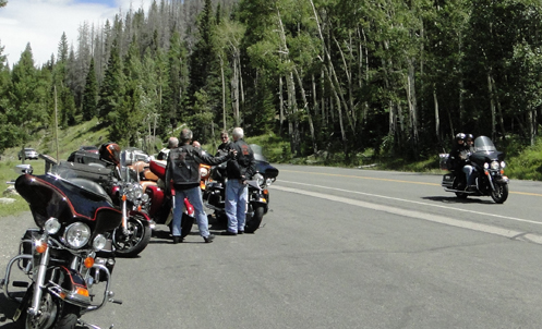
OFMC near Trail Ridge Road

Taking a road-side break on last year's OFMC trip.

We’re not taking off until July but when you travel with a large bunch of guys you have to plan ahead. Everyone has done their work making reservations so the 2016 OFMC trip is waiting to happen. Here’s the route.

First night will be Cripple Creek. This is a short run for the guys from the Denver area and not bad for John coming from Montrose. And these guys all like to make at least one gambling stop each year so this one comes right at the start.

Our self-appointed trip planner, John, had it in mind to do something very different this year, so when we leave Cripple Creek we will be heading east. All the way to La Junta. We’re riding the prairie!

From La Junta we head down to Santa Fe for two nights with golf intervening. That’s another common characteristic of these trips. It’s nice to spend two nights in one place once during the week.

We’ll leave Santa Fe and come back up to Colorado, to Durango, and then the next day west to Utah to Moab.

The last night will be the expensive one, at a vineyard inn in Palisade. Wine tasting and a concert in the courtyard included.

For John then it will be a short scoot back to Montrose and we’ll jump on the highway and blast back to Denver. Should be a good trip. We haven’t had a bad one yet. We’re all looking forward to July.

Biker Quote for Today

A Ride On The Prairie

Thursday, March 3rd, 2016
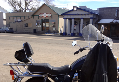
Patty Ann's Cafe

I strongly recommend Patty Ann's Cafe in Kiowa.

We’ve had such great weather that I suspect even people who normally put their bikes away for the winter have been out riding. I suspect riding is even possible in the mountains, whereas I normally don’t ever go up there at this time of year. Maybe I’ll give it a shot soon but so far I’ve stuck to the flatlands.

That means going out on the prairie if you’re going to go more than just around the neighborhood, so I headed out east on Jewell, which has become my go-to route out of town. It turns to gravel just east of Gun Club Road but it’s good, hard-packed gravel, and besides, I was on the Honda, which does OK on gravel.

I reached the T intersection at Watkins Road and turned south to Quincy, another T intersection. I had been at that point numerous times, going both directions, but had never gone further east on Quincy. It was time.

I didn’t know what to expect–I was just exploring. But I figured if I found a place to turn south I could work my way to Kiowa or Elizabeth. I just didn’t know how far I’d have to go before I would find that road south.

I came to Tom Bay Road (ever heard of that?) and it looked possible but after I made the turn I saw it went to dirt right away and the dirt didn’t look all that great. So I continued east on Quincy. Next came Brick-Center Road and I didn’t even try that one. Someday I suspect these will be as familiar–and paved–as Gun Club Road, Tower Road, and all those. But not yet.

Then I hit Kiowa-Bennett Road and I knew that was my baby. South I went. Not too much out here but a few clusters of mini-mansions and a lot of farming and grazing land. But pretty, in a prairie kind of way.

I got to Kiowa and was glad I was going the direction I was on this route. If I had come out on CO 86 looking to turn north I might have missed it. There’s no big intersection or anything; it just looks like any other street in this small town. But it does seem to be a somewhat common route for motorcycles. I passed a fair number going the other direction. I’m guessing they gather at the Stagecoach in Franktown and head east, then north, before turning back west to town. The opposite of what I was doing.

At this point I was ready for lunch and Kiowa had a selection of places to eat. Patty Ann’s Cafe had a sign saying “Bikers Welcome” so I went in there. What a good choice! It appears that all their food is prepared from scratch and it has real flavor. I just got a bowl of soup but it was no little bowl. It had to have been at least twice as much as most restaurants serve as a bowl. Plus, it came with fresh-baked biscuits. Yum!

From there it was back west through Elizabeth to Franktown. Then north on CO 83 through Parker and back to Denver. What a great day to be out on the bike.

Biker Quote for Today

She said “the bike or me.” Decision made.

Ride Videos Up And Down Lookout Mountain

Monday, February 22nd, 2016

I’m still experimenting using my new GoPro camera, and with the great weather we’ve been having I’ve been out. The first test I did was a simple ride over the top of Cherry Creek Dam, with the camera mounted on my helmet. Next I decided I wanted to try it with the camera mounted on the fairing of my Concours.

I also wanted to try out the time-lapse function because I can’t believe many people are going to want to watch a 45-minute video going over some pass. But they might watch a 2-minute time-lapse version of that. What would that time-lapse be like? I wanted to find out.

I selected Lookout Mountain. With the camera on the fairing I shot time-lapse going up and regular video coming down. See here for yourself how it turned out:

Time Lapse Going Up

Regular Video Coming Down

So you can see, the time-lapse goes pretty fast. That was shot at one frame every half second and that’s the fastest rate possible. I’d like to have done in something like maybe eight frames per second so it would be a bit smoother and also not such a race to the top. But you work with the technology you’ve got.

I also wasn’t thrilled that much of what you might see in the mountainside view is blocked by the guard rail. I’m thinking the top of the helmet would have been better, to see over the rail. The view, in this case, is mostly down. Going through Glenwood Canyon the fairing might be good because there the view would be mostly up. That’s why I’m experimenting.

Ultimately I’d like to get video going over every pass in the state that I have included on the website, plus every canyon, and add them on those web pages. That means I’m going to have to ride all of them again! What a dirty job. But I’ll do it. That’s just the kind of guy I am.

Biker Quote for Today

Did you hear about the guy who got a motorcycle for his wife? Pretty good swap don’t you think? (OK, this one is going to get me in trouble with my wife. I don’t really agree with the idea but I still thought it was worth a chuckle.)

A Ride Around DIA

Monday, February 15th, 2016
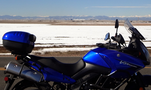
motorcycle with DIA and the mountains in the background

That jagged bit of white there is DIA.

Unlike so many of my rides, I had a plan this time. I saw that if I went out to Watkins I could go north on Imboden Road to 120th and thereby go around Denver International Airport. It was an incredibly gorgeous day and that looked like a good plan.

The ride to Watkins was pretty standard. I’ve done this a number of times recently. I-225 to Iliff, which becomes Jewell, to Watkins Road, then north. I was interested to see that even way out that far east, US 36 is also called Colfax Avenue. Take that about half a mile out of town east and you’re at Imboden.

So we’re really out in the country here, OK? There are some old houses scattered around but it’s basically wheat fields and pasture. And there’s no kind of development up ahead. Nevertheless, what do I encounter coming south but a couple of guys on Harleys. Guess they like getting out in the open spaces, too.

I had done a Google street view thing to make sure Imboden was paved but I hadn’t gone far when I saw a sign that read “Pavement ends.” OK. This was part of why I had ridden the V-Strom. And it did end, with a hard, smooth surface with a lot of loose gravel, but then after about a mile the pavement started up again. And I did hit another short stretch of gravel before I reached 120th.

At about 88th I found the spot I was looking for, where I could see the airport terminal with the mountains behind it. So I stopped and shot that picture above.

As warm as it was I had not worn my heated gloves but I did wear my electric vest. Good thing, because I turned it on before I even got to Watkins Road. I was hoping I wasn’t going to be kicking myself about the gloves. When you have a top bag you can just throw stuff into in case you need it, why don’t you do it? I haven’t yet found an answer to that question.

120th is pretty empty way out there, too, but the further west I came the more development there was. I turned south on Tower Road, with C-470 right over there, and had a chance to see all the airport-related development going on up there. Back at Colfax I turned west as far Airport Blvd. and then south. East on Alameda Parkway to Havana so I could stop at CostCo and get gas. That annoying little icon on my instrument cluster had been shouting at me for quite awhile now. The tank holds 5.8 gallons and I put in 5.25 gallons. What was I worried about?!

And on home. I love living in Colorado.

Biker Quote for Today

I never lose. I only run out of laps, gas, or time.

First Ride With New GoPro Camera

Thursday, February 4th, 2016
GoPro First Ride

Catching myself in the mirror as I set out on my first GoPro ride.

Our street is snowed in again but there were a few days there when I was able to get out, and I did. One thing high on my list was to try out the new GoPro Hero4 camera I got for Christmas. I stuck the mount on the top of my helmet, let it sit for a day, and then went for a spin. Nothing much, just out and over the Cherry Creek Dam and then back. So much to learn about using this thing.

For one thing, unlike any other camera, the GoPro does not have a viewfinder. The only way you can see what the camera is seeing is to install the GoPro app on your smartphone and then sync the phone and camera via bluetooth. Of course, all I had was a little flip-phone so I ended up going out and buying a smartphone. Technology is like that: you get something new and you have to upgrade other stuff in order to use it.

First thing I had to do was figure out where to mount the camera. I’ve seen these guys with the cameras sticking up on top of their helmets and that has always struck me as stupid looking. I was thinking of attaching it on the chin piece of my helmet but when I scoped it out I found that that would have had the camera angle looking right through the windshield on all three bikes. Not gonna do that.

Long story short, I put it on top of the helmet. But I also stuck another mount on the fairing of my Concours. That won’t have the benefit of being able to point the camera at a specific point, the way I can with in my helmet, but it should have its own benefits. But on this first ride I just stuck it on top of the helmet. Then I synced up the phone and camera, adjusted the angle, and was ready to ride.

Of course, before I could get going I managed to nudge the camera and knock it out of alignment, and rather than go through the whole hassle of syncing things back up again and readjusting I just nudged it back a bit and hoped that was good enough. If you view the video you’ll see that in fact it’s still pointed down a bit too much. Oh well, I’ll get the hang of it.

Afterward I viewed the video and decided which parts to cut out and which to keep and then used the software that GoPro provides to make a few more adjustments. When you’re ready it lets you pick what venue you’re going to post it on (YouTube, Vimeo, etc.) and I figured it would then optimize it specifically for that venue. I chose YouTube and I’ve got to say, if it optimized it it’s hard to tell. This is an 8 minute clip and it is taking about 171 minutes to upload to YouTube. That’s right, “taking,” because while I’m writing this it’s still uploading. There has got to be some way to upload something without it taking anywhere near that long. As I said, I have a lot to figure out.

OK, hours later, I found I was uploading the wrong file. Probably the raw video file, not the edited MP4 file I should have been. Once I figured this out the upload took seven minutes and processing afterward took another eight.

So anyway, here it is, my first GoPro video. Nothing special, just a short ride, but it’s my first.

Biker Quote for Today

I asked God for a bike, but I know God doesn’t work that way. So I stole a bike and asked for forgiveness. — Emo Philips

Finally A Clear Exit Path–Barely

Thursday, January 21st, 2016
A path through the ice just wide enough for a motorcycle tire.

I gouged this passageway out of the ice about an hour earlier.

The snow that was predicted but didn’t come over the weekend made all the difference in our street getting clear. On Monday we got a dusting but it was gone by afternoon. Finally on Wednesday, thanks to a little gouging with my heel, a lane just wide enough for my tires was open and I could ride out of the neighborhood without using the sidewalk for the first time in weeks. So I did.

Having no set route in mind I did what I often do, riding across the top of the Cherry Creek Dam heading southeast out of town. I got down to Parker and decided to go east on Main Street. Probably the last time I had gone east out of Parker on Main Street was about 35 years ago. I don’t know what the population was then but a quick search shows me it was 5,450 in 1990. Today that figure sits at about 50,000. So yeah, there have been a lot of changes.

I proceeded east past streets whose names I didn’t recognize–which is to say they are not major north-south streets–until I came to a T intersection at Delbert Road. I had never heard of Delbert Road. I figured I’d go north.

I was definitely out on the very eastern edge of the metro area here, with primarily 2.5-acre “ranchettes” and their McMansions.

Delbert Road effectively ends when it hits County Line Road, although it does go a little beyond. I stayed on it and to my left I could see the newest neighborhoods under construction. And after about a block Delbert turned to mud so I turned around. I was on the Honda so I would not have objected if it was just dirt, but mud was a different matter, especially since the tires on that bike are ready to be replaced and there is very little tread left.

Heading west now on County Line Road, I found that it does not even go through right here, hitting a T intersection at Powhaton Road. So I turned north on Powhaton and very soon it started looking familiar. When I reached the very end of Smoky Hill Road I knew why it looked familiar; I had been here coming the other direction once before.

So that gave me a very direct shot back into town along Smoky Hill. I headed home. The mileage on this ride was around 40, which was fine on a January day. I wore my electric vest and had it turned on and I even bumped my heated gloves up from the lowest setting to two notches higher. I would have been cold without them. I’ve also been wearing my fleece-lined chaps lately. They’re much warmer than my leather ones.

So the forecast for this weekend looks great. Anyone who isn’t out on their bike on Saturday just isn’t even trying.

Biker Quote for Today

Race the rain. Ride the wind. Chase the sunset. Only a biker understands.