My Close-Up Experience of Roy’s Mystery Ride
Thursday, October 20th, 2016I gave an overview of Roy’s Mystery Ride last week but that report was necessarily short on details. It’s often the details that make something really interesting so that’s what you’re going to get here.
Heading out from Performance Cycle this route immediately put me on roads in the Tech Center (I use that term loosely, I guess) that I had never been on. That’s a plus right from the start. Winding around a bit I turned onto Jordan Road headed south. Next I needed to turn left onto Pine Lane.
The hardest part about this ride was having such detailed directions and needing to stop and consult them frequently. Mileage was very precise but I didn’t zero out my tripmeter before starting so I made it a little harder on myself than I could have. I kept looking for Pine Lane, even pulled over at one intersection to consult the directions again, and kept going south. Too far south, I was convinced. And then I reached Hess Road where Jordan ended and I turned around and headed back north. It turned out Pine Lane was where I stopped to consult the directions, and I apparently didn’t see the street sign when I stopped. OK, back on track.
Pine Lane took me east into the hilly area beyond Parker Road and there were numerous interesting sights to locate: a giraffe, a pair of pink pigs, a psychedelic cow, and much more. These were all things we were to watch for. The point of this ride was to be observant while riding your motorcycle.
It was funny to see how easy it was to identify other participants on this ride. I’d be consulting the directions and someone would go past on a bike. A couple miles later I’d pass that same rider and he would be looking at a very familiar piece of paper.
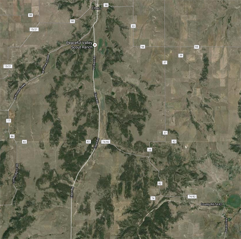
The route led down through Elizabeth, on roads I had mostly been on before, and then on south from there to Elbert. I think I may have only been to Elbert once before, but I saw then that there is some very intriguing landscape around there. My memory was confirmed and now I want to go back there again and do some real exploring.
Heading south out of Elbert I was looking to go east on Sweet Road. The main road seemed to sweep to the right (west) at one point, and that was Sweet Road, but that didn’t seem right so I stopped to consult the sheet. While I was there two other bikes blew on past, with one yelling to me “This is west!” And they kept going. I looked to the south and there was a road heading east about another 100 yards down that way. I went to check and it was Sweet Road. I was on track; they weren’t.
More zig-zagging around carried me further and further to the southeast. Finally Falcon Highway carried me west again and then the route cut through a neighborhood in the eastern suburbs of Colorado Springs where they seem to have a penchant for interesting lawn ornaments. I can’t imagine what it took to design this route.
A stop at a shopping center was built in, so I got a mocha at Starbucks and waited for other riders to show up. A few did, circling the parking lot, but nobody stopped, except a couple who needed gas. So I pushed on. Now the roads were carrying me back east, away from town, and once again into the Black Forest area. McLaughlin Road, Eastonville Road, Meridian Road, Hodgen Road: all of them could be called highways. And if they were called highways I would have known they existed, but they’re not so I didn’t. Now I do.
Then once again it was time to cut through a neighborhood. I’m sure the folks living there wondered why all these bikers were going by this day. That road wound around and eventually came out to CO 83 and then it was just a straight shot back to the Denver area and the finish point.
The whole thing was such a nice ride on a gorgeous autumn day that I told Judy I would take her on a repeat if she has time in the next few days. And next time I won’t have to stop so often to consult the sheet.
Biker Quote for Today
True happiness is when you think of your bike and an automatic smile is on your face.


