Archive for the ‘Routes to Add to Website’ Category

Taking A Look At Motorcycle Journeys Through the Southwest

Friday, May 23rd, 2008

Motorcycle Journeys Through the Southwest
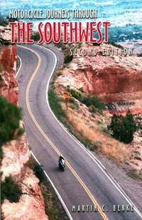
I picked up a copy of this book, Motorcycle Journeys Through the Southwest, on the recommendation of Steve Shards, the Kiwi rider whose pending trip to Colorado I discussed in several posts previously. It’s an interesting book and if you’re coming to the four-corners states (Colorado, Utah, New Mexico, and Arizona) there is a lot of good information about roads you may not know exist. I mean, let’s face it, there aren’t any websites comparable to motorcyclecolorado.com for any of those other states.

What caught my interest was when Steve included some roads in Utah on his trip plans that I had never heard of. I asked him how he (in New Zealand mind you) came to know about these roads, and he told me he read about them in this book. So I bought the book.

The author, Martin Berke, breaks the four-state area up into a number of geographically logical sections.

  • Grand Circle, which includes Utah and Arizona, takes in, as he says, “one continuous trail encompassing six national parks, two national monuments, two national recreation areas, four national forests, three major dams, and the two largest man-made lakes in the United States.”
  • West Slope Slalom, primarily taking in western Colorado, includes routes going over 25 passes.
  • Front Range covers just what it says, the first range of Colorado’s mountains.
  • Enchantment Land covers New Mexico.
  • 2 x Four Corners reaches into all four states, in that vicinity of each state.
  • Hanging on the Mogollon Rim basically covers northern Arizona. He describes the Mogollon Rim as “a geologic rift that marks the southern end of the Colorado Plateau, runs southeast to northwest across Arizona to the New Mexico border to just below Flagstaff.
  • Bloomin’ Desert covers southern Arizona, all the way down to Nogales and the Mexican border.
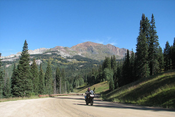
  • What I personally find most interesting about this book is that Berke covers a number of roads here in Colorado that I have ignored on the website primarily because they don’t go through to anywhere. That is, these are roads that dead-end or where the pavement runs out and you would need to either turn around or venture out on the gravel — or worse. He also suggests campgrounds up some of these roads as bases for day trips.

    Looking through this book pointed out to me that I’ve been a little short-sighted in this regard, both in what I’ve included on the site and in my own travels. Especially now that I’ve started including some of the better gravel roads, I’m going to let this book help me explore some parts of this state that I’m unfamiliar with. I’d say that’s a darn good recommendation.

    Biker Quote for Today

    Never hesitate to ride past the last street light at the edge of town.

    Welcome to Anyone Coming Here Via Mile High Harley-Davidson

    Saturday, May 17th, 2008

    I had a pleasing email in my inbox this morning. It seems the folks at Mile High Harley-Davidson discovered this site and liked it enough to feature it in a post on their blog. They sent me a bunch of rides to add to my Rides and Rallies page and mentioned, oh by the way, we recommended your site on our blog. Boy, did they ever! They didn’t just link to the home page, they gave their readers links to all of the great roads pages on the whole website.

    If you are one of the folks coming here via those links, this “Welcome” is for you! Go ahead and explore the site. Then, if there’s something you particularly like I’m always happy to hear that. And if there’s something you’d like to see added I’m even more interested to hear that.

    Of course, if you have any events you’d like added to the Rides and Rallies page just send them along and I’ll get them up right away. Thanks.

    Biker Quote for Today

    Only a biker knows why a dog sticks his head out of a car window.

    I Love What I Learn From You

    Wednesday, May 14th, 2008

    One thing I really love about running this website and publishing this blog is the way I learn about new places to ride from the folks who visit the site. I’m not always able to go check them out right away but they definitely go on my list to get to as soon as I can.

    The most recent road to add to my list is the Kebler Pass road coming over from Crested Butte to CO 133 coming down off McClure Pass toward Hotchkiss. I’ve mentioned Andy Simons several times recently and Andy gets credit for this one, too. He sent me some photos from the road and described it as “dirt road but suitable for all bikes (well graded and packed).” Here’s one of his photos that confirms his description.

    Kebler Pass

    Now, I have never taken this road, not even in a car. In fact, I didn’t know it was there and that you could go anywhere on a good road from Crested Butte other than back down the road you came in on. So I did some checking to find out more about this road. I found one site with a lot of photos where they had this to say:

    This is a beautiful drive, forest road 12, that connects Crested Butte highway 135 with Paonia Reservoir and highway 133. Suitable for any vehicles. If you like aspens, mountains, and many photos ops this is the road for you.

    Then there is this site where people can post their comments on various roads and such, where one person says:

    i lived in colorado for about five years, traveled as many back roads as i could in that time, and Kebler Pass was by far my favorite…for one, it’s a little out of the way so it tends to not be crowded…it is also breathtakingly beautiful…the aspens in this area are huge, and the aspen stand is enormous, mile after mile of aspens…

    I will note that another person on this same site had this cautionary remark:

    The road is heavily washboarded in places and was very muddy after several days of rain, but was easily passable with our Subaru and wouldn’t present much of a problem to any vehicles if the driver is paying attention. I wouldn’t recommend towing over this pass however. Big snows at high elevation would be a problem – something to consider if weather is severe. Take your time as some of the curves are tight and the road drops a lot of elevation on the west side of the pass. We saw plenty of deer, but no other large mammals this trip.

    So it sounds like it should be no problem as long as it’s dry. If it has rained recently don’t even try it. Fair enough. You probably won’t want to try it in May or June but by July or August it sounds like a go. I know I’m going.

    Biker Quote for Today

    The only good view of a thunderstorm is in your rearview mirror.

    A Colorado Road I Need To Ride

    Tuesday, January 1st, 2008

    I picked up the January 2008 issue of Rider magazine with interest as the covered touted a story about “Descending the Black Canyon in CO.” Of course I’ve been to the Black Canyon of the Gunnison many times. It’s steep and gorgeous and deep, and the first night out on one of our earliest summer motorcycle trips we camped there. But I’ve never been to the bottom. The only road I knew of going to the bottom was a very steep (7% grade) gravel road going down from the dam that forms the Blue Mesa Reservoir, and I couldn’t conceive of taking that on anything but a good dirt bike, with a lot more dirt biking experience than I can claim.

    So of course I was very interested when I saw that the writer, Clement Salvadori, took some road to the bottom on a fully dressed Harley Ultra. What road is this? Why am I not aware of this?

    Out comes the map, with the magazine open beside it. Where is this turn-off?

    Aha! Now I see. Clem says to continue west on US 50 “a few miles west of Cimarron.” That would be about 12 miles west, and lo, there it is, CO 347, going off to the north. I have to wonder about this road. It’s right there on my new-for-2007 Colorado state map, but it doesn’t exist on the Microsoft Streets & Trips software that I use for the maps on this website. And Clem says it leads you up to an entrance to the park. I have to wonder how long that road has been paved.

    Of course I’ve never been on this road so I’ll just share with you what Clem has to say:

    . . . it is a well-paved road with a very, very steep descent; I heat up those three brake discs while having a high old time. Down by the river it is a few degrees warmer than at the top, with a small dam and a camping area. . . . I have a look around and then rush back up, which is equally fun and a little less adrenaline-inducing.

    Who knew? I sure didn’t, but I’ll promise you right now that the first chance I get I’m going down that road and it will be up on the website soon afterward. Thanks for the heads-up, Clem!

    Why Isn’t Mount Evans On The Site?

    Sunday, March 25th, 2007

    That’s the question I got from M Rockey. With all the motorcycle roads I have posted info about on the website, where is the road up Mount Evans. Actually, I’ll let him speak for himself:

    Nice site, very enjoyable…but where is MT Evans? :) It’s the best ride of them all in my opinion….I couldn’t find it if it is there..:)

    But thanks..this gets me all worked up for this summer’s CO trip!

    He’s right, you know, and I had realized that last fall. I’ve spent so much time putting up info on routes that get you from A to B that I forgot about rides where you just go and come back. So I’ve had it on my list of things to do soon to add Mount Evans. The thing is, I can’t do it now because that road is closed for the winter, and is probably under six feet of snow at the moment. But check back in June or so and you’ll see Mount Evans. Thanks for the prodding.