Archive for the ‘Dirt biking’ Category

RawHyde Adventures Opens Second Training Facility Here

Monday, December 16th, 2013
motorcycle riding in the dirt

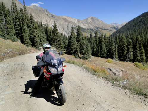
The dirt is calling me.

My introduction to RawHyde Adventures was excitement followed by disappointment. Back a few years ago when being the National Motorcycle Examiner was a viable gig I was contacted by someone asking if I’d be interested in participating in a media event at their then only facility out in California. This was to be–I don’t remember–a four or five day session where they would put us up and feed us and give us several days of off-road training. All I would have to do would be get myself there and get home. Of course I said yes instantly.

It didn’t pan out. This was a short-notice event and while I was totally flexible and able to leap in an instant, apparently the folks working for the more traditional magazines and such could not drop everything and go. It got canceled. I was bummed.

Well, just Sunday I discovered that as of June RawHyde has opened a Colorado facility. I can’t tell from their website just where exactly they are; all it says is “Located high in the Rocky Mountains on the Continental Divide Trail, in the heart of the best Adventure Riding in America.” So it’s somewhere up there in the hills.

If you’re looking to get some training for adventure riding–this is not just riding dirt, it’s more ambitious–RawHyde seems to have a pretty good program. The classes or whatever they call them are:

  • Intro to Adventure Training Camp
  • The Next Step Training Camp
  • Rocky Mountain Adventure Ride
  • High Rockies Adventure Ride
  • The Continental Divide Ride

And they say coming soon, the Triple Nickel Test Ride Program. Not sure what that is.

It looks good. The intro unit is described as, “For experienced street riders wanting to get comfortable in the dirt.” Here’s what they say it will include:

  • An introduction to dirt riding techniques and the top mistakes people make
  • Body position for effective off-road riding
  • Throttle, brake and clutch techniques
  • Weight-shift techniques for steering
  • Balance techniques
  • Turning technique using counterbalancing
  • Obstacle avoidance
  • How to control front and rear wheel skids
  • Hard Acceleration technique on dirt and gravel
  • Hill Climbing
  • Descending steep hills in a controlled manner
  • How to ride in Sand and Gravel
  • How to recover from a stall on a steep hill
  • How to turn around, fully loaded on a steep hill

That sounds like that would about do it. Where do I sign up? And how much does it cost?

Oh yeah, cost. Get out your wallet, cause it ain’t cheap. If you ride your own bike (they do have rentals) the sign-up is $1,395. Ouch. Some people obviously have more money than I do. Maybe you.

What you get for that money is a two and one-half day program, food and beverages, three nights lodging, and a T-shirt. And not just any food. “All meals prepared by Cordon Bleu trained Chefs.”

So, wow. Wow, I’d really like to do this. Wow, I really don’t have that kind of money. Hey RawHyde, if you want to do a media event to help publicize the fact that you’ve got this new operation running, give me a call. I’ll say yes in a heartbeat once again. I’ll even bring my own bike.

Biker Quote for Today

That hill doesn’t look too hard…..you go first!

The Road to Silt

Monday, August 5th, 2013
The road to Silt.

The road as it descends to the north, toward Silt and New Castle.

OK now, before I was so rudely interrupted by this OFMC motorcycle trip I was going to tell you about the road to Silt from down around Vega State Park. Back to where we left off.

As I had described, we had turned off the McClure Pass road (CO 133) to cruise a gravel road that runs over to Collbran, with Vega State Park on the way. After camping overnight at the park we were planning to backtrack a few miles and take the road that runs north to Silt.

In the morning, though, before heading out, we went around Vega Lake and stopped at the Vega Lodge to check it out as a potential overnight destination for the OFMC. It was a nice place with good rates so I have since told John that he ought to consider adding it as a stop on some future trip.

While talking with the lady who runs the place we mentioned we were planning to go back east a bit and take the road to Silt.

“Oh, we hate that road,” she said. “We go to Collbran and take the Debeque cut-off.” She told us it was a bad road in good weather and in bad weather it gets “really greasy.”

But the weather was good and we were not planning on being in any kind of hurry so off we went.

For quite a ways the road was not bad at all. It climbed a bit and we got up fairly high, and then came over the crest and started down. (You can see what I mean in the photo.) That was where things got quite a bit worse. It was obvious that cars and trucks going the other way had had struggles getting up this hill in the wet. In places there were ruts in the road dug by four-wheel-drive tires in mud and the going was pretty rough. Still, there was plenty of smooth road surface if you took your time and avoided the ruts. I definitely would not want to be on this road going either direction is a rainstorm, though. You could really see what she meant by “greasy.” Slick road surface that would give no traction at all when wet. Bad news.

But the weather was good and we had a nice trip. The road went down quite a ways and then we started running into farmland. The road was paved as we got further north and we reached a T intersection. Go left and it took you to Silt. Go right and it took you to New Castle. It’s called the road to Silt but there’s really no reason to go to Silt unless you plan to head west on I-70. If you were going east, as we were, you might as well turn right. We did and it was a nice run to New Castle.

And then it was time to do some slabbing. All good things do come to an end.

Recent from National Motorcycle Examiner
OFMC dips into New Mexico

Biker Quote for Today

The destination is not important, only the ride there…

Colorado Backcountry Discovery Route Is On The Map

Thursday, February 7th, 2013
Colorado Backcountry Discovery Route map

A section of the Colorado Backcountry Discovery Route map.

I eagerly unfolded my copy of the Colorado Backcountry Discovery Route map, from Butler Maps. What roads would it take, which ones have I been on, and which ones might I realistically consider riding at some point?

To refresh your memory, the Backcountry Discovery Route series is sponsored by Touratech, makers of adventure motorcycling gear. What these guys do is go out and develop a route that crosses an entire state, generally north to south, and then they make the GPS logs available for free. Butler Maps has partnered with Touratech on this, producing maps of the routes.

And what do you know, I actually have ridden parts of this route.

The Colorado Backcountry Discovery Route with elevation indicated.

A bit of what the Colorado Backcountry Discovery Route has to offer.

Of course part of it was easy. The route starts at Four Corners and comes up through Cortez and up to Dolores on paved roads. I’ve done all that. Then it gets off on the more gnarly stuff. The route parallels CO 145 along over Lizard Head Pass, taking the west side of the San Miguel Mountains and the lizard head, up to where CO 145 has now passed Telluride. Dropping back south of Telluride almost to Lizard Head Pass, it leaves the paved road again through Ophir and over Ophir Pass to connect to US 550 a little north of Silverton. Jogging north, it then crosses Cinnamon Pass over to Lake City (ridden that one) and then heads up Slumgullion Pass before getting off on the dirt again all the way to Cochetopa Pass, south of Gunnison, and on to meet up with US 50 east of Gunnison at Doyleville.

I’m not going to describe the entire route. In brief it goes something like this: Tin Cup, Taylor Reservoir, Cottonwood Pass (ridden that), Buena Vista, Weston Pass (been there), Leadville, Hagerman Pass, Crooked Creek Pass (been there), Gypsum, Colorado River Road (ridden that), State Bridge, the Trough Road (ridden that one), Lynx Pass, Steamboat Springs, Columbine (been there on the bike), and on to the Wyoming state line at Battle Creek.

The route is broken up into sections and gas stops are indicated on the map. That’s pretty handy when you’re going off the pavement and don’t run into a lot of stations, I’m sure. Alternate routes are pointed out that are a little easier (or possibly simply passable when things get wet), and nice sidetrips to places such as hot springs are pointed out. Lodging is pointed out.

Altogether this route covers 675 miles. As the map states, “It is intended for intermediate to advanced riders and can be ridden on most street legal dual-sport and adventure motorcycles.”

Hey, if you’re looking for some adventure riding, this is Colorado, after all. Go ride!

Recent from National Motorcycle Examiner
Lojack announces top five motorcycle recoveries for 2012

Biker Quote for Today

It’s not how fast you’re going, its about how fast your fast comes to a stop.

Two Chances to See Colorado Backcountry Discovery Route Video

Monday, January 14th, 2013

Going backcountry on adventure motorcycles

This photo is from the Utah Backcountry Discovery Route ride, and is by Jonathan Beck. It was provided to me for the RumBum piece; I hope Jon doesn't object to my reusing it here.

Are you interested in crossing Colorado, border to border, on an adventure motorcycle on unpaved roads and trails? That’s what the Colorado Backcountry Discovery Route is all about and the folks who mapped it out will be showing a video of their riding of this route.

The first showing will be this Saturday, Jan. 19, at BMW of Denver, 2910 S. Havana. The show starts at 5 p.m. They ask that you RSVP to save a seat. The second showing will be the following Saturday, Jan. 26, at Performance Cycle of Denver, 1990 S. Broadway. No further info on their showing. There’s no admission fee.

The Colorado Backcountry Route is another in a series of such efforts headed up for the most part by Touratech, a company that specializes in creating and selling tough gear for adventure motorcyclists. The backcountry route thing is great for off-road riders because it helps establish routes (free GPS files are available) and good for Touratech because it helps them sell more gear.

Paul Guillien is general manager of Touratech and I spoke with him at the time that the non-profit group they formed released the Utah Backcountry Discovery Route. I’d link to that article but unfortunately it was published on RumBum.com and RumBum has shut down operations and it’s not available. I’d republish it here except that I sold all rights to the piece to RumBum, so they own it, not me.

Too bad, it was a good piece. I will, however, excerpt the opening two paragraphs. That’s fair use under copyright law.

By the standard of “It’s not an adventure until someone says, ‘WTF are we doing here??’,” Paul Guillien and his riding companion were pretty certain they were having an adventure coming down from Reservation Ridge.

“Two of us were out scouting away from the group and we got stuck on Reservation Ridge. It’s about 9,000 elevation, we were buzzing along, and next thing we know a rain storm opened up on us and within minutes the bikes were falling down.”

Suffice it to say, this Colorado video is likely to be well worth watching. Even if you don’t ride in the dirt.

Recent from National Motorcycle Examiner
LoJack announces top five motorcycle recoveries for 2012

Biker Quote for Today

We have always taken “very dangerous” and “not recommended” as indicators of where some good riding was to be had.

Getting Acquainted With United Dirt Bike School

Monday, November 5th, 2012
United Dirt Bike School

The banner on the United Dirt Bike School web site.

I’m not much of a glad-hander, so even though I’ve been an ABATE member for several years now and I go to my district’s monthly meetings as often as possible, I still don’t even know most of the people’s names, and I’ve never spoken to most of them. So I was very interested to figure out recently that one woman who has been coming for awhile, and whom I had never met, is Kathy Banning, one of the co-owners of United Dirt Bike School. And so at the meeting last Sunday I approached her afterward and we spoke.

If you’ve been reading this blog you know that for some time I have had a growing interest in riding off the pavement. I’m not necessarily interested in the serious, really difficult trail riding that some people do, I’m just tired of missing out on all these great roads that Colorado has that don’t happen to have asphalt on them. I’ve ridden a bit with Kevin Smith, of Colorado Mountain Moto, and Ron Coleman, of Western Dual Sport Motorcycle Adventures, but I want more. And most especially, I want my own dual-sport or dirt bike.

What I don’t want is to get out somewhere, all on my own, and get in trouble. Now, I’m a confident sort of person and I think I’m pretty good at recognizing my limitations, so I don’t really think that is all that likely. But what if it did? One way to improve my odds would be to improve my skills. I’ve taken the MSF Beginning Rider Course and the Experienced Rider Course, so why not take a dirt-riding course? And Kathy and her partner, Michael St. John, are both MSF certified to teach dirt riding. I told Kathy that I’m interested.

An interesting thing is that apparently, so are a lot of other people. They have limited access to the training course they use and from what Kathy tells me, they have a line of people waiting to get in their classes. That’s a good problem to have, I guess, though you would actually wish you could accommodate everyone who wants to pay for your services.

So I got the scoop on it all. They provide the bikes and the gear. You need gloves and proper footwear. A full-day class runs $175 if they provide the bike, $150 if you bring your own. Get on their email list and they’ll keep you apprised of class opportunities. And even with winter coming on, that doesn’t pull the plug on classes. As long as conditions allow it and they have interested students, they teach all year round.

I’m not saying I’m definitely going to do this, but I’m definitely thinking about it. And after working totally as a freelance writer for the past 3-1/2 years I have now taken an editor position, on contract, with the National Park Service, so I’m going to have some money again, at last. As always, you’ll read about it here if it happens.

Recent from National Motorcycle Examiner
More articles published in Rider and Accelerate

Biker Quote for Today

Paved roads…… Just another perfect example of needless spending by the government.

AMA Urges Comments on Resource Management Plan That Would Limit Riding

Thursday, January 12th, 2012

Riding in the hills above Lake City

January 17 is the deadline for comments on a proposed Resource Management Plan (RMP) put together by the Colorado River Valley (CRVO) Glenwood Springs field office of the federal Bureau of Land Management (BLM). After studying the plan the American Motorcyclist Association (AMA) has issued an alert stating that “The current proposed RMP calls for a significant decrease in the number of miles for off-highway vehicle use as well as a total elimination of all cross country travel,” and urging motorcyclists to register their concerns with the plan. Letters should be sent to:

BLM CO River Valley Field Office
2300 River Frontage Rd.
Silt, CO 81652

Or you can email your comments to cormpkg@ttsfo.com.

Limitations proposed by the plan include the following.

  • Eliminate all cross-country travel currently allowed on 123,000 acres
  • Decrease designated route mileage for full-size vehicles from 760 miles to 470 miles
  • Decrease designated route mileage for ATVs from 82 miles to 62 miles
  • Decrease designated single-track route mileage for motorcycles from 85 miles to 66 miles
  • Closure of an additional 47,900 acres currently open to snowmobile recreation
  • Closure to snowmobile usage on anything other than a trail on an additional 14,800 acres

The particular issues the AMA has with the plan, and what they consider the talking points to be raised in making comments, include the following.

  • There is a lot of information provided in the plan for different uses; however it is disorganized and hard to review.
  • Travel management analysis and decisions appear to have been overlooked in the development of the plan and there is no analysis offered as to why all routes closed to motorized usage are assumed to be available for non-motorized and mechanized usage going forward. The lack of analysis for travel management related issues is a violation of NEPA’s requirements for a detailed statement of high quality information of why decisions in the Plan have been made.
  • Motorized users are the only loser in the plan as travel management is the first tool used to address management issues that have nothing to do with travel management, like big game hunting issues and cave management.
  • Alternative D is the best alternative but it still fails to address usage trends on the CRVO.
  • Alternative C is very weak scientifically and violates both state and federal planning guidelines.
  • The Plan moves to a fully designated trail system for all users; however the stated benefits of the proposed changes are simply not addressed. The Plan does not analyze why this protection is not enough and further closures are necessary, when most habitat management plans never identify the need for any trail closures to protect the species.
  • Loss of the Gypsum Hills Special Recreation Management Area (SRMA) is unfair and runs counter to the reason it was originally created (to off-set the impacts of two Wilderness Study Areas (WSA’s). The WSA’s are still present and the SRMA should not be removed until there is a proposal to re-open the WSAs.
  • User conflicts are often overstated to obtain closures for other reasons and most user conflicts can be addressed without the closures of trails and roads.
  • Closure of the Hardscrabble Area for motorized access and subsequent designation of the Hardscrabble area for targeted recreational motorsports activities is inconsistent. This plan fails to give any analysis of the existing motorized opportunities that will be lost in the Hardscrabble area.
  • Many of the Wilderness characteristic areas and areas of critical environmental concern designations are inconsistent or conflicting.
  • Many proposed management standards violate multiple usage requirements such as the standard of managing all big game habitats to optimum standards

Recent from National Motorcycle Examiner
Safety advocate group includes helmet laws in 15-item list

Biker Quote for Today

Life is long enough – it just isn’t wide enough. Although I do enjoy a good single track now and then!