Archive for the ‘Colorado motorcycle rides’ Category

Riding On The Plains

Monday, October 31st, 2011

Riding motorcycles on the prairie

It has gotten cool and we’ve had snow in Denver now. I know they’ve gotten a lot more snow in the mountains. I probably won’t be riding up in the hills any more any time soon.

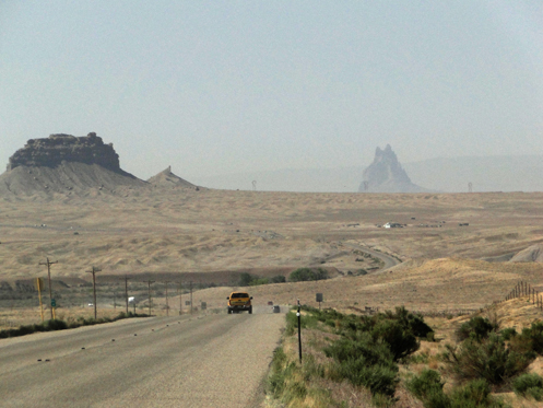
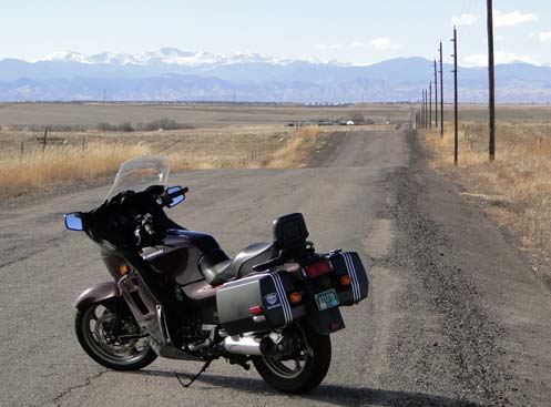
That doesn’t mean I won’t be riding, though. It’s just time to change direction. In fact, I already took my first ride on the prairie this past weekend. Guess what? It’s really nice out there.

In the cooler parts of the year I like to ride around the outskirts of Denver and explore the new construction going on out there. If there’s road that is newly paved, I want to see where it goes. I find myself wandering around out there and sometimes getting lost but how lost can you get on Colorado’s eastern plains? The mountains are to the west.

Of course every time I do this it blows my mind how much construction and new development there is. We have friends who moved from west Denver a few years ago to Watkins and I used to think they were a long way out there. Have you wandered around out there recently? The city is not that far any more. It will probably swallow them in 10 years.

As it is now, houses go on beyond where Smoky Hill Road ends, and of course that road is four lanes almost to the very end. Heck, I remember when it was just two lanes, and I’m not even sure it was paved back when I’m thinking about. But I’ve taken rides out there with some frequency and watched the transformation. For years I looked at these mostly large houses and wondered where in the world all these people got all this money. Of course, now we know many of them never had that money and now I wonder how many of these places are sitting empty. That may buy our friends in Bennett another 5 years before the city gets there.

My point, of course, has nothing to do with houses or the economy. My point is just that even when the mountain roads are snowy there is still a lot of good riding to be done at the lower elevations. I don’t ever put my bikes away for the winter. How about you? Maybe I’ll see you out on the road sometime in January.

Recent from National Motorcycle Examiner
Only a biker knows . . .: Motorcycle wit and wisdom #19

Biker Quote for Today

I wonder where that road goes?

Byways, Byways, We’ve Got Byways

Thursday, October 20th, 2011

Do you ever feel like going for a ride on your motorcycle but can’t figure out where to go, because you’ve already been everywhere, at least locally? I know I get tired of doing the same old routes again and again.

View of South Park from Boreas PassThat’s when it can be good to turn to somebody else’s idea of a good route. And with the modern day convenience of the internet, that can mean Byways.org.

Scenic and historic byways are routes that probably include roads you’ve been on, but perhaps you’ve never combined them in quite the same manner. Take the Lariat Loop. I’ve heard of that route for many years but never really looked into where it goes until today. It starts in Golden, goes up Lookout Mountain and then snakes over to Bergen Park, to Evergreen, and down to Morrison. Then it follows CO 93 back to Golden. I’ve been on all those roads, but have I ever ridden that route all at one time? No.

So Byways.org lists 11 major byways in Colorado, along with 14 others that it says “may be incomplete or contain byways that overlap.” To give you an idea of what’s there, here’s a sampling.

Frontier Pathways Scenic and Historic Byway — Down west of Pueblo, this route runs to Westcliffe, past Bishop Castle, and past the Jackson Hill Stage Stop.

Santa Fe Trail — This ride comes in from Kansas and heads down into New Mexico following–what else?–the old Santa Fe Trail. One nice thing about Byways.org is that it shows you the continuation of roads like this because it covers all the states.

West Elk Loop — Starting and ending at Carbondale, this loop heads up over McClure Pass to Hotchkiss, takes the road through Crawford that runs along the north rim of the Black Canyon of the Gunnison, crosses the dam and heads east into Gunnison, and then turns north to Crested Butte. From Crested Butte, it goes over Kebler Pass back down to CO 133 and back over McClure to Carbondale.

Of course, you don’t need to double back to Carbondale. Heck, you don’t need to do the loop at all. The point is, at least for me, to look at these byways with the idea of identifying roads that perhaps you have overlooked. Or maybe learn about spots along the way that you were unfamiliar with and worth a stop the next time you’re out that way.

Plus, this sort of site strikes me as an excellent resource when you’re planning a trip to an area you are not as familiar with as you are your own home state.

Or you can just continue to ride the same old roads. Totally up to you. Just thought I’d offer an idea.

Recent from National Motorcycle Examiner
Study says 138 million electric two-wheelers by 2017

Biker Quote for Today

Adventure: The pursuit of life.

Guanella Pass Really Is Open Again

Monday, October 3rd, 2011

Guanella Pass

I owe thanks on this one to Steve Farson, author of the newly released The Complete Guide to Motorcycling Colorado. I reviewed his book last week and mentioned that he did not tell his readers that Guanella Pass is closed. They closed it in 2008 and the most recent thing I had heard was that there were no plans to reopen it.

Well, what do you know, Steve emailed me to thank me for the positive review AND to tell me that in fact, Guanella was reopened earlier this year. Finally. And he said the road was beautiful, that they have done a terrific job.

Of course Judy and I had to go see for ourselves, and we did on Saturday.

Holy smokes, what a nice road! The asphalt is beautiful, there are a lot of guard rails where there didn’t used to be any, and the new retaining walls are impressive. On top of that, the pavement goes a lot farther than it used to. Used to be, it was paved all the way to the top on the Georgetown side and then just over the crest it turned to gravel. Then it was gravel all the way to Grant, except for some spots where the asphalt from many years ago was still holding together a little.

We checked it on the odometer and here’s what we found. From the top headed toward Grant, the new pavement extends another 3.8 miles. At 8 miles from the top the old surviving pavement starts to get bad and at 9.2 miles it ends altogether. There are then 3.6 miles of gravel before you hit pavement again 0.5 mile from Grant.

So there’s really no reason not to ride this pass. The 3.6 miles of gravel are easily traversable on any street bike as long as you take it nice and easy. Heck, before they closed it for nearly 3 years I used to see Harley baggers and everything else up there, and there was a lot more gravel back then.

Truth is, this road is so much better than it was before I’ve concluded I need to promote it on the website from just a “Dirty Road” mention to its own full page. Look for that sometime next year, as I doubt I’ll have time to get to that right away.

Thanks for the update Steve.

Recent from National Motorcycle Examiner
‘Mythbusters’ reiterates previous ‘bikes not greener’ conclusions

Biker Quote for Today

So many roads, so little time!

The Fall Color/Cemetery Dual-Sport Tour

Thursday, September 29th, 2011

V-Strom and F800GS at old cemetery above Central City

Had a terrific time with Ron Coleman of Western Dual Sport Motorcycle Adventures today dual-sport riding in the hills west of Boulder and around Central City. He was on one of his V-Stroms and I was on his F800GS. Oh, and I dumped the thing twice. Details in due time.

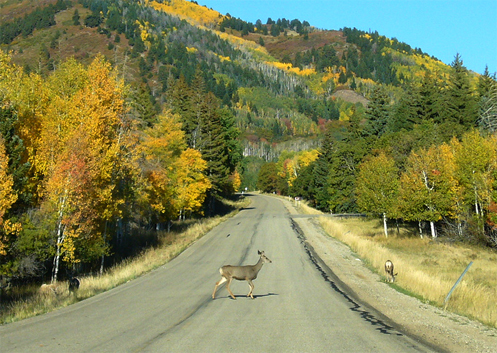
Ron dubbed this the Fall Color/Cemetery Tour for very literal reasons. The aspen are at their peak of color about now and here’s an interesting thing you may not know: cruising around in the hills above Central City there are numerous old cemeteries, with gravestones dating back to the mid-1800s. They’re actually very picturesque, with some very ornate markers.

We headed out of Boulder going up Boulder Canyon but then turned off onto Magnolia Drive. This road climbs very steeply with numerous switchbacks that must have a road pitch of at least 15 percent. It was nice to be on a bike that was light and had great low-end torque. Up over a crest and the mountains to the west came into sight and the pavement ended. We wound our way along and then reached the Peak-to-Peak Highway just north of where the road up Coal Creek Canyon hits it.

Heading south on the Peak-to-Peak, we turned off just before reaching Black Hawk onto Apex Valley Road. Where Apex Valley Road appears to end, a hard left took us up Upper Apex Road and after awhile we came out into a clearing on a ridgetop where there were three cemeteries. What was surprising was that there were also some very new condos up there. Ron said he believes they were built to house casino workers when gambling was legalized in Black Hawk and Central City.

We headed down toward Central City but turned off on a gravel road that carried us along a ridge overlooking the town. At one point Ron stopped, took a hard right, and went down a badly washed out road that had softball-sized rocks and about 6 inches of sand. In retrospect, I should have made the commitment to do it and just gone for it. But I didn’t. I was very hesitant and lacking in confidence, and I high-sided. That bike flipped me like a rag doll but I landed totally unhurt and the bike was not damaged either. We got it back up and went on our way.

From Central City we took the parkway over to I-70 and on to Idaho Springs for lunch, where we met up with Jacque, a friend of Ron’s who I had ridden with before. She was on her F650GS. We continued west just to Fall River Road and then, after probably less than a mile on that road turned off onto the York Gulch road. This brought us to another old cemetery where, when I put my feet down to stop, I ended up just falling over because my feet didn’t make contact with the ground. Ron pointed out after we picked the bike back up that there was a rut right where my foot was expecting something solid. Once again, no injuries, no damage.

Following that road further we ended up right back at the other cemeteries above Central City and retraced our path down Upper Apex and Apex Valley Road, back to the Peak-to-Peak. We headed north but then turned east on South Beaver Creek Road, unpaved, which ran into CO 72 coming up Coal Creek Canyon. Took that road down to CO 93 at Rocky Flats and then on back to Boulder.

What a great day to be out in the mountains in the dirt. So good, in fact, that we’re going to do it again next week.

Recent from National Motorcycle Examiner
Honda debuts fuel-efficient motorcycle engine with ‘powerful, throbbing torque’

Biker Quote for Today

Rule 1 of motorcycling: Get back on the bike. Sooner or later, you will.

Great Dual-Sport Gunnison Weekend

Monday, September 26th, 2011

Coming down off Carnero Pass

I went dual-sporting again this weekend with Kevin Smith over in the Gunnison area. Kevin lives over there and rents V-Stroms through his company, Colorado Mountain Moto. Last year we rode Cinnamon Pass. This year we rode Carnero Pass.

Never heard of Carnero Pass? Neither had I. But it’s the perfect example of what I keep saying, that I want to do a lot more dual-sport riding because I know there are a lot of fabulous roads in this state that I’ve never been on because they are not paved.

Oh, and just to make that last statement seem a little foolish, Kevin’s wife Janet rode with us–on her Ninja. Now, Kevin says this Ninja 500R is really more a standard than a sportbike, but still, we were on dual-sports and Janet was on her Ninja. It’s a matter of attitude. Some people say “A touring bike is whatever bike you’re on when you go touring.” I guess you can say that a dual-sport bike is any bike you’re on when you go dual-sporting. This is the bike Janet has so it’s the bike she rides wherever she wants to ride. This is not the first gravel mountain pass road she’s been on on that bike.

Now, I still wouldn’t have wanted to have been on that road with my Concours. But my CB750 is a different story. That bike just handles better on gravel than the Kawi. And if that Ninja could do this ride my CB could, too.

So where did we go? We headed east out of Gunnison just a few miles to where we turned off on CO 114, which runs down over North Cochetopa Pass to Saguache. We went over the pass but before we got as far as Saguache we turned off onto Saguache County Road 41G. This is the road that goes up over Carnero Pass. Carnero is almost as high as Slumgullion Pass, which we crossed later, but you’d never know it. I guess we had done most of our climbing coming up North Cochetopa, and so even though we down then a ways, it didn’t seem like that much further up to Carnero after we got off CO 114.

Coming down, though, we had a pretty good descent as we made out way toward Del Norte, where we finally reached the pavement again. In the interim we rode some very nice roads and saw some terrific scenery and just generally enjoyed a day out away from pretty nearly anyone else. We did go back to Gunnison via South Fork, Creede, and Lake City, though so that was all paved and populated. The aspens are turning, though not quite at their peak yet, and it was a beautiful autumn day, though it did get blustery in the afternoon. What a great day to be out on some great roads. I love living in Colorado. (You can read more about it and see pictures from the ride on Examiner, via that link immediately below.)

Recent from National Motorcycle Examiner
Dual-sport riding out of Gunnison

Biker Quote for Today

The quickest way from Point A to Point B is not on a straight line, it’s on a motorcycle.

New Book of Colorado Rides Is Very Comprehensive

Thursday, September 22nd, 2011

The Complete Guide to Motorcycling Colorado contains colorful in-depth descriptions of 172 different rides that can be combined in a variety of ways to create the best trips for all riding styles and interests.”

Cover of The Complete Guide to Motorcycling ColoradoSo says the blurb that came with this new book from Whitehorse Press and of course, of all possible reviewers, I wanted to see what it’s all about. First off, what 172 rides could the author, Steve Farson, possibly have compiled? Here on the Passes and Canyons website I list 33 rides on my Great Roads page, and just a few more on my Dirt Roads and Side Trips page.

One thing I knew from the start is that he includes a lot of dirt roads. OK, that will certainly add to the number in a big way. There are a lot of great unpaved roads in this state that are wonderful for a dual-sport bike. You could do an entire book just on them. Also, it turns out, Farson breaks some segments out into individual rides that I lump together as a group. My Peak-to-Peak Highway and Adjoining Canyons page is a perfect example of that. That page includes the entire series of roads running from Estes Park down to U.S. 6 as well as Clear Creek Canyon and five others. So OK, now I’m starting to see how he reached that 172 number.

The bottom line there is that this book is comprehensive. And I can tell you from my own experience building this website, Steve Farson must have put an enormous amount of effort into compiling all this information. He doesn’t just show you the routes and give you an idea of what you’ll see, he also delves into history and tells you a lot about the areas. Along with current photos of these roads there are also numerous old black and whites from 100 years ago or more showing the then and now.

Farson breaks the state up into seven regions and addresses each individually. At the end is also a Colorado Statewide section that offers suggested routes linking together a bunch of the individual rides that he discusses separately. For instance, there are the Weekender Trip to the Northwest and Weekender Trip to the Southwest, both of which start in Buena Vista. He even breaks them down into suggestions for how to make these rides either one-nighters or two-nighters.

The sections for each region begins with a “Regional Overview” with a map showing all the routes highlighted. In the Southwest regional section, for instance, that’s nearly every road on the map because that whole part of the state is just that spectacular. It lists the “Rides in This Section” and then proceeds through them. Each ride gets at least one page and most cover two. Some extend to three pages and each has at least a map and one photo.

Next comes “Recommendations,” comprising groupings such as “Backroad Journeys,” “Especially Twisty Rides,” “Circling Tours” and “Linked Dirt-Road Adventures,” which are pretty much what the names imply. The section wraps up with “Favorite Rides,” which is broken down into categories such as “Most Scenic Spots,” “Best Cruising Journeys,” “Best Sporting Curves and Sweepers,” Best Dirt-Road Adventures,” Little-Known Gems,” and “Worthy Destinations.” Each of these is a simple listing of the rides with the ride number so you can turn to it.

What can I say? This is an impressive book. Yes, there are some dirt roads that are not included, but there’s no way you could include them all. And yes, he includes some roads that I don’t consider all that big a deal, such as Poncha Pass. But Farson uses that word “Complete” in the title, so you can’t fault him for including it. The one caution I would offer is on Guanella Pass, which the book does not mention is closed to through traffic. It has been closed for a couple years now and the last word I’ve heard is that they do not intend to reopen it. If you plan a trip with that as part of your route you’re going to be doing some significant backtracking.

Update: I just heard from Steve Farson and he gave me more current information on Guanella Pass than I had had before. Says Steve, “Guanella Pass opened this past spring. The work to stabilize the slope on the north side of the pass is complete. The work to pave the entire north side is almost complete (Oct 1 completion). In the meantime there are three hour windows on weekdays when they close the pass, then the rest of the time it is open, including weekends. It is quite something to ride the north side now. Almost park like. If Jim Gorden, owner of the Tumbling River Ranch on the Grant side finally relents, the south side of the pass down below Geneva Park might eventually be paved as well.” Thanks for the update Steve.

It’s a terrific reference book. I know that for myself, as I get more and more into dual-sport riding, I intend to use it to find some good dirt roads to ride. Use it hand in hand with this website and between the two of us I think you’ll find just about everything you’ll need to plan your Colorado trip.

Recent from National Motorcycle Examiner
Brammo adds electric cycle rentals in Europe

Biker Quote for Today

There’s no adventure in turning around.

Mapping Software for Your Motorcycle Trip

Monday, August 8th, 2011

Microsoft Streets & Trips mapping software

OK, I’m going to shill a bit here but it’s a product I use and believe in and I’ll make it worth your while to read this.

I was contacted the other day by a fellow working with Microsoft to market their Streets & Trips application. He offered me a free 2011 version and also offered to provide free copies to a few of the folks who read this blog.

Now, the fact is, I’ve been using Streets & Trips ever since I starting building the www.MotorcycleColorado.com website back in 2005. Every map on the site was created using Streets & Trips. And when I got a new computer I bought a new version of the application because the old version wouldn’t run on the 64-bit processor in the new machine.

That’s all to say, I like it, it’s easy to use, and it does everything I need it to do. In fact, it does a lot I don’t even use it for. I don’t have a GPS unit but if you do you can use Streets & Trips to generate files for your GPS. Don’t ask me to explain what it does or how because, as I said, it’s not a feature I use, but it’s there. And honestly, the 2011 version is not a lot different from the 2009 version I’ve been running. But if you don’t have any version, getting your hands on the latest could be very cool.

So here’s the deal. As part of this marketing campaign, Microsoft is running a “Cruisin’ the National Parks Trivia Sweepstakes” through the end of this month. Visit the site, answer the trivia question put up each week, and you could wina $50 Visa gift card. On that same page there’s a button to “like” Streets & Trips on Facebook and for everyone who does Microsoft will be giving $1 to the National Parks Foundation.

And here’s your chance to pick up a free copy of the software. Leave a comment at the bottom of this blog post telling about the most amazing thing you’ve seen riding your motorcycle through a national park. Three of the best stories will be selected and you’ll get a copy. When posting your comment be sure to leave your valid email address because I’ll need to contact you to tell you you’ve won and get mailing info to provide to Microsoft so they can send it to you. Ready? Set? Go!

Recent from National Motorcycle Examiner

Year’s first Progressive International Motorcycle Show on the horizon already

Biker Quote for Today

Any adventure journey has secret destinations unknown to the traveler.

Reconsidering North Cochetopa Pass

Thursday, July 28th, 2011

This whole thing is a little confusing. I’ve always known the pass on CO 114 between Gunnison and Saguache as North Pass, but my friend John calls it North Cochetopa Pass. On top of the pass it uses that name on the sign. But I find it called by both names in various places. Go figure.

North Cochetopa PassEither way, I had been over it but when we rode over it yesterday I was very surprised to find it much nicer than I remember. Just as I remembered, it was a gentle climb through pine forests from Saguach, and no spectacular views. Nice, but I’ve never considered it worthy of giving it its own page here on this website.

What I had forgotten was going down on the Gunnison side. The road quickly descends from the heights and exits the pine forest to wind its way down a ranching canyon. You have brown hills rising on both sides and the bottom land is covered in meadows, hay fields, and pasture. The home of many happy horses and cows.

Then the canyon narrows. All of a sudden you’re riding some great twisties between towering rock canyon walls, with the narrow canyon bottom taken up equally by the river and the road. The canyon then opens up again, and later it gets tight and steep. One road sign tells it all: Trucker beware–tight turns next 8 miles.

The bottom line is that if you’re out this way it’s worth riding this pass. It’s an alternative to Monarch Pass, and while Monarch is more spectacular, if you’ve been over Monarch before and haven’t been on North Cochetopa, and particularly if you’re coming up from Alamosa, you can go wrong taking this road. Enjoy.

Recent from National Motorcycle Examiner
OFMC ride hits the high spots, literally

Biker Quote for Today

Chrome don’t get ya home.