Archive for the ‘Adventure bikes’ Category

A Dirt Ride To Consider

Monday, January 17th, 2022

Photo courtesy of Exit Tours.

I’ve been having an email conversation with Mike Brown, of Exit Tours, about doing some rides with his group. To recap, Exit Tours is structured as a club and for your annual membership fee you get one free ride and then others are fairly inexpensive.

So Mike is making a big push this year to reach a higher level of participation and to that end, I’m assuming as an introduction, he is putting on a no-charge, no-membership-needed Fathers Day Ride to the Alpine Tunnel, set for June 18 and 19. This looks very interesting.

The group will gather near Greens Creek, near Salida, and camp the night of the 18th and do the ride on the 19th.

Here’s the description of the ride:

Ride to the Alpine Tunnel on Sunday June 19.
The Dual Sport ride is a 121 mile Loop with a challenging section on Tomichi Pass.
Snow may be present in late June.
We will provide an alternate Adventure bike loop option over Blacksage and Waunita Passes to Pitkin and the Tunnel site, return over Blacksage and Waunita Passes.
This route is a bit Longer, but does not include any real challenging sections.
Ride counterclockwise from Greens Creek to Old Monarch Pass, Snowblind to Tomichi Pass to the Alpine Tunnel on the Dual Sport Loop.
Then head towards Pitkin on the old Denver, Southpark & Pacific Railroad line.
Lunch & Fuel in Pitkin.
Waunita Pass to Black Sage Pass to Sargents on Hwy 50.
To over Marshall Pass to down Hwy 285. Poncha Springs on Hwy 50 to Greens Creek.
Fuel and Food available at the Silver Plume General Store in Pitkin on either loop.
Phone Compatible GPS Tracks will be provided.
This is a FREE club ride with no other Amenities provided.
Fill out the form on the Sign-Up link if you want to go on an epic ride on Fathers Day and receive GPS tracks.

If you go to the Exit Tours website you’ll notice in the pictures that all the bikes have knobby tires. I have a V-Strom and I run 80/20 Shinko tires. That’s 80% biased to street, 20% biased to dirt. I asked Mike if that would be adequate on the alternate routes that are less challenging. His answer was not reassuring.

However, I mentioned the ride to Bruce, who checked it out and immediately signed up, and he said he has ridden most of those routes before and he thinks I could do it OK.

So I’m not sure here. I would definitely like to do this, and I suppose I could have some more dirt-capable tires put on the V-Strom but I just had new tires front and back put on, and mounting tires is a real expense. Gonna have to think on this.

If you, on the other hand, are totally prepared for this kind of ride you may want to seriously consider signing up.

Biker Quote for Today

We know you’re a poser if you won’t ride down a gravel road.

Profile: New Zealand Calling

Monday, March 4th, 2019
Road sign

Photo by Zigy Kaluzny

Zigy Kaluzny wanted to get away – far away. And he didn’t just want to visit a country, he wanted to see it. So he contacted a bike dealer and arranged to buy a 1996 BMW R1100GS, with a guaranteed buy-back at the end of his trip. Off he went to New Zealand.

It was a trip filled with serendipity. Upon Kaluzny’s arrival in Wellington, on New Zealand’s North Island, the dealer picked him up at the airport and dropped him at the hostel where he had reservations. The hostel, or “backpacker” as they are known there, was literally right around the corner from the dealership.

After checking in at the backpacker, he strolled over to the dealership to handle the paperwork with the bike. The dealer mentioned that one of his customers was planning to visit the U.S. and would love to talk to him, but was away on his sailboat at the moment. Perhaps when Kaluzny returned the bike . . .

Two Big Islands
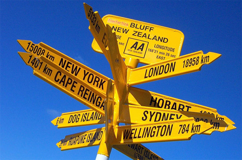
New Zealand consists of two long, narrow main islands and is approximately the size of California or England. One thousand miles in length, there is reportedly no place on either island farther than 75 miles from the ocean. Intending to ride the South Island first, Kaluzny boarded a ferry and started riding counter-clockwise around it. New Zealand has impressive mountains, but, as Kaluzny says, “Since I live in the mountains, I wanted to stay by the ocean.”

The North Island has 75 percent of the population and two of the country’s largest cities, Wellington and Auckland. The South Island has the other 25 percent of the population, with Christchurch as the largest city.

“The South Island is more beautiful. It’s much more agricultural, it’s sheep country, lots of rolling hills. Plus, I’ve never been to a place where you can be at a glacier that then runs down through the jungle to the ocean. There’s a jungle on either side of the glacier and the run-off goes to the ocean right there. Climatically I don’t think there’s any other place like that in the world.”

Kaluzny didn’t have a plan or itinerary.

“I would just wander, and I knew about some places I was curious to go to, because I had done some research. But for me it’s more the day to day experience of being in a place and seeing what happens. I’d run into motorcyclists all the time, and sit and have dinner if we were staying in the same hostel.”

One spot of particular interest was the town of Blackball. This mining town was the site of a big union struggle years ago and has a lot of history. The main hotel is an old Victorian building that is “a target for motorcyclists,” says Kaluzny. It was named the Blackball Hilton, but the international hotel chain sent them a cease and desist letter, so they changed the name to “Formerly the Blackball Hilton.”

“I pulled up and there were about a dozen motorcycles, and I immediately sat down and started talking with the riders. With motorcyclists, unless they’re a bunch of Harley guys, in general, you’re all immediately companions of the road.”

On another day, in a tiny town whose name he doesn’t remember, Kaluzny was sitting having coffee and he looked out the window and saw a couple walking around the GS and talking about it. “I go out and I say hi and they start talking to me and I realize it’s the couple he (the dealer in Wellington) was talking about. So they invited me to come and stay with them.”

That openness and friendliness is part of what Kaluzny loves about New Zealand.

“The people are tremendously friendly, but there’s enough British reserve so it’s not like you’re always being bugged by somebody. It’s like America in the ’60s, just rip out the Vietnam war. Most stories from travel, for me at least, are either really terrible meals or really weird people, or experiences that could have been dreadful but turn out OK. I don’t have any like that from New Zealand.”

What he does have are stories of touching encounters. In a small town one day, getting ready to ride after having lunch, “I’m putting my helmet on and a little old lady comes up, a very elegant little old lady, and she says, ‘Just touring are we?’ And I said yes, that’s right, and she said ‘Well, how do you like our country?’ I went into my 5-minute spiel about how beautiful it was, how friendly the people were, how much I enjoyed the food, why I love New Zealand, and she listens and she says ‘Yes, we think so too.’ I smiled for the next 20 kilometers.”

Not All Smiles
There was one New Zealander, however, who Kaluzny would rather not have encountered.

“New Zealand has the world’s only alpine parrot. They are profoundly destructive. They’ll rip up tents, they chew boots, they love rubber and fabrics like that. I come out in the morning and some parrot has feasted on my seat.”

It wasn’t as if he hadn’t been warned. There were signs in the parking lot to “Be aware the kea is here.” But what American would suspect a bird twice the size of a pigeon would do such damage?

One subtle danger for Kaluzny was the lack of traffic on the highways. It was common to be riding a major highway and not see another vehicle for minutes at a time.

“We (motorcyclists) are so used to being hypervigilant, then suddenly, when you’re in the middle of nowhere, you stop some of the hypervigilance after awhile. And of course that’s always dangerous. I’d have to tap myself on the helmet and say, Zigy, there’s a car out there somewhere, pay attention.”

An annoyance was the ubiquitous sand flies, little gnat-sized critters.

“They are everywhere. If I would stop along the road and want to take a nap I’d have to keep my helmet on. You can’t camp out without being in a tent.”

Nearing the End
After circling the South Island Kaluzny took the ferry back to the North Island, to Wellington, and headed counter-clockwise around it. At one small town of about two blocks, Onga-Onga, “I liked it so much, and it was getting late, so I wanted to stay there where it was totally quiet.” There were no hostels, and a local tried unsuccessfully to find him a place to camp, so he rolled on.

Then, on the very last day he was stopped along a beach and a car pulled up. Two people got out, a Maori (native) woman and her daughter. As they talked, she asked Kaluzny about disappointments. He replied that he had not gotten to attend a Maori hangi, a tribal feast.

Taking a pen and paper, she wrote and handed him the paper, saying, “Here’s my name, my phone number, and my email. Next time you come back over call me and we’ll invite you over for one.”

“I was really touched by that,” he says. “It still gives me goose bumps, it was just generous.”

And so typically New Zealand.

Biker Quote for Today

If you see me in your rear view on one wheel . . . stay in your $#@% lane! (OK, I do have problems with this quote but it was interesting so I figured I’d use it.)

Recovery To Ride And ‘Two Wheels Through Terror’

Thursday, May 3rd, 2018

I was still in the hospital after my heart surgery and Bill came to see me. He figured I had a lot of time to read and brought me a copy of Two Wheels Through Terror. This is a book that tells the 2001-2002 motorcycle journey of the author, Glen Heggstad, down through Central America and South America. The big problem was that in Colombia he was kidnapped by guerillas and held for a month.

book by Glen Heggstad

Two Wheels Through Terror

Bill was really wrong about me having a lot of time to read in the hospital because for the most part I didn’t have the strength and spent most of my time sleeping. But almost six weeks out of the hospital I have picked it up and started reading it. Oh my god, what a story! And this guy Heggstad is one tough guy.

During his month with the guerillas he was force-marched long distances over steep mountains while being almost starved to death. Then as part of his strategy to get released he took to starving himself deliberately, making the point to the bad guys that if they wanted any benefit from releasing this gringo they had better do so quickly while he was still alive.

He notes that, once safely with the Red Cross, he was brought a clean shirt. Normally he wears size XXL but this was a medium–and it fit perfectly. The guy went through some serious abuse.

Anyway, it really came home to me after he was released. Most people would have given up the trip and immediately flown home but Glen was determined to keep going, even though he needed a new motorcycle and all new gear. But first he had to recover. He had to battle back to the bike. Oh yeah, I can identify with this!

Here are a few of the things he said about his condition:

So physically weakened, it would take nearly a week just to be able to walk a city block without passing out, and several more just to build up the strength to balance a motorcycle.

Oh, yeah, I know. I was two weeks after surgery before I could go out and walk part of the way up the block and back.

Add to that, time with the ELN has left me weakened mentally and physically. After a brief trip to a local gym, I found myself too weak to bench-press an empty bar.

The good thing for me is that all along I have had the total support and never-fading smile of my saintly wife, Judy. Glen had guerillas deliberately trying to break him mentally. But that bit about pressing the empty bar: I started out doing curls with one-pound weights and was tired after a set with those.

The long miserable wait has ended. After pumping up the tires, I blast down the road for a two-hour, get-to-know-my-new-friend ride into the countryside, complete with rain in the darkness on the way back. Yet even the foul weather is a welcome relief as I’m just happy to be back in the wind under any circumstance. It’s as though life flows back into me again, while the excitement of being on the road permeates my being.

OK, this is what I’m still waiting for. It’ll be about another month.

Biker Quote for Today

Forget a knight in shining armor, I’ll take a biker in dirty leathers any day.

Finding Riding Trails In Colorado

Thursday, January 25th, 2018
www.trailtaker.com

The TrailTaker site could be a good tool to spark riding ideas.

I owe Mark Odette on this one. He sent me an email way back in September and I forgot about it, but was digging through old emails today and ran across it.

For those of us who like to get off the paved roads (I include myself generously; since getting my V-Strom I haven’t been off the pavement nearly as much as I wish I had), one topic of interest is where to go to do so. Sure, there are gravel roads all over, but which of them are worth riding, and pack the best bang for your time buck?

Maybe you should check out www.trailtaker.com. Click on that link and go to their trails map and then click on one of the markers. That enlarges the map to show an area of the state and if you give it some time the map starts filling in with all kinds of trails.

For instance, I clicked on an area that runs from Lake George on the east to Aspen on the west and Alma on the north to Salida on the south. There are more trails than I can count, colored red, green, and blue. Red is advanced, blue is intermediate, and green is beginner. The legend also shows grey as unknown and black as expert but I don’t see any of those here.

And what are these trails? Well, I clicked on one that runs off US 285 toward the Collegiate Peaks. I’ve been down that road many times and looked at a road going off into the hills and wondered about it. I’m thinking this is that road. The site tells me this is Clear Creek and that it’s 9.18 miles long. It’s blue. Clicking on the “Trail Details” link it doesn’t actually give me that much more information, other than that it’s a gravel road suitable for a passenger car. And there is a link to download a GPS file (.GPX) of the trail. It also notes that the information is not verified because it has been imported from public date provided by the U.S. Forest Service. Many of these trails are like this.

Over to the east of Fairplay, near Tarryall Reservoir, there is the Packer Gulch trail (7.8 miles). Here the blue of the trail actually refers to being intermediate for 4×4 vehicles. For motorcycles it is rated unknown. It calls for high-clearance vehicles and the road is not maintained for passenger cars.

Let’s get to something a bit gnarlier. A little west of Buena Vista, with a southern terminus near Tincup, is the Timberline trail (30.3 miles). This is rated advanced for both motorcycles and ATVs and 4x4s are not permitted. This is listed as Trail Class TC4, Highly Developed. This appears to be a Forest Service designation meaning “high standard trail with significant structures, tread hardening possible.”

So you get the idea. Is that just a gravel road going off to nowhere or is it actually a trail? This site might be just the answer.

Biker Quote for Today

Why bikes are better than women: If your Motorcycle is misaligned, you don’t have to discuss politics to correct it.

Getting Off The Pavement

Monday, October 2nd, 2017
motorcycles on gravel

John’s driveway.

Some motorcycles are built to go off the paved road, even off any road at all. Generally, these have knobby tires for getting a good grip and serious suspension that can take big bumps without complaining.

Then there are street bikes. As the name implies, these bikes work best when you keep them on the pavement. And the fact is, many street riders are loathe to take their bikes anywhere near gravel. You can slip and slide and bounce like crazy on that stuff. In addition, you kick up dust and the guy behind you gets to eat it. It’s not like being in a car where you can roll up the windows.

But consider this: According to the U.S. Department of Transportation, there are 1.4 million miles of unpaved roads in the U.S. It stands to reason that there are a lot of really nice places you might like to go on your motorcycle that aren’t paved.

So, if you’re like us in the OFMC, sometimes you go anyway. Our experiences have been mixed in this regard. I’m the only one with anything close to an adventure bike, a 650 V-Strom, and everyone else just has street bikes. I have mentioned in the past (not any time recently) how some of our guys took a dirt road outside of Taos down to a hot spring. There wasn’t much to the spring and the road was very rough, with the result that Jason’s bike snapped an electrical connection and he had to make a quick stop at a dealership to get it fixed.

Another time, in the early days of the OFMC, John proposed that we take the road from Phippsburg, CO, over Ripple Creek Pass to Meeker. He had looked at the map and figured there were about 10 miles of it that were unpaved. We could handle that, couldn’t we?

Well, of course we said we could, only it turned out that there were about 40 miles of gravel, not 10. And it wasn’t smooth gravel, either, as is sometimes the case. No, there was a lot of washboard and we bounced and banged our way over this road for what seemed like a long, long time. John even managed to drop his at-that-time brand new Honda Shadow in some deep sand along the way. My luggage rack was shaken so badly that it broke in two places and I had to stop at a welding shop in Salt Lake City to get it fixed.

Later that same day, Bill turned off on a dirt road by a lake we were passing, which quickly turned deeply rutted, and John dropped the Shadow again.

With that day clear in our memories, it was something of a surprise a few years later when John suggested that he show us the Trough Road, another gravel road that runs from Kremmling, CO, over to State Bridge. He had been on it recently, he assured us, and it was smooth and hard packed. It was in fact every bit as nice as he said it was and a beautiful ride to boot that Bill and I had never been on. We’ve all ridden it at least a couple times since then, and I’ve been on it more than that.

So as much as John, especially, dislikes gravel roads, here’s the supreme irony. The worst stretch of gravel I’ve ever been on is John’s driveway. His driveway is a tenth of a mile of loose, unpacked, large stone. On top of that, it’s about 5 miles of better gravel from the main road to his driveway. More than one OFMC rider has biffed it going to or from his house.

We’ll all agree to ride gravel sometimes, but let’s just say we don’t make John’s house a frequent gathering spot.

Biker Quote for Today

Why bikes are better than women: Your motorcycle doesn’t get mad when you ignore it for a month or so.

Idaho BDR Keeps Going and Going

Monday, March 21st, 2016

You’re going to have to be a serious, serious off-road, adventure bike type of rider if you intend to do the Idaho Backcountry Discovery Route, as laid out on the Butler Maps map of that name. Not because it is so tough, but because it goes a long, long way. Not just from the bottom of Idaho to the top, but also because it takes a side-trip into Montana. I assume that is because that allows you to see some great parts of the state but also because there may not be any roads straight through–unless you want to do 50 miles of pavement. That would kind of defeat the whole BDR concept.

cover of Idaho BDR map

The Idaho Backcountry Discovery Route map from Butler.

The route starts at Jarbridge, Nevada, and heads north through dry desert prairie, which Idaho has a lot of in the south. Once you get past I-84 you get to the mountains and that’s where the fun begins. Plan on just running north through the hills for, oh, 700 miles. Now, how can that be? What I see tells me Idaho is only 479 miles from north to south. I’m thinking that’s the difference between going in a straight line and following the contours of the land. A lot of traversing up and down will do that for you.

When you reach the Clearwater River, a little outside of Grangeville, the route turns east and runs through the area of the Frank Church Wilderness. That’s about another 100 miles. Then you’re into Montana and have a lot of highway to get north to Lolo. There’s more pavement here than there would have been staying in Idaho so I’m guessing the route was determined based on not wanting to miss some great country. You came to ride, didn’t you?

From Lolo you go up over Lolo Pass on the pavement but on the other side you leave the highway and get back into the dirt. And a lot more mountains until you get to Pierce, where the road turns north again. And then it’s hills and more hills until you finally get near Canada, where the dirt options are limited. And if you do the entire thing, Butler says you’ll be covering a total of 1,253 miles. I said you had to be serious to do this whole thing.

It’s not all riding in the mountains, though. The map points out a lot interesting places to go and sites to visit along the way. There are hot springs, viewpoints, historical sites, waterfalls, and more.

Let’s face it: there probably aren’t many people who are going to do this whole ride end to end. So pick a section and do that. I’ve been up in that country and I can tell you, I’d be glad to take a couple weeks just enjoying the riding. And the sitting. And the camping. Idaho is an incredible place. If you haven’t been there you’re missing something. Go find out what.

Biker Quote for Today

Life without pleasurable pursuits is hardly worth living, and while the best things may be free, some pretty excellent ones cost money and have wheels. — Paul D’Orleans