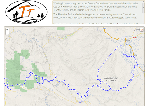
The TrailTaker site could be a good tool to spark riding ideas.
I owe Mark Odette on this one. He sent me an email way back in September and I forgot about it, but was digging through old emails today and ran across it.
For those of us who like to get off the paved roads (I include myself generously; since getting my V-Strom I haven’t been off the pavement nearly as much as I wish I had), one topic of interest is where to go to do so. Sure, there are gravel roads all over, but which of them are worth riding, and pack the best bang for your time buck?
Maybe you should check out www.trailtaker.com. Click on that link and go to their trails map and then click on one of the markers. That enlarges the map to show an area of the state and if you give it some time the map starts filling in with all kinds of trails.
For instance, I clicked on an area that runs from Lake George on the east to Aspen on the west and Alma on the north to Salida on the south. There are more trails than I can count, colored red, green, and blue. Red is advanced, blue is intermediate, and green is beginner. The legend also shows grey as unknown and black as expert but I don’t see any of those here.
And what are these trails? Well, I clicked on one that runs off US 285 toward the Collegiate Peaks. I’ve been down that road many times and looked at a road going off into the hills and wondered about it. I’m thinking this is that road. The site tells me this is Clear Creek and that it’s 9.18 miles long. It’s blue. Clicking on the “Trail Details” link it doesn’t actually give me that much more information, other than that it’s a gravel road suitable for a passenger car. And there is a link to download a GPS file (.GPX) of the trail. It also notes that the information is not verified because it has been imported from public date provided by the U.S. Forest Service. Many of these trails are like this.
Over to the east of Fairplay, near Tarryall Reservoir, there is the Packer Gulch trail (7.8 miles). Here the blue of the trail actually refers to being intermediate for 4×4 vehicles. For motorcycles it is rated unknown. It calls for high-clearance vehicles and the road is not maintained for passenger cars.
Let’s get to something a bit gnarlier. A little west of Buena Vista, with a southern terminus near Tincup, is the Timberline trail (30.3 miles). This is rated advanced for both motorcycles and ATVs and 4x4s are not permitted. This is listed as Trail Class TC4, Highly Developed. This appears to be a Forest Service designation meaning “high standard trail with significant structures, tread hardening possible.”
So you get the idea. Is that just a gravel road going off to nowhere or is it actually a trail? This site might be just the answer.
Biker Quote for Today
Why bikes are better than women: If your Motorcycle is misaligned, you don’t have to discuss politics to correct it.
Tags: trails for motorcycles