Colorado Backcountry Discovery Route Is On The Map
Thursday, February 7th, 2013I eagerly unfolded my copy of the Colorado Backcountry Discovery Route map, from Butler Maps. What roads would it take, which ones have I been on, and which ones might I realistically consider riding at some point?
To refresh your memory, the Backcountry Discovery Route series is sponsored by Touratech, makers of adventure motorcycling gear. What these guys do is go out and develop a route that crosses an entire state, generally north to south, and then they make the GPS logs available for free. Butler Maps has partnered with Touratech on this, producing maps of the routes.
And what do you know, I actually have ridden parts of this route.
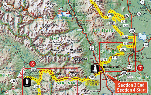
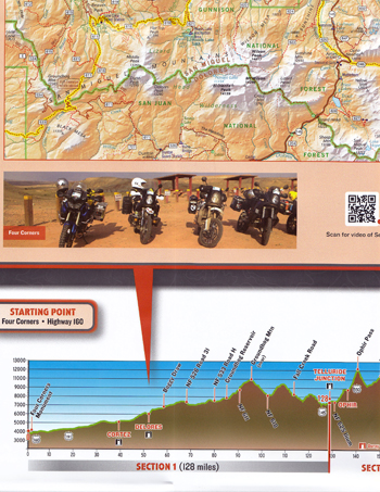
Of course part of it was easy. The route starts at Four Corners and comes up through Cortez and up to Dolores on paved roads. I’ve done all that. Then it gets off on the more gnarly stuff. The route parallels CO 145 along over Lizard Head Pass, taking the west side of the San Miguel Mountains and the lizard head, up to where CO 145 has now passed Telluride. Dropping back south of Telluride almost to Lizard Head Pass, it leaves the paved road again through Ophir and over Ophir Pass to connect to US 550 a little north of Silverton. Jogging north, it then crosses Cinnamon Pass over to Lake City (ridden that one) and then heads up Slumgullion Pass before getting off on the dirt again all the way to Cochetopa Pass, south of Gunnison, and on to meet up with US 50 east of Gunnison at Doyleville.I’m not going to describe the entire route. In brief it goes something like this: Tin Cup, Taylor Reservoir, Cottonwood Pass (ridden that), Buena Vista, Weston Pass (been there), Leadville, Hagerman Pass, Crooked Creek Pass (been there), Gypsum, Colorado River Road (ridden that), State Bridge, the Trough Road (ridden that one), Lynx Pass, Steamboat Springs, Columbine (been there on the bike), and on to the Wyoming state line at Battle Creek.
The route is broken up into sections and gas stops are indicated on the map. That’s pretty handy when you’re going off the pavement and don’t run into a lot of stations, I’m sure. Alternate routes are pointed out that are a little easier (or possibly simply passable when things get wet), and nice sidetrips to places such as hot springs are pointed out. Lodging is pointed out.
Altogether this route covers 675 miles. As the map states, “It is intended for intermediate to advanced riders and can be ridden on most street legal dual-sport and adventure motorcycles.”
Hey, if you’re looking for some adventure riding, this is Colorado, after all. Go ride!
Recent from National Motorcycle Examiner
Lojack announces top five motorcycle recoveries for 2012
Biker Quote for Today
It’s not how fast you’re going, its about how fast your fast comes to a stop.


