Posts Tagged ‘Peak to Peak Highway’

RMMRC Fall Color Ride

Thursday, October 27th, 2022

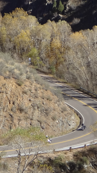
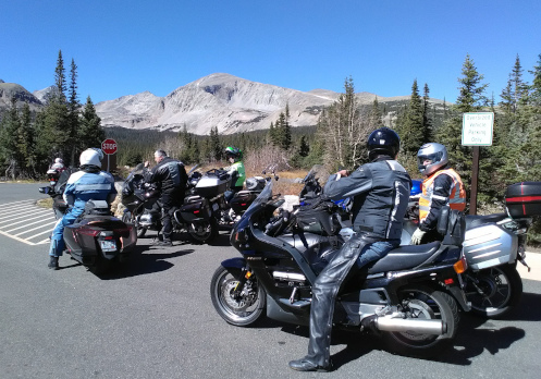
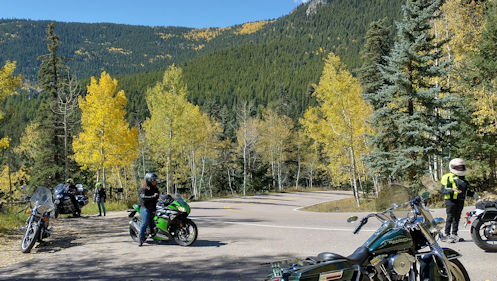
Ralf picked a nice spot going up Witter Gulch Road to pull over and shoot some photos.

Kudos to Ralf for laying out a really nice route. On the Sunday before Columbus Day a group of RMMRC riders went up in the hills to take advantage of a perfect fall day. Ralf not only picked a good route, he included one road that perhaps none of the rest of us had ever been on. I always love that.

We met out by C-470 and Ken Caryl Avenue and headed out under the highway and then around on Valley Road to reach Deer Creek Canyon. We ran up Deer Creek to where it ends at South Turkey Creek Road and went left, following that road around to where it meets US 285 at Conifer. We quickly got off 285 at Barkley Road to reach CR73, which runs north from Conifer to Evergreen.

I was hoping Ralf was planning to jog right/left and get onto Shadow Mountain Drive and take that nice route and he did. Shadow Mountain becomes Brook Forest Road and rejoins CR73 just south of Evergreen but Ralf had other ideas in mind. About halfway along Brook Forest we turned right onto Blue Creek Road and this was a new one for me and probably most or all of the others. Cool. I love being introduced to new roads.

Blue Creek ended up leading us back to CR73 just a little south of the Marshdale area where we headed east on North Turkey Creek Road, back to and under US 285 and onto South Turkey Creek Road not far from where we had hit it previously. This time we went north, past Tiny Town, and again met up with 285. Ralf pulled over.

The thing we needed to know here, he told us, was that we needed to get on 285 just for a moment and then turn left up Parmalee Gulch. So wait for a break in traffic and then immediately get to the left lane and prepare to turn. That was a good thing to make sure everyone understood.

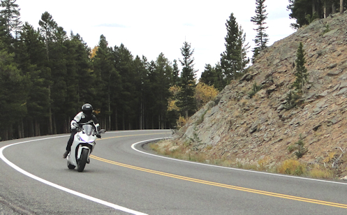
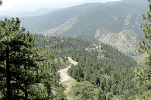
So we headed up Parmalee Gulch, up and over to Kittredge, and then caught Bear Creek Road up to Evergreen. We went through the main town area and turned to go past the lake and then on up Upper Bear Creek Road past all the swanky homes to Witter Gulch Road. This is a favorite as it climbs steeply and is full of tight turns, leading up to where it meets the Squaw Pass Road.

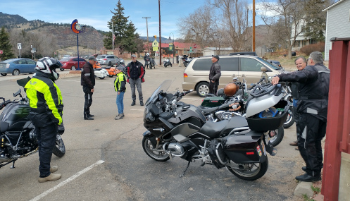
At the Squaw Pass Road we turned west, over the pass and down past Echo Lake and eventually down to Idaho Springs. Time for lunch. Past time for lunch. We ate at Smokin’ Yards BBQ, which was a good place. New for me.

At lunch we talked intentions. Ralf had figured to take I-70 the short distance down to the Central City Parkway and then down to Black Hawk and over on the Peak-to-Peak Highway to go down Golden Gate Canyon. But one couple said they were just going to jump on I-70 and blast home, and I said I figured to get on old US 40 and take it back down. Then the other two women in the group, who had found they both live in Aurora, agreed they would head home together, which left only Ralf and Bruce to go the rest of the way on Ralf’s route.

That’s fine. We all had a good ride and a good day. See you all next time.

Biker Quote for Today

Petrol Sexual: Suck, squish, bang, blow.

Escaping The Heat

Thursday, July 28th, 2022

A rider on Squaw Pass.

When the temperatures are consistently in the high 90s there is one thing you can do to escape: take a motorcycle ride in the mountains. We did.

The Rocky Mountain Motorcycle Riders Club (RMMRC) tries to have rides going on nearly every week. The week before we did the Peak-to-Peak and the canyons running down from it. This time we overlapped that route but tended more to the south.

Six of us met in Golden and headed up Golden Gate Canyon. The temps heading up weren’t cool but it sure wasn’t 95 either. One note, there is a stretch with quite a bit of sand on the road. Be careful.

We reached the Peak-to-Peak and headed south to Black Hawk, then turned up toward Central City. We passed through Central City and took Central City Parkway over to I-70. Now it was pretty darn comfortable.

At I-70 we hopped over to Idaho Springs where we stopped for lunch. The place we were heading for was no longer in business so we went downtown. The place we had in mind there had no indoor seating but had one big table with a big umbrella outside. The heat outside would have been intolerable but the umbrella made all the difference. A couple thousand feet of elevation helped a lot, too.

From Idaho Springs we headed up and over Squaw Pass. Now we got some real elevation and some cloud cover, too. Nice.

The Squaw Pass road is one of those that separates the aggressive riders from the not-so-much guys. It has a lot of twists and turns and a lot of very tight turns, often posted at 15 or 20 mph. I was perfectly having them blast ahead just as fast as they liked. I’m in no hurry.

Back down to Evergreen Parkway and a right toward Evergreen, and then we skirted around the town via Meadow Drive. If you aren’t familiar with avoiding downtown by using Meadow Drive you ought to look it up. I can’t believe I went so many years and never knew about it.

Then we headed down to Kittredge but turned up Myers Gulch Road, which becomes Parmalee Gulch Road, bringing us out onto US 285. That just allowed us to stay in the hills a little bit longer.

And then we came down out of the hills expecting to get hit by a blast of heat but instead, as soon as we rolled out onto the flatlands we hit a rain shower. Not enough to get soaked, just enough to cool things off. I was on the Concours, which has a great fairing, so I hardly got wet at all. And the rain kept up until we got nearly to Federal. From there it was just a short cruise the rest of the way home and what little wet I had picked up just had time to evaporate–read: cool me off–by the time I was home.

I love it when everything goes in your favor.

Biker Quote for Today

The joy of riding a motorcycle is out of this world. The thrill of riding in the hills and mountains is an opiatic addiction.

The Coldest Warm Day To Ride

Monday, March 28th, 2022

The RMMRC preparing to leave Smokin’ Dave’s.

The forecast for Sunday had called for highs in the 70s so we were all a bit surprised to find the temperature in the low 40s as we geared up and headed out. Nevertheless, a big group, about 18 or 19 of us, gathered in Morrison for an RMMRC ride up to Lyons for lunch at Smokin’ Dave’s BBQ.

The gas station was a busy place. There were two other motorcycle groups meeting up there as well as a scooter group and a group of Mini Cooper owners. Presumably the gas station gets a fair amount of business from all this because the bunch of us took up nearly every parking place available.

The plan was to take side roads to avoid Boulder itself and then to come back via the Peak-to-Peak Highway. Presumably it was going to be a warm day.

In what was a nearly unimaginable feat, we made it all the way up to Lyons without getting broken into smaller bunches. We started out running up to Golden on C-470 and took CO 93 north over Rocky Flats. Coming down toward Boulder there was low-lying smoke all around thanks to the grass fire burning up near NCAR. But we didn’t really even smell smoke, at least I didn’t.

We skirted around Boulder to the east on Cherryvale Road and worked our way north to Niwot, then turned west on Niwot Road to where it meets up with 93 just south of Lyons. It was only at this point that we got a bit separated, and that was due to a few cars getting intermingled with us. We weren’t really separated, they just joined the group.

I was wearing my electric vest and darn glad of it, but my hands were pretty cold. We got to Smokin’ Dave’s and other people commented about how their hands were numb. Where’s that 70 degrees we’d been promised?

Lunch was good. I’m getting to like Smokin’ Dave’s more and more. And during lunch we discussed the question, do we really want to go higher, to the Peak-to-Peak when it’s this cool down lower. The general feeling seemed against it, plus, the South St. Vrain road that is the most direct way to the Peak-to-Peak continues to be closed. But a check on the weather showed that it was apparently warmer up in Ward than down where we were. Maybe the smoke was blocking the warming sun and the Peak-to-Peak is above the smoke.

Whatever the case, as we were getting ready to leave it was decided to run back down 93 and take Left Hand Canyon up to Ward and the Peak-to-Peak.

This was where I decided to go my own way. We’d been out for a pretty good while and I was more interested in just heading home so I stayed on 93. Going through Boulder with a large group would have been crazy but just a lone rider had no problem. Back down 93 to Morrison and then east on US 285 and home. A good day’s ride.

And then later in the day it really did warm up. Finally.

Biker Quote for Today

We know you’re a poser if you spit out the bug that just flew in your mouth.

Gotta Love This December Riding

Monday, December 6th, 2021

We were riding up on the Peak-to-Peak Saturday. Think about that. It was December 4 and we were up in the hills. That tells you everything you need to know about the weather we’ve had so far in this late fall. Generally by this time of year those roads are either icy or treacherous with sand and gravel.

Not that there was no sand–we encountered a fair bit of that coming down through Golden Gate Canyon. But that was the only sand we ever saw and there was no ice at all. How could there by ice? The day-time highs have continued to be in the 60s.

  Bikes on CO 46 through Golden Gate Canyon.

The only thing that surprised me when I received the notice of the ride, an RMMRC ride, was that it hadn’t come sooner. You can’t have this kind of great weather and not have rides getting planned.

There were nine of us who took off from a 7-Eleven in Golden. We headed north on CO 93 toward Boulder but then skirted around the city to the east, following Marshall Drive to Cherryvale Road and north, then Baseline Road further east to 75th St. and north on 75th to Niwot. Then Niwot Road and Neva Road took us west to US 36, which took us north to Lyons. Time for lunch.

After lunch we tried to go up South St. Vrain Drive (CO 7) to the Peak-to-Peak but it was closed for construction. So we headed back south on US 36 to Lefthand Canyon Drive. That road brought us to the Peak-to-Peak at Ward.

It had been warm down in front of the foothills but now up higher I was very glad to have my electric vest. I had dressed warmly because I didn’t trust it would be warm the whole ride and that was a good thing on my part.

We headed south on the Peak-to-Peak, through Nederland, and on to CO 46, down Golden Gate Canyon. This was where we encountered the only sand of the whole ride. Most of the time it was right in the middle of our lane, although sometimes there would be two lines of it and you’d need to be careful to stay in between them. The worst was in a really tight turn but again, if you stayed in the track you were OK. So be advised if you head up that way. This is not the road that hot-shots on sport bikes should go blasting down any time soon.

Once we were back at CO 93 in Golden it was every man for himself and we scattered quickly. Great day for a ride.

Biker Quote for Today

Whenever I ride my motorcycle I always keep an excess of hay with me. I use hay to increase the horsepower of my bike!

Going Down (And Down And Down) Douglas Mountain Drive

Thursday, July 22nd, 2021

Looking down from up high on Douglas Mountain Drive.

I mentioned this road on Monday and promised more info right away, so here we are: Douglas Mountain Drive. I was jazzed enough by this road that I went out a couple days later and rode it again, this time with my regular camera and my GoPro camera.

As before, I headed up Golden Gate Canyon Road. It was a great day to be out riding, with a lot of heat in the city but much cooler up higher. Plus, there was not a bit of traffic in front or behind me so I could cruise at my own easy speed.

I reached the well-marked turn to the left to go up Robinson Road and made the turn. A sign warned of road work ahead and there was, but just minor shoulder work and the flag man flipped his sign to send me right on up. All clear after that.

The road does enough serious climbing that I figured I would need to ride it in the other direction some time. You go on up and over a crest and then, what a surprise, you’re in an alpine park that is a neighborhood. Who knew so many people lived up here?

On through the park and I came to a place where Robinson Road goes off to the right but the pavement goes to the left, now becoming Douglas Mountain Drive. A “Pavement Ends” sign could lead you to believe the pavement would end soon but that must apply to Robinson Road, up ahead, which goes to gravel immediately. If you’re not paying careful attention you won’t notice the change and wonder about the sign.

Douglas Mountain Drive continues on over a ridge and then you come to another “Pavement Ends” sign. This one is for this road but it really ought to read “Pavement Maintenance Ends.” I suspect the county decided to cease maintaining this road but it will be years before it totally degrades. Right now it is paved all the way, though in need of some repair. Not a problem, you just steer around the potholes.

And then it goes down. And down and down, at steep angles with hairpin curves. And great views. And look at all the houses built on the steep sides of the hills!

I stopped right where the two roads split and that’s when I turned on the GoPro. You can watch the video of the whole ride down to where it hits Colorado 119, the Peak-to-Peak Highway, just past where US 6 goes left to head to Idaho Springs. A nice ride.

I got to the bottom and didn’t really relish running down Clear Creek Canyon so I turned around and went right back up. That also gave me the opportunity to check out Centennial Cone Park, which is part of Jefferson County Open Space. The road to that branches off just a short ways up the hill. It looks like a very nice place but if you’re going to hike the whole loop it’s about 14 miles.

Then a nice ride down to Golden Gate Canyon Road and another cruise down the canyon with zero traffic in front or behind. And then into the heat of the city.

Biker Quote for Today

“I want to ride my motorcycle up the side of the Luxor to the light and vanish.” ? Criss Angel

Smokin’ Mama!

Thursday, October 1st, 2020
motorcyclists at Brainard Lake

Regrouping up at Brainard Lake.

Wednesday seemed like it would be a great day to ride, so Roy planned a fall color RMMRC ride up the Peak-to-Peak. As I headed out, though, going west on Hampden, I couldn’t even see the foothills. Either I was heading into a serious rainstorm or a ginormous cloud of smoke.

I assumed it was smoke from the forest fires, and counted on that because I did not have my rain gear with me. As I got further west I started smelling the smoke, so that question was answered.

As I approached C-470 I could see that the smoke was much much thicker to the north, where I still couldn’t see the foothills, versus the south where I could see the hills. Not good, considering that we were heading north.

When I got to the meeting place I immediately asked Roy if he had a Plan B. He said of course he did, but he apparently didn’t hear the “B” portion because he proceeded to detail the route originally set. That is, he definitely had a plan. Not a Plan B. I asked about the smoke but he didn’t think it was of any concern.

We headed up the Golden Gate Canyon road and I wondered if, as we got higher, the smoke would either clear or perhaps the wind would be blowing up there and chasing it away. In the meantime, it was killing my sinuses and I coughed constantly.

Up on the Peak-to-Peak it was better than down below but not good. But it wasn’t terrible. We headed north and whenever we came to places where we went down, such as coming into Rollinsville and Nederland, you could see the denser smoke in the lower areas and you could sure smell it as we came down.

Just past the turn-off to Ward we turned left to go up into Brainard Lake Recreation Area, our destination. I was a little surprised but the fact is I had never been there. It’s a really nice ride up to the lake and very pretty once you get up there. More importantly, we really seemed to finally shed the smoke as we climbed this little bit higher.

So we got up there and had the lunches we had brought and the sky was blue and sunny and it was beautiful. How nice. You couldn’t have asked for better. And the place was busy. Don’t all these people have jobs to go to? Apparently not. We didn’t.

Heading down it was startling how quickly we hit smoke again. We hadn’t even made it back to the ranger building where you pay your entry fee when it started looking and smelling smoky. And then by the time we were back down to the Peak-to-Peak we were right back in it.

From there we scattered. There are so many ways to get down from there. Some of us went down through Ward through Left Hand Canyon. Others headed for Coal Creek Canyon. Others, who knows?

Riding down Left Hand Canyon I realized I had only been this way a few times, not like the dozens or hundreds of times I’ve ridden the other canyons coming up to the Peak-to-Peak. It’s a nice ride and I realized I ought to be adding this canyon to my “The Peak-to-Peak Highway and Adjoining Canyons” page. Something else to add to my to-do list.

Biker Quote for Today

Top 10 signs that a computer is owned by a Harley rider: 02. — The keyboard is mounted at the level of the user’s chin and his seat tilts backward — ape-hanger keyboard!