What, No Maps?
I had a very odd experience this summer when the RMMRC took a ride down into Arizona and New Mexico in that for perhaps the first time in my motorcycling life I had no maps with me. I just forgot them, though how you do that I’m not sure. But I managed to, somehow.
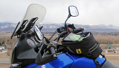
I have tank bags on all my bikes and typically I bring maps and have them in the map case on top so that I can refer to them at a glance at any time. Back when there were a lot more guys in the OFMC and John was usually the leader it was not at all unusual for several of them to have no idea which way we were going. They just got in the group and followed whoever was in front of them. John remarked at one point that the only person he trusted to know where they were going was me, because he knew I had a map in front of me at all times. And I generally rode sweep so the other guys could just play dumb and it didn’t matter.
So there I was with no map. It was weird. And uncomfortable. Sure, I would pull out my phone and call up Google Maps before the day’s ride and check out the route. But it’s not the same.
The time it mattered the most was the day we stopped for gas–and tried to get lunch, but didn’t–in Alpine, Arizona and there was confusion about which way we were going. First the group decided to go one way, then we had to wait because one guy was missing, and by the time he showed up a few guys a bit away from the rest of us decided to go a different direction and just took off that way. So the rest of us followed but I was distressed because I knew the way we had intended to go was really nice and I didn’t now anything about this alternate route except that it was a good bit longer.
Well, if I’d had a map in front of me, especially a Butler map, I would have seen that the road we did take was one of the best in Arizona. Heck, I probably would have been pushing that route as the clear best choice. If I’d had a map.
The other time it would have come in handy we were leaving Grants and needed to head west a bit so we could go north and then east. As it was, we went west on I-40 a good ways to Thoreau and went north from there. But before we got to Thoreau we pulled off at Milan to regroup. It turns out, we could have taken the road north out of Milan and gotten where we wanted to go and saved about 60 miles of flat, straight road. I think whoever planned this day’s ride used GPS and GPS does not always give you the best route. I would have seen it on the map and I would have pointed it out. If I’d had a map.
Then later that day we planned to go one route but the guy in the lead went a different way and I knew we had varied from the planned route but I had no idea where he was headed or where we would come out. Nothing would have changed by my knowing but at least I would have been able to see where we were, and where we were headed, and I like to know.
I don’t know about you, but I love maps. I hope I don’t ever forget mine again.
Biker Quote for Today
I do believe it’s time for another adventure.
Tags: Butler Maps, travel maps

