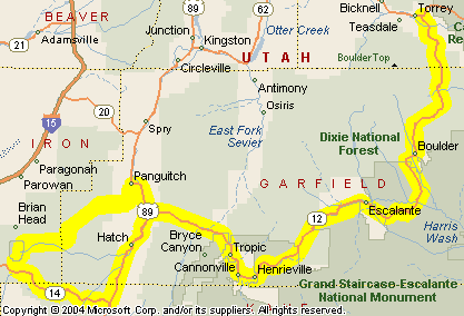
Recap: Steve and some buddies are coming from New Zealand in 2009 for some motorcycle touring in Colorado and Utah. This series of posts lays out their proposed routes, with my comments. Your comments are welcome as well.
Day 7
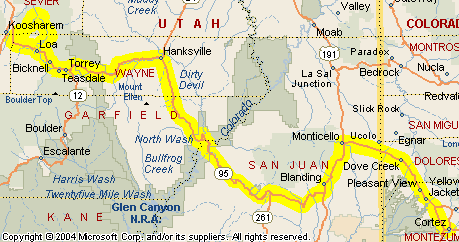
All right, in cruise ship terminology, today is a repositioning day. Our crew is in Torrey, UT, and needs to get back to Colorado. The destination is not totally certain as yet, our riders just know they want to be in a general area, set up for the next day’s ride. Within that general vicinity I would recommend Eagle, and that is how I’ve set up the map. As always, click to view the map in larger format.
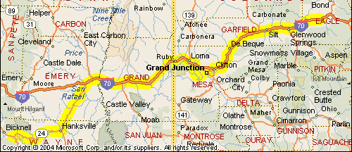
They’ll be leaving Torrey and heading east on UT 24, which turns north at Hanksville and hits I-70 a bit west of Green River. Again, I’ve been on this road but my recollection is not clear so I can’t tell you much about it.
Their plan is to stay on I-70 all the way into Colorado. This is wide open territory and they’ll blast along.
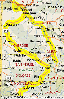
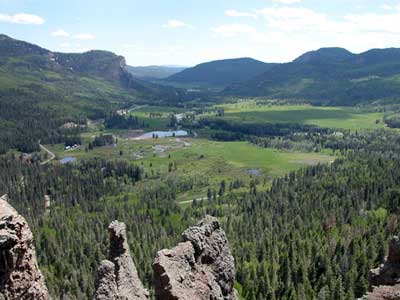
Once they enter Colorado it’s only a short ride to Fruita, where they will turn off for a cruise through Colorado National Monument on Rim Rock Drive. You may recall that Rim Rock Drive was on the agenda for Day 4 of this trip, but Steve tells me he likes my idea of doing it on Day 7 instead, so the switch has been made. Here’s what the National Park Service has to say about the Monument:
Colorado National Monument preserves one of the grand landscapes of the American West. Sheer-walled canyons, towering monoliths, colorful formations, desert bighorn sheep, soaring eagles, and a spectacular road reflect the environment and history of the plateau-and-canyon country.
Coming out of the Monument at the east end, they’ll come into Grand Junction, where they’ll probably want to pick up Business 70 to reconnect with I-70 on the east side of town. Then it’s back on the superslab. This superslab gets interesting, though, pretty soon. Exiting the Grand Valley it twists up into Debeque Canyon, and here you see again how, compared to other states, even the interstate through much of Colorado is darn scenic. Here, it runs alongside the river, through winding canyons, occasionally coming out into wider valleys, but there are always mountains on either side of you.
The road opens out as you get to Rifle. Along this stretch you’ll notice something very interesting. If you’re traveling at night it looks like there are fully lighted Christmas trees dotting the hillsides all over. During the day you can see that these are in fact drilling rigs. And they’re everywhere. High energy prices have driven oil and gas exploration like never before. This particularly matters to all travelers because the intrastructure has not kept pace with the population. Do NOT come to the Rifle area expecting to just find a motel room for the night. There are none available. The drillers are living in them. You’ll probably be lucky if you can even reserve one in advance. Plan to stay either in Grand Junction or in Glenwood Springs.
Glenwood Springs is definitely worth a look if you’re not spending the night there. Get off the highway and cross the river to the heart of town. This is a good place to stop for food and drink.
Then it gets gorgeous. Going east from Glenwood Springs you enter Glenwood Canyon. Excuse the superlatives, but this is probably the most beautiful section of interstate anywhere in this country. It was the very last piece of the original interstate system to be completed because the preservationists fought tooth and nail to keep it out altogether. Their resistance forced the government to preserve the canyon as much as possible and we all are beneficiaries of that. Take your time cruising through, and make a point to stop where it’s permitted.
Once you’re out of the canyon it’s just a short ride to Eagle. This is a good place to end this day’s ride.