Archive for the ‘motorcycle touring’ Category

Ride Planning

Thursday, October 6th, 2016
motorcycles on the road

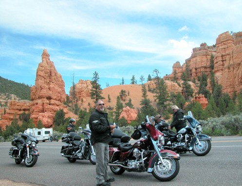
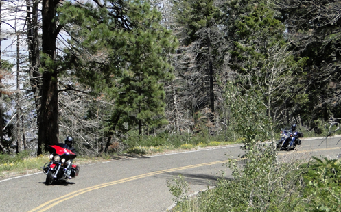
Some trips really do require planning. Others you just get on the bike and go.

At my second meeting tonight of the the Rocky Mountain Motorcycle Riders Club (RMMRC) the discussion was about ride planning and the rides the group has planned for next year. This is a group that does some serious rides but sometimes they get even more serious.

Specifically, the word is that Roy, the group’s safety coordinator, has a professional background in tour planning and he is organizing a 35-day ride to Nova Scotia. Ooooh my goodness! I could do that. Of course there are all kinds of considerations.

Several of the folks were very clear that, hey, they’re not retired, and there is no way they can take that kind of time. Nevertheless, Sean and Sara plan to go; he’ll trailer the bike to Ontario so as to make good time and she’ll fly out and meet him, and then fly home. And other people have similar ideas to take part in at least some of that ride.

Someone else mentioned how a trip like that could be very costly. By the time you figure motels, food, and gas–not to mention any other incidental expenses–this will not be inexpensive. I mean, motels alone, if you figure sharing a room and each paying $50 per night, would be $1,750. Costs will vary depending on how high your standards are for accommodations. Mine are fairly low; I would prefer to do something like that and spend most nights camping. Then you might get down to around $600-$700 for accommodations, figuring at least a few nights in motels.

So we’ll see. The idea of doing something like that is very tempting but this sort of thing may be the true test for me as to what sort of involvement I’m going to have with this group. Spending 35 days with a possibly sizeable group in a fairly structured situation may not be what I’m up for. Now, if I could get several of these guys together to do a less formal four person ride or something like that, that would really get my attention. Especially if they like to camp, too.

But I’m not ruling anything out just yet. I’ll play it all by ear.

So because ride planning was the topic of discussion, Sara went over a slide presentation about the elements to consider if you are interested in planning a ride for the group. Or for any group. The RMMRC has a page on their website with some good info on ride planning. The presentation she used can be found there. Considerations such as, is this a day trip or a multi-day trip? Is the destination what’s important or is the ride itself the most important? (Heck, it’s always the ride, isn’t it?)

And of course, food. Noting that for her, food is always one of the very most important parts of the ride, she said she’s planning a food-day ride for next year. I’ll be interested to learn more about that one.

In the meantime, I’ll be joining the group on a ride for the first time on Saturday. More about that after it happens.

Biker Quote for Today

And then God said “Let there be beautiful, passionate, irresistable, crazy women who take no crap.” So he created biker chicks.

Examiner Resurrection: Touring Utah Canyon Country On Motorcycle

Thursday, September 29th, 2016

This is another Examiner.com resurrection, dating from June 2009.

motorcyclists at Red Canyon in Utah

Riders taking a break at Red Canyon.

“Spectacular” is the word to describe the canyon country of southern Utah, and the best of it is completely accessible on a motorcycle. And no, I’m not talking dual sport. I mean Harley/Honda luxotourers.

Get here via whatever route suits you, we’re just going to cover Utah 12 and Utah 63, which goes down into Bryce Canyon National Park.

Heading east from the junction with U.S. 89, Utah 12 very quickly enters Red Canyon. Here you get just an inkling of what you’ll find at Bryce Canyon, but Red Canyon is incredibly beautiful all on its own.

Continue east until you reach the turn-off for Utah 63, which heads south a few miles before entering the national park. There are a couple motels just north of the park and they have restaurants that are open until 10 p.m. If you’re the camping sort, there are campgrounds inside the park, and back at Red Canyon as well.

The entrance fee for the park is $12 for motorcycles, unless you’re a grey-hair and have your Golden Age Pass.

We found the best thing to do was to run all the way to the end of the road without stopping and then make all your stops on the way back north. The reason is, all the view areas are on the east side and this lets you avoid pulling in and out across oncoming traffic. Of course, the entire road through the park is well-maintained asphalt.

Taking this approach, your first stop will be Rainbow Point. The view, on a clear day, is more than 100 miles. You’re at a towering height and it’s like the whole world is laid out at your feet.

Working your way back to the north, there are small, unnamed view areas and bigger, named view areas. Not surprisingly, the views are more spectacular at the named spots. That’s not to say the smaller spots are not worth stopping at.

The further north you get the most the view becomes one of towering, multi-colored hoodoos, as they’re called. These are the pinnacles that stand tall as the areas around them erode away. Not a true canyon, Bryce Canyon has been formed primarily by water seeping into cracks in the rock, freezing, and forcing the crack wider and wider, while the chips that break off get washed away.

Finally, back near the north end of the park, is the ring of view areas named Sunset, Sunrise, Inspiration, and Bryce Points. This is the best spot to get off the bikes and actually hike down into the canyon. The shortest loop, six-tenths of a mile, is Navajo Trail Loop. For a bit longer hike, take the Queen’s Garden trail from Sunset Point over to Sunrise Point, about 1.6 miles. There’s a lot of down and then a lot of up, so be sure to wear decent walking shoes and carry water. Don’t be surprised if it rains a bit while you’re walking, but usually the coolness and wet is welcome.

Then you’re on your way again. Panguitch, about 7 miles north of Utah 12 on U.S. 89 is a nice place to stop for the night, with numerous attractive motels, a grocery store, gas stations, and restaurants.

Enjoy the ride, but enjoy the stops, too.

Biker Quote for Today

I love to ride. I hate to arrive.

Examiner Resurrection: A Terrific Motorcycle Sidetrip In Southwestern Utah

Monday, September 26th, 2016

For eight years I was a writer for Examiner.com–the National Motorcycle Examiner, if you will–and in that time I published somewhere in the neighborhood of 1,000 articles. That relationship ended about a year ago, so it was only a few days ago that I learned Examiner had shut down in July 2016, taking down all the many thousands (millions?) of articles done by many, many writers.

While a lot of my articles were timely and republishing them now would be useless, in my own opinion at least, some of the work I did was very good, remains relevant, and deserves to be resurrected. I had already been republishing some of the very earliest stuff because advances in technology had rendered some early work technologically incompatible, and it had been dropped. Now that list of potential resurrections has grown enormously.

A terrific motorcycle sidetrip in southwestern Utah

OK, you’re riding from California or Las Vegas, trying to make good time and cover a lot of ground, on your way somewhere east. You’re staying mostly on the interstate, but passing through southern Utah you hate passing all this beautiful terrain, and you need a quick fix of twisty roads. Do I have a treat for you!

13 percent grade ahead

  Fun riding just ahead!

Cedar City is where you want to get off the superslab. Get onto Utah 14 and head east and you soon find yourself climbing through gorgeous canyons and winding and twisting to your heart’s content. Enjoy.

After about 18 miles or so you’ll want to catch Utah 148 going north. If you liked what you’ve seen so far, you’re in for an even better treat. This road winds through Cedar Breaks National Monument and the numerous view areas are all worth stopping for. The panaromic vistas range from deep, red canyons to mountain views that, on a clear day, extend over 100 miles.

You’ll come to the Brian Head summit, a bit over 10,000 feet in elevation, and see Brian Head itself just to the east. Later in the summer you might even want to ride the 3 miles of good gravel road to the summit, but in late May/early June when we’re visiting the road still has deep snow on it.

Over the hump, you come down into the ski resort town of Brian Head, where a sign warning of 13 percent grades gives you a hint of what is ahead. Down the hill you go, again winding and twisting, until you come out to the little town of Parowan, where you rejoin the interstate.

You’ve just enjoyed a 42 mile diversion from I-15 and only added half that distance to your trip. Oh yeah, you can take this route going the other direction, too.

This is the type of thing riding motorcycles is all about, isn’t it?

Biker Quote for Today

Give the world and its baggage the middle finger, then get on your bike and ride.

Endless Motorcycle Roads Down South

Thursday, June 2nd, 2016
Motorcycles In South Carolina

The South has endless curvy roads.

We just got back from a five state trip (Georgia, South Carolina, North Carolina, Tennessee, Alabama) and I’m left with two big thoughts on motorcycle riding down there.

1. It doesn’t matter where you go, at least in the hilly parts of the state every road in every direction is curvy, up and down, and through endless greenery and beauty.

2. When all you see is trees on both sides of the road, trees towering above you so you can’t see anything else, it doesn’t take long for one curvy stretch of road to look exactly like every other one, as if you were going in a circle all day.

Really, as long as you stay off the big highways, it doesn’t seem to matter where you go, the good riding is everywhere. If there are hills–which there are plenty of up in the northern areas where these five states all cluster together–the riding is good. But even when you know you’re going up a steep hill and there ought to be a terrific view out over the valley, you almost never get to see that view because of the trees.

Judy and I noticed this a long time ago. We were in South Carolina visiting my mother and when we got back to Colorado we were both overjoyed to see the sky again. Back there, all you see of the sky is that narrow strip overhead between the trees on both sides of the road. And those trees are tall.

We cruised along the Blue Ridge Parkway a short distance and at least there they have deliberately managed the forest to allow for some views. But when we went up to the top of Clingman’s Dome, the highest point in Great Smoky Mountains National Park, you could see a long way but one tree-covered hill looks a whole lot like every other tree-covered hill. It was nothing at all like the kind of views we’re accustomed to out here in the west.

We did get one tip, however, that you might want to remember if you’re planning a trip down that way. We were at Little River Canyon National Preserve and all we could see of this deep gorge was trees. We almost couldn’t even see the water. But the park brochure explained that winter was a good time to visit because with the leaves gone you can see the rocks. And the fall is good because you get riotous fall colors and, when at least some of the leaves have fallen, you can also see some of the rocks.

So time your trip for the fall. I’m betting it’s pretty spectacular about that time. And with so many roads to choose from, if you pick an out-of-the-way one, you won’t have to share it with 10,000 other motorists.

Biker Quote for Today

Killing bugs is a full-time job.

Ride The Texas Mountain Trail?

Monday, March 28th, 2016
map of the Texas Mountain Trail

The Texas Mountain Trail.

I’ve been to Texas quite a few times but nearly always in the east or central areas. While it’s pretty flat in a lot of places there are some hills, especially in the Austin area and east over by Louisiana. But mountains? Texas has mountains?

Well, yes, it does, and I’ve now seen quite a bit of them. And they even have something called the Texas Mountain Trail, which seems like a natural draw for someone on a motorcycle. But it’s not quite that simple.

First off, these mountains are real, but they’re not like mountains in Colorado, or even in New Mexico. Whereas we have a lot of greenery, the mountains in Texas are almost entirely barren of greenery and are brown and very much like the desert. More cactus than pine, or even juniper.

That said, mountain roads inevitably have twist and turns and high vista points. Even in Texas. The other consideration is that in between the mountains it’s basically Texas, which is to say, pretty flat, dry, and hot. Even now in March we encountered temperatures as high as 98 degrees. So if you’re interested in riding the Texas Mountain Trail the time to do so is no later than March. February might be better. Or November.

We crossed into Texas just southwest of Carlsbad, New Mexico, and almost immediately reached Guadelupe Mountains National Park. These were real mountains and this is where we picked up the trail. And this was the highest point in all of Texas.

We headed south to Van Horn and then east on I-10 to Texas 118, which was where we first realized there was such a thing as the Texas Mountain Trail. We picked this route down to Fort Davis because the map showed a loop that was marked scenic. It definitely was. There was even some green in the hills. And Fort Davis was beautiful.

On from there to Alpine and we left the trail to go to Marathon and then south into Big Bend National Park. After a couple days on the east side of the park, looking across the Rio Grande about 40 feet into Mexico, we headed to the west side of the park and picked up the trail again. Coming out of the national park you’re almost immediately into Big Bend Ranch State Park. This is where the road got really extreme. At one point we passed a sign warning of 17% grades ahead. 17% grades!!

At Presidio, we and the trail turned inland again, toward Marfa, and that was really the end of the mountains as far as we could see. We followed that trail in green on the map all the rest of the way to El Paso but this was just gaps between the high points. So take the idea of this trail with a grain of salt.

Still, if you can get the bike out of the winter down to where it’s warm, at least some portions of the Texas Mountain Trail would offer a good destination. Just be ready to burn up a lot of miles between the high stuff.

Biker Quote for Today

Riding washes from the soul the dust of everyday life.

Great Roads You Never Heard Of

Thursday, March 24th, 2016
Washinton Butler Map

North Cascades National Park looks to me like a must.

One of the things I look for most in a motorcycle roads resource is tips on roads I don’t even know exist. That’s one of the things I like best about the motorcycle maps made by Butler. As anyone who reads this blog knows, I’m an unabashed fan of Butler maps. In a very you-scratch-my-back-I’ll-scratch-yours manner, they give me all the maps they produce and I look them over and write about them. Make no mistake, if I thought they were crap I’d say they were crap, but I don’t and I don’t.

So the latest one I’ve been looking at is for the state of Washington. Washington is far enough away that the OFMC has never gone there on our yearly trips, though I’m lobbying for those of us who are now retired to remedy that deficiency. Let’s take any of the wives who are interested (I know Judy would be) and make a two to three week trip of it.

And there’s one place in particular I see us heading: North Cascades National Park. Now this is kind of funny. I worked for three years at the National Park Service, on planning documents dealing with a couple hundred different park units. I’m pretty sure I worked on this one. So how did it slip by me?

More specifically, here is what Butler has to say about this yellow stripe (the best roads) called “North Cascades Highway”:

Highway 20 slices through North Cascades National Park — you won’t have to ante up the typical park fee to ride this beauty. It’s not terribly demanding, but no problem — the scenery is off the charts: glaciers and glacial lakes, dense forests, and giant rock formations abound. The route is roughly 80 miles and without services, so fuel up on either end of the park before making the trek. The road is wide, curves gently and often sees little traffic. Truly, this journey carries with it some of the most spectacular mountainous scenery of any road in the continental U.S. — in fact we rate it in the top 5 “must do” motorcycle routes in the entire country.

Yow! Top five in the entire country? I’m going to Washington! Are you other guys coming with me?

Of course, that’s not all Washington has to offer. I’ve always wanted to go to the Olympic Peninsula, but I see from the map that there is surprisingly little in the way of good motorcycle roads there. Fine, just go for the peninsula, not the riding.

Where the best riding is, it appears, is around Mount Rainier and Mount St. Helens. That’s the really good stuff. And then the northeast corner of the state has a heck of a lot to offer, as well. Tie that in with Montana and Idaho, where there is also fabulous riding in this area, and you could spend a month.

Off in the southeast corner of the state, on the other hand, it’s almost all flat and open. Best to go around this either to the north or west, where you have mountains. Still, just in the very corner, there is one patch of yellow, which is Oregon 3 coming out of that state and becoming Washington 129. This is Rattlesnake Pass, “a canyon climbers’s dream.”

This is the kind of stuff you could miss. That’s why I love these maps.

Biker Quote for Today

Push your limits until you crash.. then back off just a bit.